Due to the lapse in federal government funding, NASA is not updating this website. We sincerely regret this inconvenience.
Eruption of La Soufriere Volcano
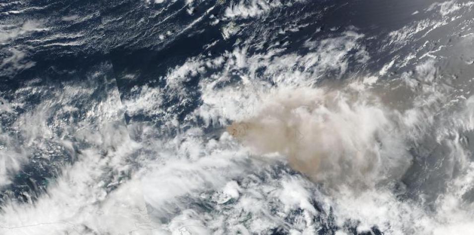
Image captured on 10 April 2021, by the VIIRS instrument, aboard the joint NASA/NOAA Suomi NPP satellite.
True-color image of the eruption of La Soufriere Volcano on the island of St Vincent in the Caribbean. This image was acquired on 10 April 2021 by the Visible Infrared Imaging Radiometer Suite (VIIRS), aboard the joint NASA/NOAA Suomi National Polar orbiting Partnership (Suomi NPP) satellite. View the high Aerosol Index associated with the eruption, as well as the presence of sulfur dioxide in the atmosphere from the eruption.
Visit Worldview to visualize near real-time imagery from NASA's EOSDIS, and check out more Worldview weekly images in our archive.
Details
Last Updated
Published on
April 19, 2021
