Content from all Earth science data sites are migrating into this site from now until end of 2026. Not all NASA Earth science data will appear across the site until then. Thank you for your patience as we make this transition.
Read about the Web Unification Project
Snow/Ice Albedo Data Access and Tools
NASA has snow and ice albedo datasets that help researchers measure how much frozen surfaces reflect solar radiation. Access a range of data and data tools such as AppEEARS, Worldview, and Giovanni to make the most of snow and ice albedo data.
Featured Snow/Ice Albedo Observation Method: MODIS
The Moderate Resolution Imaging Spectroradiometer (MODIS) gathers data in 36 spectral channels and can survey the entire Earth every one to two days. The instrument flies aboard NASA's Aqua and and Terra platforms. MODIS data can be used for a broad range of Earth science observations, including surveys of snow and ice cover across the planet with resolutions ranging from 250 to 1000 meters.


The Visible Infrared Imaging Radiometer Suite (VIIRS) will help ensure continuity of Earth observations after the upcoming retirement of the Moderate Resolution Imaging Spectroradiometer (MODIS).
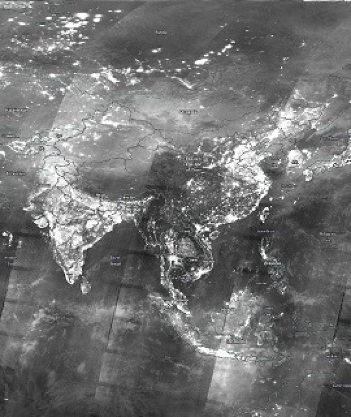
Image captured on 29 December 2019, by the VIIRS instrument, aboard the joint NASA/NOAA Suomi NPP satellite.

Join us to learn how to discover, subset, access and visualize both MODIS and VIIRS data products using a suite of user-friendly tools developed by NASA's ORNL DAAC.
Frequently Asked Questions
Earthdata Forum
Our online forum provides a space for users to browse thousands of FAQs about research needs, data, and data applications. You can also submit new questions for our experts to answer.
Submit Questions to Earthdata Forumand View Expert Responses