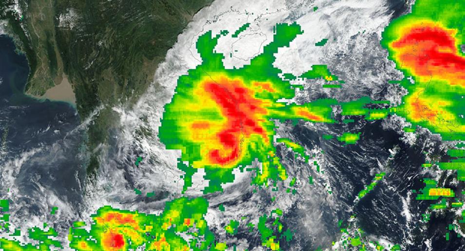
Image of Typhoon Damrey over Vietnam, acquired on 4 November 2017. The photo-like, true color corrected reflectance image was captured by the Visible Infrared Imaging Radiometer Suite (VIIRS) instrument, aboard the joint NASA/NOAA Suomi National Polar-orbiting Partnership (Suomi NPP) satellite. Overlaid on the reflectance image is the Rain Rate from the early run of the IMERG (Integrated Multi-satellite Retrievals for the Global Precipitation Measurement [GPM] mission).
The algorithm intercalibrates, merges and interpolates “all” satellite passive microwave precipitation estimates, together with microwave-calibrated infrared (IR) satellite estimates, monthly precipitation gauge analyses, and potentially other precipitation estimators at fine time and space scales for the TRMM and GPM eras over the entire globe. The red indicates high rain rates (over 10mm/hour) and the green represents lower rates of rain.
Visit Worldview to visualize near real-time (NRT) data from NASA's Earth Observing System Data and Information System (EOSDIS).
