Due to the lapse in federal government funding, NASA is not updating this website. We sincerely regret this inconvenience.
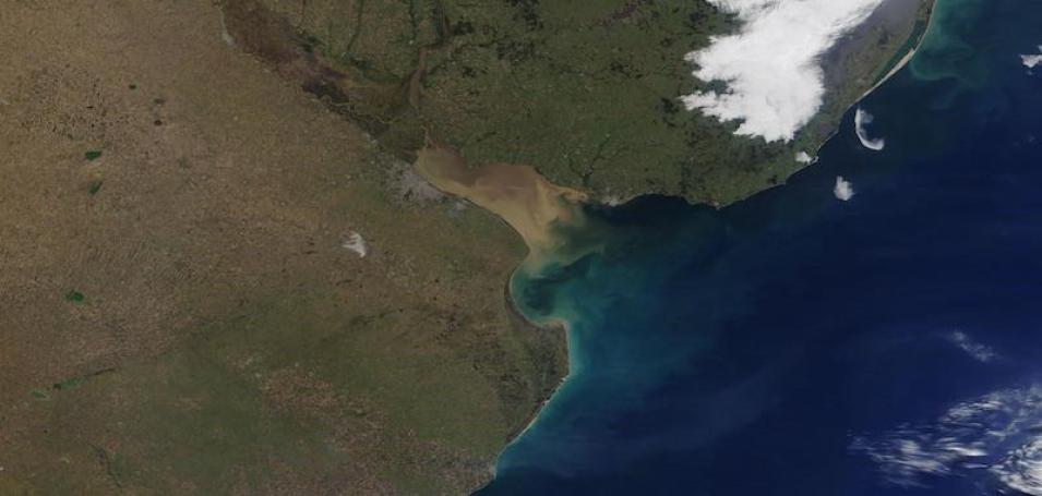
Rio de la Plata Estuary
Image captured on 6 July 2021, by the MODIS instrument, aboard the Terra satellite.
True color corrected reflectance image of the Rio de la Plata estuary, between Argentina and Uruguay in South America. This image was acquired by the Moderate Resolution Imaging Spectroradiometer (MODIS), aboard NASA's Terra satellite. The estuary is at the confluence of the Uruguay River and the Parana River and empties into the Atlantic Ocean. River sediments from the rivers cause the brown waters.
Visit Worldview to visualize near real-time imagery from NASA's EOSDIS, and check out more Worldview weekly images in our archive.
Details
Last Updated
Published on
July 12, 2021
