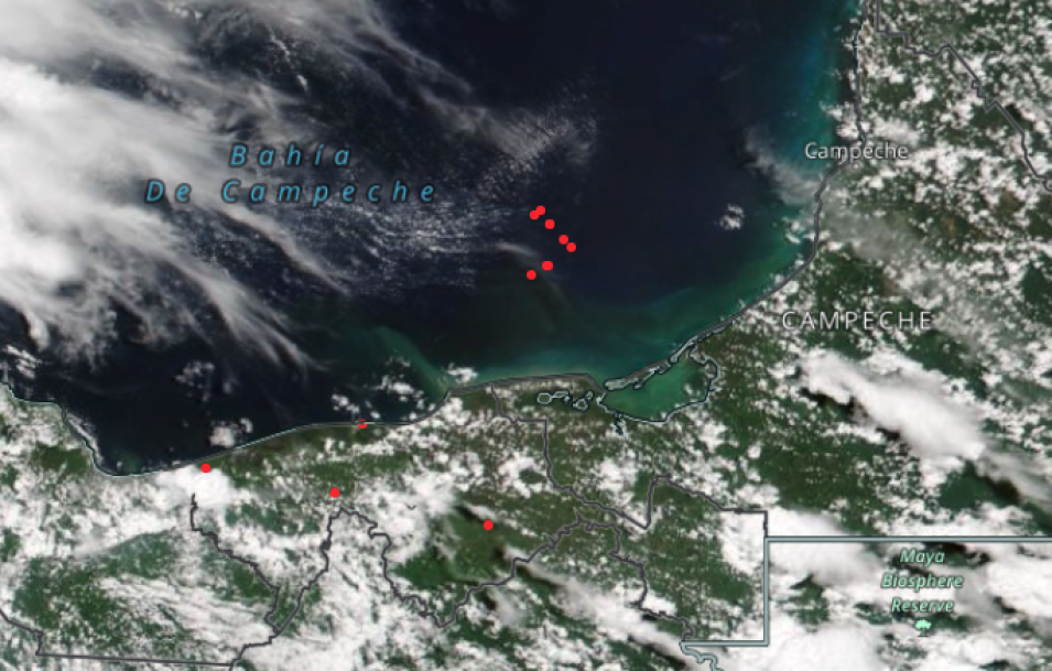
A true color/natural color corrected reflectance image overlaid with the Fires and Thermal Anomalies layer showing red points in Campeche Bay on August 1, 2022. This image was acquired by the Visible Infrared Imaging Radiometer Suite (VIIRS) aboard the joint NASA/NOAA NOAA-20 satellite. The image shows a cluster of red fire and thermal anomalies points in the bay.
These points correspond to gas flares emanating from oil rigs on offshore platforms. Crude oil often contains natural gas and when the oil reaches the surface, oil rig operators sometimes will burn the excess gas if it cannot be easily stored and utilized elsewhere.
To fully interact with the map, click on the image to open the full version of Worldview in a new browser tab.
Visit Worldview to visualize near real-time imagery from NASA's EOSDIS; check out more Worldview weekly images in our archive.
