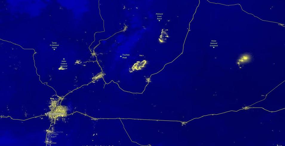
The image above is a Black Marble Nighttime Blue/Yellow Composite (Day/Night Band) image of Fires in New Mexico, USA on April 23, 2022. This image was acquired by Visible Infrared Imaging Radiometer Suite (VIIRS), aboard the joint NASA/NOAA Suomi National Polar-orbiting Partnership (Suomi NPP) satellite.
The fires are visible northeast of Albuquerque, the major city in the lower left corner of the image. Lights from larger cities are visible along the major roads, and the fires are occurring in areas that are not in close proximity to these major roads.
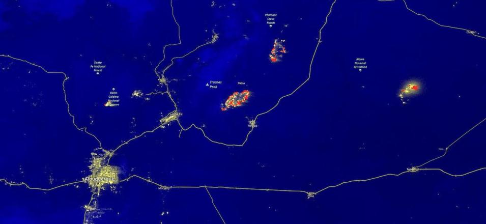
The map below shows the fires and thermal anomalies layer overlaid on the fires. The fires in the center are the Calf Canyon and the Hermits Peak Fires which have merged to become the largest fire currently in the state; further northeast is the Cooks Peak Fire. The fires visible further east have not yet been named.
You can click on the back (left) arrow in the lower left corner of the embedded map to change the date to April 7, then click on the forward (right) arrow to see the progression of the fires over time.

