Fires in Namadgi National Park, Australia
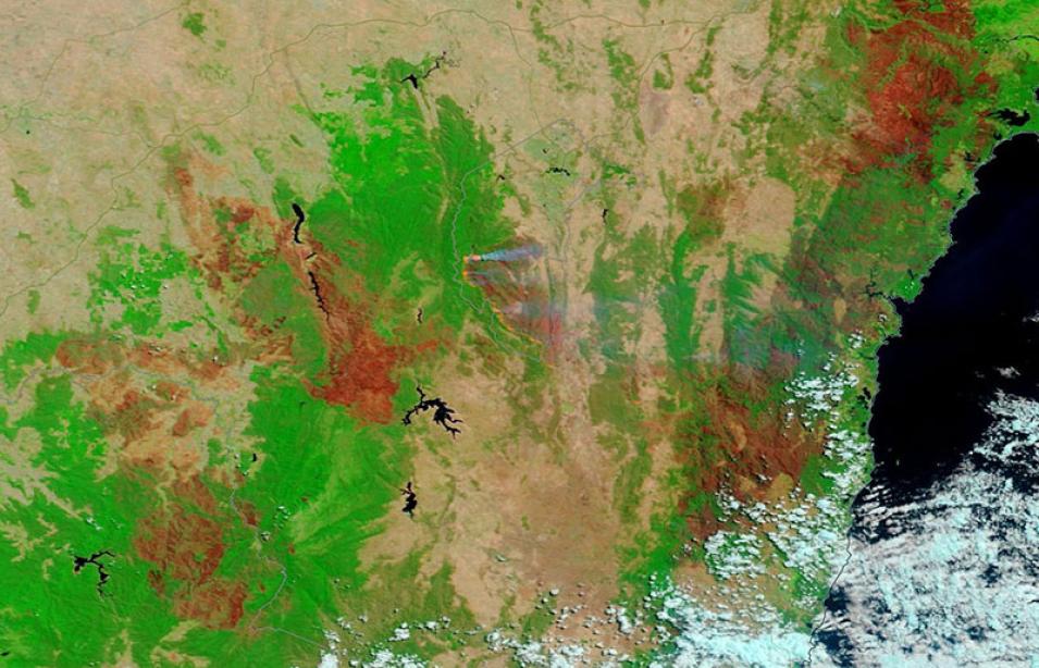
False-color Corrected Reflectance (Bands 7-2-1) image of fires and burned areas in Namadgi National Park, Australia, acquired on 3 February 2020 by the Moderate Resolution Imaging Spectroradiometer (MODIS) Instrument, aboard the Terra satellite.
The center of the image shows Namadgi National Park, southwest of the Australian Capital Territory. Burned areas appear in the false-color image as deep red and fires appear as bright red spots on the western edge of the burned area.
Burned areas or fire-affected areas are characterized by deposits of charcoal and ash, removal of vegetation and/or the alteration of vegetation structure. When bare soil becomes exposed, the brightness in MODIS Band 1 may increase, but that may be offset by the presence of black carbon residue; the near infrared (Band 2) will become darker, and Band 7 becomes more reflective. When assigned to red in the image, Band 7 will show burn scars as deep or bright red, depending on the type of vegetation burned, the amount of residue, or the completeness of the burn.
View the comparison of the false-color image and the true-color image on 3 February 2020. The true-color or natural-color image is similar to what the human eye would see and the smoke from the fires is most visible in this image.
Visit Worldview to visualize near real-time imagery from NASA's EOSDIS, and check out more Worldview weekly images in our archive.
