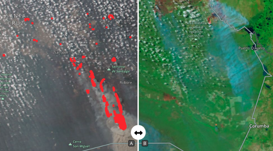
Comparison of true-color corrected reflectance image on the left and a false-color corrected reflectance image (Bands 7-2-1) on the right of fires in the Santa Cruz region of Bolivia on 22 August 2021. These images were acquired by the Visible Infrared Imaging Radiometer Suite (VIIRS), aboard the joint NASA/NOAA NOAA 20 satellite.
The true-color image is similar to what the human eye would see, overlaid on the image are the NOAA-20/VIIRS Fires and Thermal Anomalies layer which is shown as red dots, these represent the center of a 375m pixel containing one or more fires. The false-color image is a false-color Red-Green-Blue (RGB) composite where Red is M11, Green is I2, and Blue is I1. This combination is most useful for distinguishing burn scars from naturally low vegetation or bare soil and enhancing floods. Vegetation appears green, water is black/dark blue, burn scars are red and the actively burning fire fronts are bright red.
Click the image above to visit Worldview in a new tab. Use the slider on the map to see the differences between the imagery. Smoke is more visible in the true-color imagery, whilst the burned area is more visible in the false-color imagery.
Visit Worldview to visualize near real-time imagery from NASA's EOSDIS, and check out more Worldview weekly images in our archive.
