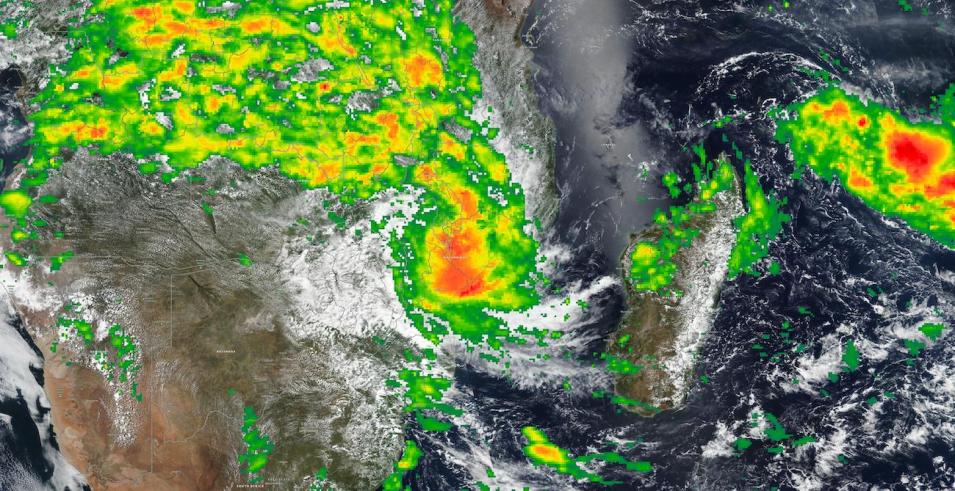
True color corrected reflectance image of Tropical Cyclone Freddy continuing to bring rain to Mozambique and Malawi on March 13, 2023. This image was acquired by the Visible Infrared Imaging Radiometer Suite (VIIRS) aboard the joint NASA/NOAA Suomi National Polar-orbiting Partnership (Suomi NPP) satellite.
Overlaid on the base image is the IMERG Precipitation Rate layer displaying rain rate and snow rate in millimeters per hour (mm/hr), with red/orange colors indicating areas of heaviest rain. It is estimated by the Integrated Multi-satellitE Retrievals for Global Precipitation Measurement (GPM) (IMERG) algorithm. The IMERG algorithm uses passive-microwave data from the GPM constellation of satellites along with infrared data from geosynchronous satellites. View Tropical Cyclone Freddy over Mozambique and Malawi in Worldview.
Visit Worldview to visualize near real-time imagery from NASA's EOSDIS, and check out more Worldview weekly images in our archive.
