The SWOT On-Demand Level 2 Raster Generation System (SWODLR) is an open-source software system developed to generate custom Level 2 raster data products from data acquired by the Surface Water and Ocean Topography (SWOT) platform. Originally developed by and available through NASA’s Physical Oceanography Distributed Active Archive Center (PO.DAAC), SWODLR is now integrated into NASA Earthdata Search.
While Earthdata Search and SWODLR support similar use cases, features, and functionality, Earthdata Search has not previously supported the customization of SWOT Level 2 raster products. Now that SWODLR provides these features through Earthdata Search, this system will no longer be available through PO.DAAC. Open-source SWODLR elements will still be available through the PO.DAAC SWODLR GitHub page.
What is SWODLR?
SWODLR is a collection of various services deployed to an Amazon Web Services (AWS) cloud-based environment. It provides an Application Programming Interface (API) and Graphical User Interface (GUI) that allows end-users to provide custom configurations to generate on-demand raster data products from underlying standard data products (PIXC, PIXCVec).
The SWOT Algorithm Development Team (ADT) developed the capability to generate raster products on-demand from underlying SWOT standard data products. To maintain a consistent end product, a second copy of the SWOT Science Data System (SDS) hosts the on-demand product generation capability. This system interfaces with the SWODLR system and with end-users to provide a seamless experience.
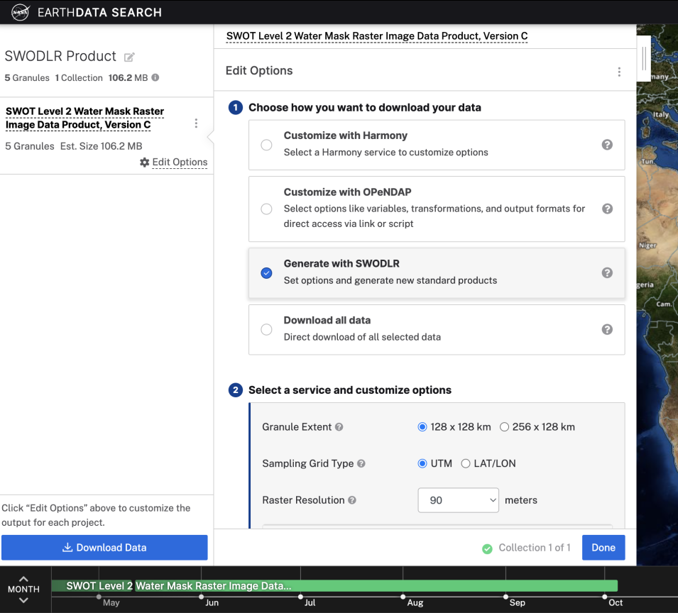
SWODLR in Earthdata Search
There are two components to SWODLR: the user interface (UI) and the backend service that generates the on-demand raster products. The SWODLR UI functionality is migrating to Earthdata Search and is available as a Data Access Method for supported collections. The backend service will continue to be managed by NASA's PO.DAAC.
Users who already use Earthdata Search for data discovery and access can now use the same UI to generate on-demand raster products for supported SWOT data collections instead of having to go to a separate UI with a different workflow.
