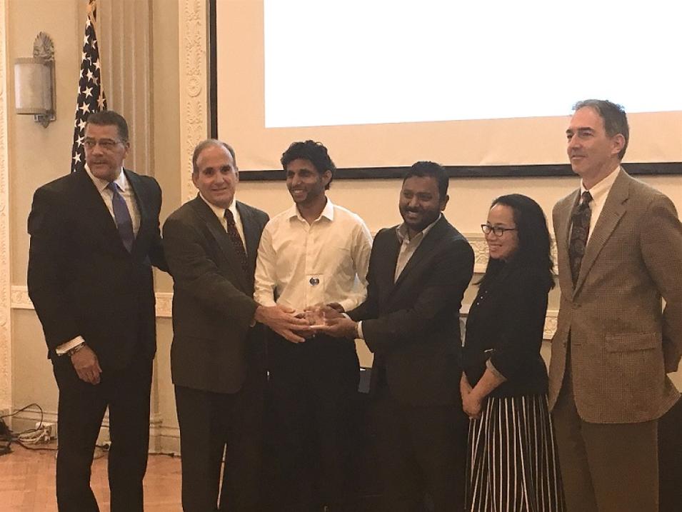
The team at NASA’s Oak Ridge National Laboratory Distributed Active Archive Center (ORNL DAAC) focused on Moderate Resolution Imaging Spectroradiometer (MODIS) data are the first recipients of the Doug D. Nebert National Spatial Data Infrastructure (NSDI) Champion of the Year Award for their work developing an innovative suite of tools for using MODIS data sets.
ORNL DAAC MODIS Team Wins National Award
ORNL DAAC representatives accept the FGDC Doug D. Nebert NSDI Champion of the Year Award. Left to right: Ivan DeLoatch, Executive Director, FGDC; ORNL representatives Dr. Robert Cook, Dr. Makhan Virdi, and Suresh Vannan; Camille Touton, Deputy Assistant Secretary for Water and Science, Dept. of the Interior; Kevin Gallagher, USGS Associate Director for Core Science Systems. Image courtesy ORNL DAAC.
The award, which was established this year, is given by the Federal Geographic Data Committee (FGDC) and recognizes an individual or a team in the U.S. that has developed an “outstanding, innovative, and operational tool, application, or service capability used by multiple organizations that furthers the vision of the NSDI.” ORNL DAAC Manager Suresh Vannan, ORNL DAAC MODIS Tool Lead Dr. Makhan Virdi, and ORNL DAAC Chief Scientist (retired) Dr. Robert Cook accepted the award at a ceremony in Washington, D.C., on September 29.
The ORNL DAAC MODIS Team developed MODIS subsetting and visualization tools to allow data users, especially terrestrial ecologists, to access multiple years of MODIS data and analyze these data over areas ranging from 1 MODIS pixel (about 1 x 1 km) up to 201 x 201 km. The simple interface and data structures of the MODIS tool suite were recognized by the FGDC “as an exemplar of success through integrating and delivering spatial data, tools, and services to a broad global community of practitioners, educators, and students.” As noted by the FGDC, the ORNL DAAC’s MODIS subsetting and visualization tools serve an audience of more than 7,000 distinct users and handle an average of 20 million global requests each year.
The vision of the NSDI is to assure that spatial data from multiple sources are available and easily integrated in order to enhance the understanding of the physical and cultural world. Nominees for the Doug D. Nebert NSDI Champion of the Year Award are evaluated based on the following criteria:
- Innovation and vision
- Interoperability
- Use of standards
- Advancement of NSDI principles
- Service to communities of users
- Developed once, but used by many
- Improved performance and service
- Real-world application
ORNL DAAC is one of NASA's Earth Observing System Data and Information System (EOSDIS) Distributed Active Archive Centers (DAACs) that are managed by NASA’s Earth Science Data and Information System (ESDIS) Project. ORNL DAAC provides data and information related to biogeochemical dynamics, ecological data, and environmental processes that are critical for understanding the biological, geological, and chemical components of Earth’s environment.
NASA’s EOSDIS provides end-to-end capabilities for managing NASA’s Earth science data. These data represent some of the most complex and diverse Earth science data sets on the planet, and come from satellites, aircraft, field measurements, and numerous other programs within EOSDIS. The primary services provided by EOSDIS are data archive, management, and distribution; information management; product generation; and user support services.
