In 1978, NASA launched a new radar remote sensing instrument called a scatterometer on the Seasat satellite. The instrument only worked for three months due to a power source failure in the satellite, but 20 years later, data from that first scatterometer and its descendants have opened up new possibilities for scientists who study climate change.
Teaching Old Data New Tricks
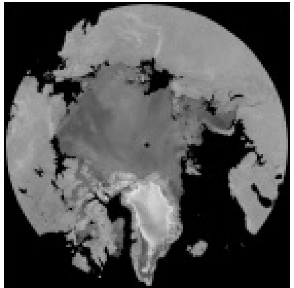
This map of the Arctic was made using QuikSCAT radar backscatter. (Image copyright NASA Scatterometer Climate Record Pathfinder at Brigham Young University).
A scatterometer sends a pulse of microwave energy to the Earth’s surface and then interprets the resulting echo, or backscatter. Since each material on Earth reflects, or scatters, energy in a different way, scientists use the backscatter from the scatterometer energy pulse to identify and study surface features, such as forests, snow and ice cover, icebergs, clouds, and oceans.
Originally designed to measure ocean winds, scatterometers detect wind speed and direction by analyzing the backscatter from the small wind-induced ripples on the ocean surface. However, researchers discovered that the data could provide important information on a variety of other surfaces, such as forests and ice, which became the basis for global climate change study applications. David Long, professor in the Electrical and Computer Engineering Department at Brigham Young University, and several of his graduate students are applying scatterometer data to a variety of environmental problems, ranging from deforestation to global warming to iceberg tracking.
“The scatterometer data are clearly useful for climate studies, especially in the polar regions,” said Long. “The idea that these data are only useful for ocean winds is outdated.”
The Scatterometer Climate Record Pathfinder (SCP) project, sponsored by NASA as part of the broader NOAA/NASA Pathfinder Program, is a collaborative effort between investigators at Brigham Young University, the Jet Propulsion Laboratory, the European Space Agency, and the National Ice Center. The SCP project’s main goals are to find new ways to use the ocean scatterometer data to study climate, and to make the data more widely available to researchers.
Scatterometer data have proven useful in global climate studies largely due to the length of the data record. The data cover more than 20 years intermittently, providing scientists with a wealth of information. In a 1999 study, Long and his colleague, Mark Drinkwater, used the 1978 Seasat data as a baseline to track the changes in the Greenland ice sheet from 1978 to the present. The results showed a retreating ice sheet melt line and a warming trend in Greenland.
In this QuikSCAT image, ocean colors indicate wind speed (blue is low, yellow is high), and white streamlines indicate wind direction. Landmasses show enhanced resolution backscatter values ranging from high in tropical vegetation to low in the deserts. Polar sea ice extent is imaged as enhanced resolution backscatter values, and the dry snow zone and melt facies of Greenland can be clearly distinguished. (Image copyright NASA Scatterometer Climate Record Pathfinder at Brigham Young University).
The scatterometer data also show striking changes in Antarctica, but the evidence for warming in that region is not as clear. Icebergs have been breaking off the main Antarctic ice sheets in higher numbers over the last two years, which many people interpret as a sign of global warming. But the long-term evidence provided by the scatterometer data seems to show something different.
“While there has been a substantial increase in the number of icebergs reported for the last two years, this is primarily related to some large calving events on the Ross and Ronne Ice Shelves,” said Long. Aside from those events, the actual number of very large icebergs has not changed much in the last 20 years.
Historical shipping data from the last 100 years show that 50 or 60 years ago, similar large calvings occurred in the Ross and Ronne Ice Shelves. The evidence seems to suggest that the large Antarctic ice shelves are actually returning to previously mapped extents, and so far, they are not shrinking beyond historical minimums.
“A lot of what we’re seeing now, in terms of increased iceberg count, stems from improved technology at the National Ice Center and a greater interest in Antarctic processes, rather than any real physical change. Our retrospective analysis of scatterometer data confirms this,” said Long. “The scatterometer data show that the changes going on in Greenland and Antarctica are consistent with what other investigators are finding.”
Sea ice extent and iceberg tracking are two other areas where the SCP data have proven useful. Project researchers have developed techniques and methods to interpret scatterometer data so that the National Weather Service, National Oceanic and Atmospheric Administration, and the National Ice Center can use it in “real time” for ship routing and weather forecasting. “The SCP data are actually providing about half of the iceberg tracks that are being used by the NIC,” said Long.
Scatterometer data have coarser spatial resolution than synthetic aperture radar (SAR) imagery, but much better coverage over time. Researchers get daily near-global coverage with the scatterometer data, making it easier to see changes that occur over short periods of time.
The January, 2002 issue of National Geographic contained a composite image map of Antarctica based on satellite data. The central continent image required one month’s worth of RADARSAT SAR data to make a full coverage, high-resolution map of the whole continent; whereas the sea ice portion of the map required only one day’s worth of scatterometer data from the SCP project. Although the resolution was lower with the scatterometer data, the image was clear, was generated more quickly, and covered a broader range. Since hours can make all the difference in discerning melting events, the scatterometer data proved more useful in this case.
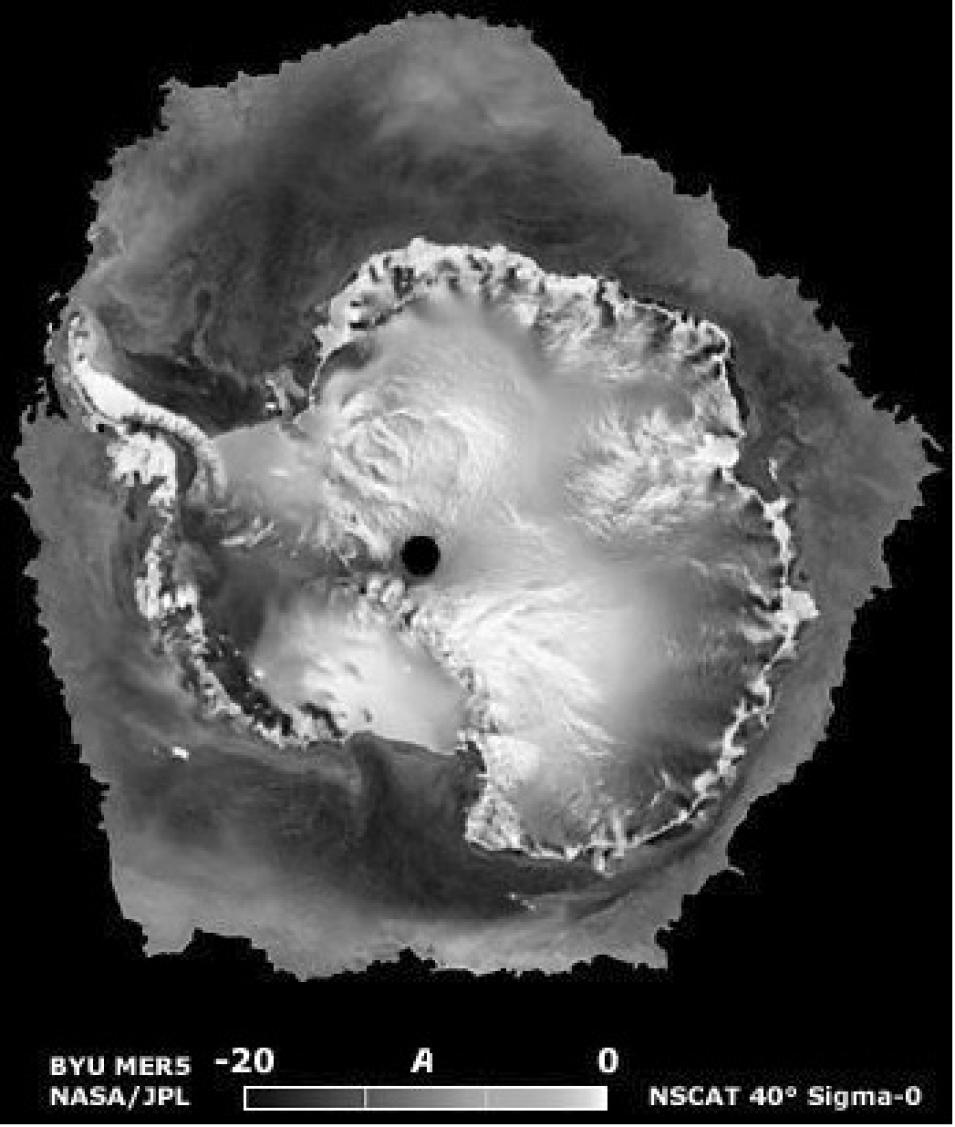
This NSCAT image, constructed from 6 days of scatterometer data in September 1996, shows Antarctica and the surrounding sea ice. Antarctica is covered with a thick ice sheet, which appears very bright in the image due to snow crust and refrozen ice in the snow cover. The black circle in the center of the image is where no data were collected. The dark band around the continent is sea-ice pack surrounding Antarctica. (Image copyright NASA Scatterometer Climate Record Pathfinder at Brigham Young University).
Comparing data from different scatterometers presents some challenges. Because each generation and type of scatterometer uses different angles and resolution, researchers at Brigham Young University’s Microwave Earth Remote Sensing Laboratory developed the Scatterometer Image Reconstruction (SIR) algorithm to merge all the data onto a common grid. The SIR algorithm also combines data from multi-orbit passes to achieve the best possible resolution and image coverage. “The SIR algorithm makes the data more useful. It has its limitations, but it’s well-suited for many applications because it makes images that general investigators, not just scatterometer experts, can use,” Long said.
Researchers using the SCP data continue to look for new ways to use the data and to maintain the inflow of data. “We’re looking at new funding opportunities to keep this activity going and ways to keep scatterometer missions flying so we can continue the long-term climate studies that we’ve started.”
“The SCP project is a prime example of an application of the NASA/NOAA Pathfinder Program. We have a serendipitous application of data that were really designed to study something else. The project has given us the opportunity to develop and process all the data sets and make them available to a wide variety of investigators at a very low cost to the Pathfinder Program,” said Long.
References
Drinkwater, M. R., and C. C. Lin. 2000. Introduction to the special section on emerging scatterometer applications. IEEE Transactions on Geoscience and Remote Sensing. 38:1763-1764.
Long, D. G., and M. R. Drinkwater. Cryosphere applications of NSCAT data. 1999. IEEE Transactions on Geoscience and Remote Sensing. 37:1671-1684.
Long, D. G., M. R. Drinkwater, B. Holt, S. Saatchi, and C. Bertoia. 2001. Global ice and land climate studies using scatterometer image data. EOS Transaction, AGU.82(43):503.
For more information
NASA Physical Oceanography Distributed Active Archive Center (PO.DAAC)
NASA Scatterometer Climate Record Pathfinder at Brigham Young University
| About the remote sensing data used | ||
|---|---|---|
| Satellites | NSCAT CSP RADARSAT | |
| Sensor | Synthetic Aperture Radar (SAR) | |
| Parameter | global climate studies | |
| DAAC | NASA Physical Oceanography Distributed Active Archive Center (PO.DAAC) | |


