Riding the Permafrost Express

Researchers use innovative techniques to protect the newly constructed Qinghai-Xizang railroad across the Tibetan Plateau from permafrost.

Behind the Himalaya Mountains lies a cold, isolated landscape, where the average elevation is higher than most of the Rocky Mountains in North America. Often referred to as "The Roof of the World," the Tibetan Plateau is the largest and highest plateau on Earth. Treeless, except for a few river valleys, the Plateau is an expansive alpine zone, with more than 17,000 glaciers covering its surface.

Historically, paths and roads built for trade connected the Tibetan people to neighboring regions, but journeys into or out of Tibet were long and difficult. Travel between Lhasa and towns within China's Qinghai or Sichuan provinces could take six months to a year. Even in the early 1950s, lack of adequate roads and railways forced China to use camels to transport cargo to Tibet. On average, 12 camels died for every kilometer the caravan traveled across the Tibetan Plateau and over high mountain passes.

Beginning in 2007, the Qinghai-Xizang railroad will connect Lhasa to the rest of China, providing a major access route into Tibet. Its pressurized cars will protect passengers from the extreme altitude along the route, much of which lies at least 4,000 meters (about 13,000 feet) above sea level.

But building a railroad across the highest plateau in the world is laden with construction hazards. Due to the thin air, unacclimated workers risk nosebleeds, blackouts, and even death. So, they carry oxygen bags, undergo daily medical monitoring, and work no more than six hours a day. In addition, workers rotate off the Plateau every few weeks to avoid prolonged exposure to the extreme climate conditions.

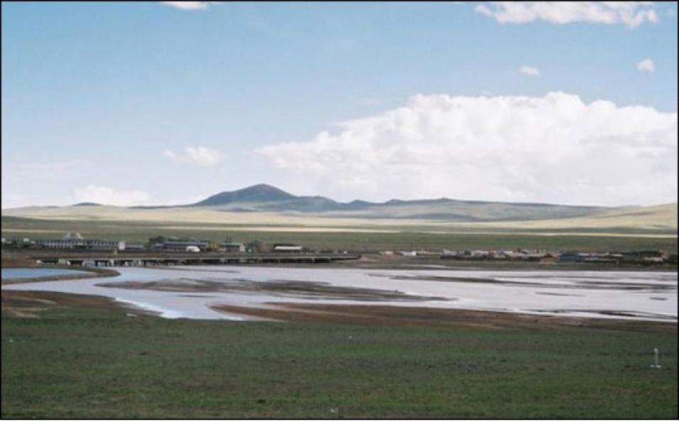
TuotuoHeyan Tibet
Image Caption

The village of TuotuoHeyan, located in the north-central region of the Tibetan Plateau, lies along the Qinghai-Xizang railroad's route at an elevation of 4,500 meters. (Image courtesy of Richard Armstrong)

In addition to the risks associated with construction at high altitude, engineers face the challenge of building a railroad across an unstable landscape. Half of the Qinghai-Xizang railroad's 1,118 kilometers (695 miles) of track will lie across permafrost areas, and builders must take extraordinary measures to protect each mile of track from permafrost thawing.

"The Qinghai-Xizang railroad is the most ambitious construction project in a permafrost region since the TransAlaska Pipeline," said Tingjun Zhang, a scientist at the National Snow and Ice Data Center in Boulder, Colo. Zhang studies the effects of climate change on permafrost areas around the world. "Permafrost is thawing in many regions, and this is significantly influencing landscapes and engineered structures," he said.

Permafrost refers to perennially (year-round) frozen ground that occurs where temperatures remain below 0 degrees Celsius for two years or longer, regardless of the rock and soil particles in the ground. Permafrost regions occupy about 20 to 25 percent of the world's land surface, and in parts of northern Siberia, permafrost can be up to a mile (1,600 meters) thick.

Scientists and engineers charged with monitoring permafrost along the Qinghai-Xizang railroad's route are primarily concerned with the layer that lies directly above permafrost, known as the active layer, which freezes and thaws seasonally. Longer periods of seasonal thaw cause the active layer to become even deeper, which can result in increased thaw settlement during the summer and more frost heaving (distortion of the surface) during the winter.

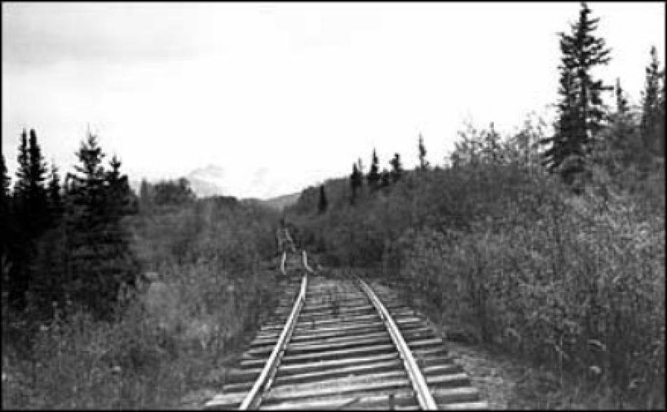
When buildings, roads, and railroads are built on permafrost with a deep active layer, seasonal changes in the soil can wreak havoc on the structures above. As the ground thaws and freezes, it contracts and expands, putting stress on foundations and twisting rail lines. In arctic areas where structures have been built over permafrost, insufficient insulation has led to the collapse of buildings and twisting of rail beds, due to the movement of thawing permafrost. For example, in south-central Alaska, thawing permafrost caused the railroad bed of the Copper River and Northwestern Railway to settle unevenly, resulting in a "roller coaster" buckling effect. Although maintenance and use of the railroad were abandoned in 1938, lateral displacement continues today.

Cooper River and Northwestern Railway
Image Caption

The abandoned Copper River and Northwestern Railway near Strelna in south-central Alaska illustrates how building a railroad on permafrost thaw can cause the railroad bed to settle unevenly. Although maintenance and use of the railroad was halted in 1938, lateral displacement continues today. (Image courtesy of U.S. Geological Survey)

To prevent structural damage from thawing permafrost, engineers have developed various methods for maintaining stable temperatures below buildings and roads, including painting roads to increase surface reflectance, elevating buildings on pilings above the ground, and using thermo siphons—metal tubes placed along roads or around buildings that help remove heat from the ground. Thermo siphons helped alleviate permafrost problems along the Alaska pipeline route, but they are costly to install and maintain, and they must be placed along the entire length of a road or railway.

On the Tibetan Plateau, railroad engineers have even more cause for concern than in the past. When the Qinghai-Xizang railroad was first designed, researchers predicted that the region's air temperatures would increase by only 1 degree Celsius over the next 50 years. Now, scientists believe that the Plateau's temperature may rise by 2.2 to 2.6 degrees Celsius in that time period, making the rail bed even more susceptible to deformation from frost heaving and thaw settlement. Recent studies show that the average annual temperature on the Tibetan Plateau has risen 0.2 to 0.4 degrees Celsius since the 1970s, and according to the Chinese Academy of Sciences, some permafrost areas on the Tibetan Plateau are 5 to 7 meters (16 to 23 feet) thinner now than they were just 20 years ago.

About half the permafrost under the rail bed is "high-temperature" permafrost, which means that the frozen soil is only 1 or 2 degrees Celsius below freezing, according to Zhang. "This high-temperature permafrost is very susceptible to thawing," he said. "And that's a problem, because not only is the climate in that region slowly warming, but the construction and operation of the railroad itself also creates heat."

But researchers hope to spare the Qinghai-Xizang railroad from the fate of Alaska's Copper River Railway. Construction engineers are using several techniques to stabilize the permafrost below the roadbed and protect the rail line from freeze/thaw hazards. These include re-routing some sections to avoid unstable areas, erecting overpasses across sensitive terrain, and building an insulation layer under the rail bed to maintain permafrost stability.

Researchers from the Chinese Academy of Sciences found that a layer of crushed rock can be used to insulate the railbed and keep the foundation stable. "Like thermal siphons, the crushed rock can both insulate and cool the permafrost," said Zhang. Although installation of crushed rock is labor-intensive, its maintenance costs are extremely low.

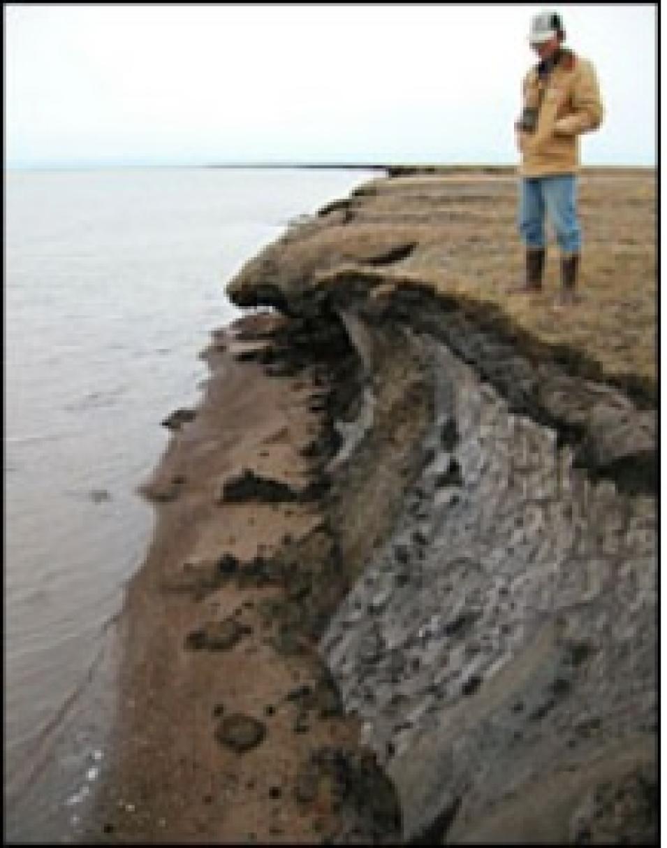
Elson Lagoon
Image Caption

This photograph, taken at Elson Lagoon near Barrow, Alaska, shows a thin active layer over permafrost and a narrow silty beach. (Image courtesy of Circumpolar Active-Layer Permafrost System, Version 2.0. A. Mahoney, photographer)

Through a series of experiments, engineers found that a 1-meter layer of loose rocks minimizes the transfer of heat to the soil under railroad embankments during warmer months. The Cold and Arid Regions Environmental and Engineering Institute in Lanzhou, China, tested a crushed rock layer in a section of railroad embankment that overlaid permafrost. After one year, the section was significantly colder than before the installation of the rock layer. "The rock layer is so effective that it actually helped create a cooling effect over time," said Zhang. Crushed rock insulation was first investigated as early as the 1960s, but this is the first time a large-scale project is using the technique as one of its primary solutions, according to Zhang.

Despite the cooling effects of the crushed rock, the fragile permafrost along the Qinghai-Xizang railroad must be routinely inspected to detect any frost heaving or thaw settlement below the tracks. But the sheer size and inaccessibility of the Tibetan Plateau make large-scale monitoring a difficult task.

Over the past 10 years, improved satellite instrumentation has enabled researchers to monitor the freeze/thaw cycles that threaten structures and railroads. "The advantage of satellite data is that it enables us to see the entire plateau," said Zhang. So, instead of just looking at changes that are occurring in a small, isolated area, which may or may not apply to the whole plateau region, Zhang and his colleagues can now create weekly maps that show the timing and extent of near-surface soil freezing and thawing over the entire Tibetan Plateau.

Passive microwave instruments, including the Special Sensor Microwave Imager (SSM/I) and the Advanced Microwave Scanning Radiometer-Earth Observing System (AMSR-E), can detect surface soil freeze or thaw based on brightness temperatures—a measure of the radiation emitted by an object. The large contrast between the brightness temperatures of water and those of ice makes it possible for scientists to distinguish between freezing and thawing conditions.

"Knowing when the freeze cycle starts in autumn and when thawing begins in spring helps us see whether the thaw season is getting shorter or longer, which can help us predict changes in the active layer thickness," said Zhang. Data from both sensors are archived and distributed by NASA's National Snow and Ice Data Center Distributed Active Archive Center (NSIDC DAAC).

"If current observations are indicative of long-term trends, we can anticipate major changes in permafrost conditions during the next century," said Zhang.

"Changing trends in the freeze/thaw cycle indicate a warming climate," said Richard Armstrong, a research scientist and one of Zhang's colleagues at the National Snow and Ice Data Center. "And if there's a warming climate, then that means more days of thaw—which is a concern for the railroad."

But as three diesel engines pull each train across the "Roof of the World," a combination of innovative construction techniques and remote-sensing monitoring will ensure a smooth ride when the Qinghai-Xizang railroad opens in 2007.

References

Zhang, T., R.G. Barry, and R.L. Armstrong. 2004. Applications of satellite remote sensing techniques to frozen ground studies. Polar Geography 3: 163-196.

For more information

NASA National Snow and Ice Data Center Distributed Active Archive Center (NSIDC DAAC)

About the remote sensing data used
Satellite Defense Meteorological Satellite Program (DMSP) Aqua
Sensor Special Sensor Microwave Imager (SSM/I) Advanced Microwave Scanning Radiometer-Earth Observing System (AMSR-E)
Parameter surface soil freeze and thaw surface soil freeze and thaw
DAAC NASA National Snow and Ice Data Center Distributed Active Archive Center (NSIDC DAAC) NSIDC DAAC

Details

Last Updated

Published

Data Center/Project

National Snow and Ice Data Center DAAC (NSIDC DAAC)