Quayle also noted that the temporal resolution of routine daytime Landsat observations may be improved by requesting that the USGS’s Earth Resources Observation and Science (EROS) Center arrange nighttime OLI imagery collections for targeted areas when it can feasibly be done within the confines of current Landsat science and mission priorities.
“This can potentially improve the temporal resolution of the Landsat active fire product to about four days for particular incidents,” Quayle said. “There is also the potential to use additional satellite sensors with spatial and spectral resolution similar to Landsat's OLI, but relatively better temporal resolution. Use of the combined observations of Landsat OLI and these other sensors could reduce the temporal resolution to as little as 1-2 days.”
Expanding the extent of the operational NRT LFTA product, which, as noted earlier, is currently limited to the continental U.S., the southern half of Canada, and the northern half of Mexico, is more of a challenge.
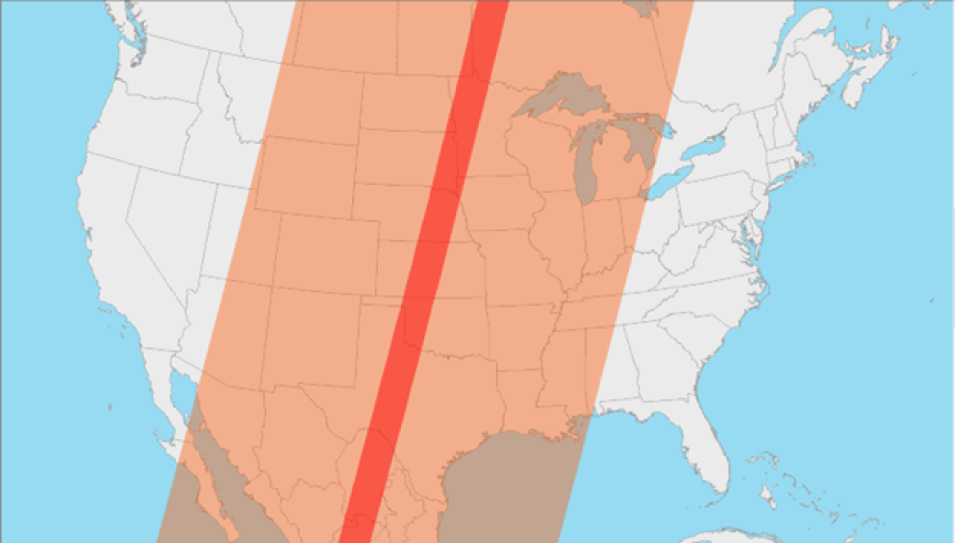
“Currently, the extent of the operational near real-time product is limited to the area of Landsat direct broadcast data collection coverage provided by the Landsat Ground Station EROS, which is located in Sioux Falls, South Dakota,” Quayle said. “This covers all of the continental U.S., the southern half of Canada, and the northern half of Mexico. To expand near real-time Landsat active fire detection coverage to other areas of the globe will require investment of time and resources to implement similar operational data streams at other Landsat 8 and Landsat 9 ground stations.”
Nevertheless, the feasibility of including additional ground stations for North America and elsewhere is currently being investigated.
The LFTA product is collaboratively produced by NASA’s Land, Atmosphere Near real-time Capability for EOS (LANCE), the University of Maryland, the U.S. Forest Service, and EROS. It was created at the request of NASA and the U.S. Forest Service, who asked EROS to develop a near real-time data processing framework that provides Level 1 terrain-corrected Landsat OLI imagery, which is then processed further with NASA science data algorithms to generate the Level-2 30-meter resolution active fire data product. This methodology produces the data that are imported directly into FIRMS and negates the need for NASA and the U.S. Forest Service to download numerous scenes of Landsat data for subsequent staging and processing.
“We coordinated with the Landsat Team at EROS to discuss possibilities about the availability of low latency Landsat OLI imagery,” said Quayle. “They have been very accommodating to our request and developed an optimized near real-time processing stream to provide terrain corrected OLI imagery about 30 minutes after an overpass.”
Currently, the Landsat active fire data reach back to June 2022. Although the processing of earlier acquisitions by Landsat 8 and Landsat 9 is possible, Quayle said there are no plans to provide them in FIRMS at this time.
Users should be aware that the LFTA product lacks fire characterization information, such as estimates of a fire’s radiative power or heat energy, and that each hotspot/active fire detection represents the center of a 30-m pixel containing one or more fires or other thermal anomalies. Therefore, the location provided for each detection is the center point of the pixel and not necessarily the coordinates of the actual fire.
Despite these limitations and its 8-day revisit time, this low latency product gives operational fire managers and fire scientists quicker access to more precise, higher-resolution data.
“For active fire management purposes, the more timely the data, the greater its value. Yes, the temporal resolution is currently the greatest limitation, but until now, the bigger limitation in the operational use of the Landsat active fire data product was its latency—the availability of the source Landsat OLI imagery after satellite observation,” Quayle said. “Without the partnership and substantial contributions of EROS, the operational availability and potential value of this product would never be realized.”
About FIRMS
FIRMS was developed in 2007 by the University of Maryland, with funds from NASA’s Applied Sciences Program and the United Nations Food and Agriculture Organization (UN FAO), to provide near real-time active fire locations to natural resource managers that faced challenges obtaining timely satellite-derived fire information.
FIRMS US/Canada, which launched in January 2021, was developed through an agreement between the U.S. Forest Service's GTAC and NASA to modernize and optimize the U.S. Forest Service's distribution of active fire information by leveraging LANCE's web-based active fire mapping tools and capabilities for disseminating data, products, and services.
Like the original FIRMS, FIRMS US/Canada provides active fire imagery that can be viewed on an interactive fire map and current and historical corrected reflectance imagery from NASA and NOAA satellites. It also meets recently developed U.S. Forest Service requirements by offering additional contextual layers and enhancements, including the depiction of active fire fronts complete with time-since-detection information, incident locations, ownership boundaries for current large fires in the U.S. and Canada, and National Weather Service fire weather forecasts and red flag warning areas.
For More Information
For information on how to view the LFTA product in FIRMS, see the post, “New Near Real-Time Product in FIRMS – Landsat Active Fire Data” on the FIRMS blog.
How to Use FIRMS Video Tutorial: This tutorial offers an introduction to the basic and advanced features of FIRMS. It provides instruction on how to view satellite observations of active fires and hotspots on an interactive map, navigate between the basic and advanced modes, and add imagery layers to see fires and smoke plumes.
