From the Dust Bowl to the Sahel
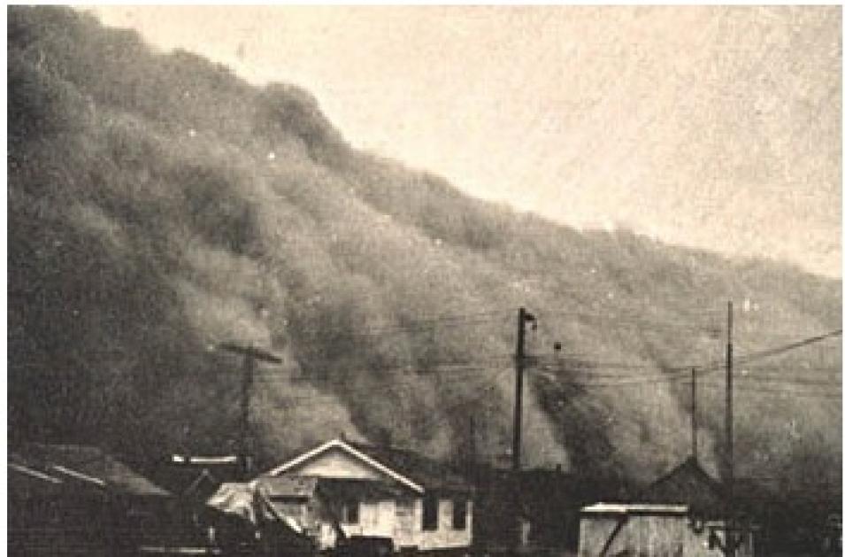
A severe drought combined with poor soil conservation practices can lead to extreme topsoil erosion, with devastating effects on the land. This is just what happened in the Great Plains region of the U.S. during the 1930s Dust Bowl years.
In May 1934, a cloud of topsoil from the Great Plains blanketed the eastern U.S. as far as 2,400 km (1,500 miles) away. In 1935, the U.S. established the Soil Conservation Service to promote good soil management practices. But according to some experts, this is not enough. Human-accelerated soil erosion continues to occur because much of the Great Plains is suited to moderate grazing rather than farming. And in 1975, the Council of Agricultural Science and Technology warned that severe drought in the Great Plains could trigger another Dust Bowl.
A dust storm that originated near the Mongolia-China border on April 10, 2001, made its way across the Pacific to the U.S., sprawling from Canada to the Southwest and as far east as the Great Lakes. Although Asian dust storms occur every year, a drought in China and Mongolia, along with abnormally strong winds, provided ideal conditions for global dust travel in 2001.
In semiarid grasslands, such as the Sahel region, dust storms are often generated where the ground has been stripped of vegetative cover by cultivation or grazing. The path of dust from a single desert storm can be traced as far as 4,000 km (2,500 miles).
The Sahel, or Sahelian Zone, lies south of the Sahara Desert in North Africa. This dry savanna environment is particularly prone to devastating drought years. Typically, several years of abnormally low rainfall alternate with several successive years of average or higher-than-average rainfall. But since the late 1960s, the Sahel has endured an extensive and severe drought.
Desertification occurs when land surfaces are transformed by human activities, including overgrazing, deforestation, surface land mining, and poor irrigation techniques, during a natural time of drought. Desertification in the Sahel can largely be attributed to greatly increased numbers of humans and their grazing cattle.
Most overgrazing is caused by excessive numbers of livestock feeding too long in a particular area. Extreme overgrazing compacts the soil and diminishes its capacity to hold water, and exposes the soil to erosion.
Although the relationship between drought and human influences is complex, desertification can be successfully mitigated if financial resources are available. But exploding population growth in developing African nations means that pressures on the land there will continue to intensify.
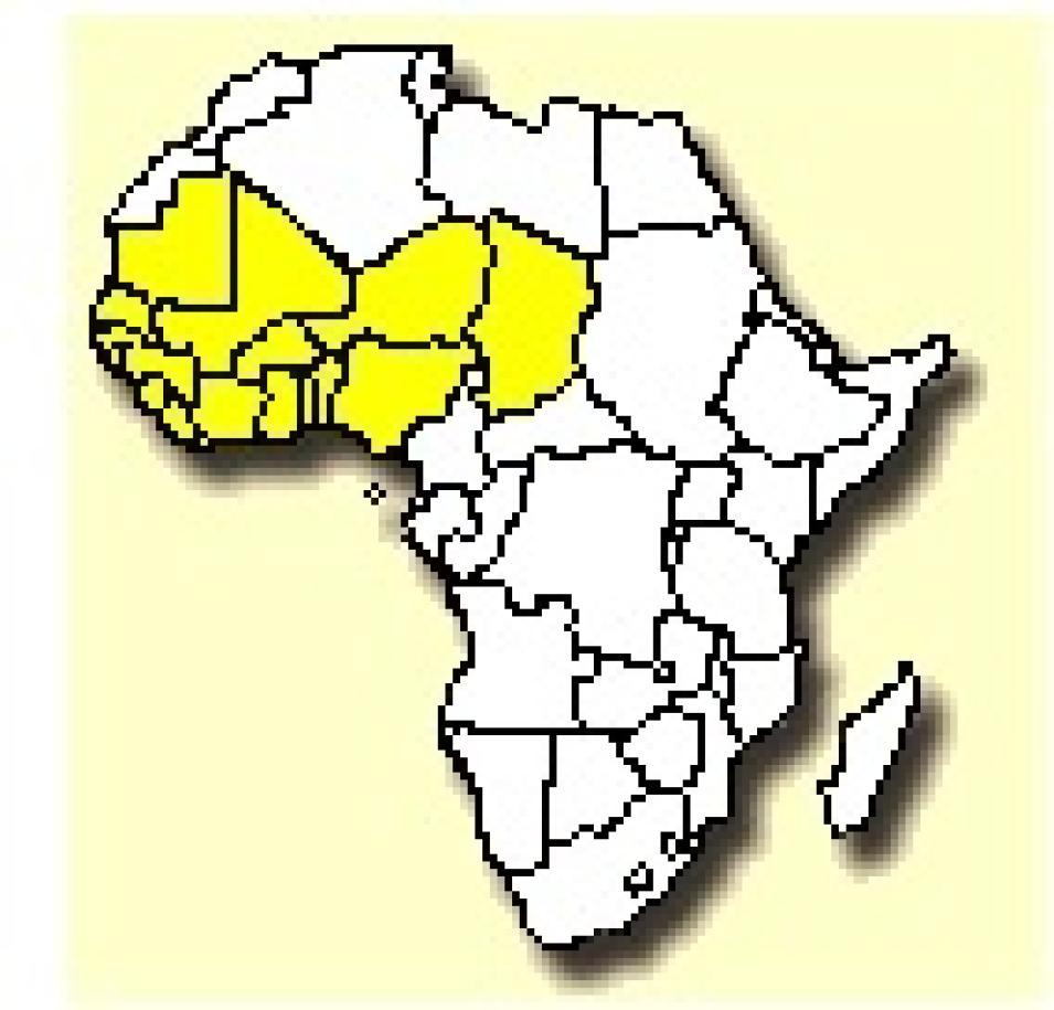
West Sahel countries appear in yellow. (Image courtesy of the Africa Data Dissemination Service from the USGS).
References
Dregne, H.E. 1986. Desertification of arid lands. Physics of Desertification. http://www.ciesin.org/docs/002-193/002-193.html. Accessed April 19, 2001.
A wall of dust approaches a Kansas town, as shown in "Effect of Dust Storms on Health," U.S. Public Health Service, Reprint No. 1707 from the Public Health Reports 50(40) October 4, 1935. (Image courtesy of the NOAA Photo Library).
Koohafkan, A.P. 1996. Desertification, drought and their consequences. SD Dimensions. http://www.fao.org/docrep/x5317e/x5317e01.htm. Accessed April 19, 2001.
For more information
NASA Goddard Earth Sciences Data and Information Services Center (GES DISC)
Droughts Aggravated by Dust in the Wind News Release from NASA's Earth Observatory
Drought from NASA's Earth Observatory
| About the remote sensing data used | ||
|---|---|---|
| Sensors | Sea-viewing Wide Field-of-view Sensor (SeaWiFS) Total Ozone Mapping Spectrometer (TOMS) | |
| Parameter | drought and desertification | |
| DAAC | NASA Goddard Earth Sciences Data and Information Services Center (GES DISC) | |
SeaWiFS and TOMS data products are distributed through GES DISC.
