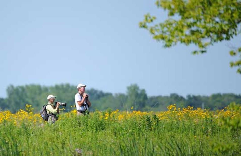
During a brisk morning in March, Judy Liddell strolled along the Rio Grande River with a group of fifteen avid bird watchers, binoculars strapped across her chest and camera slung over her shoulder. Over the course of the morning, their skillful eyes identified the rounded tail of a Cooper’s hawk as it flew overhead with a mouse in its beak, and spotted a rare Lincoln’s sparrow as it hopped along the ground pecking for insects. Liddell paused after each bird sighting and noted it in a pocket-sized logbook. Liddell, a technical writer and bird-watching aficionado, later entered her records into an online database called eBird, joining thousands of other bird watchers who are sharing their observations. “It helps to have a lot of eyes,” Liddell said.
The Feather Followers
Birds are everywhere; not so the researchers who want to know about them. More than 10,000 species of birds flap and flit across the globe. Many birds require specific climates, plants, and nesting sites. Unusual changes in bird populations can tip researchers off to changes in the environment. So every day, bird watchers become the eyes and ears for scientists who are trying to learn more about where birds are and what is happening to the environments in which they live.
Citizen scientists
Steve Kelling is an information scientist at the Cornell Lab of Ornithology who understands the power of bird watchers like Liddell. The information science team at the lab designed eBird to make it easy for bird watchers to log their sightings and observations. Collectively, eBird contributors are citizen scientists who provide researchers with bird counts from all across the globe, data that would otherwise be difficult, if not impossible, to get. Bird watchers often visit the same areas repeatedly, generating long-term bird counts that permit researchers to see patterns in bird species over large areas or long periods of time. Liddell herself maintains counts of her own yard, a local nature center, and along her bird-watching walks. She even counts birds when she travels, and keeps a notebook in her car to record incidental sightings, all of which she enters into eBird. Liddell said, “I’ve gone back in and entered all of my historical data, too.”
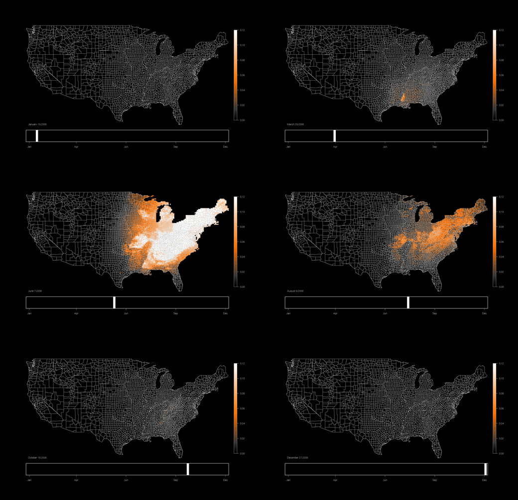
This map of summer wood thrush occurrence from June 2009 reveals the location of dense hardwood forests in the eastern United States, where the bird likes to breed and nest. White indicates highest occurrence; black indicatesleast occurrence. Wood thrushes prefer hardwood forests to nest and breed in, and are sometimes pushed out of their environment when forests are cleared for agriculture. (Data graphic based on a map produced by eBird, Cornell Lab of Ornithology; inset photograph of wood thrush courtesy J. Oldenettel)
Now that eBird has several years of detailed observations, Kelling and his research group are developing ways for scientists to use that data. He said, “We can start looking at patterns of bird distribution and make predictions about where birds are for any time of year, and across the entire continent.” By engaging a massive net-work of tens of thousands of bird watchers, eBird provides the foundation for studying where birds live across space and through time at scales previously unobtainable. When researchers have access to millions of bird sightings, they can begin to visualize the long migrations of species like the tiny Rufous hummingbird, which journeys round-trip more than 7,000 miles between Alaska and Mexico, swooping south down the Pacific Coast and returning north through the Rocky Mountains. The data can also show that some species never leave an area, while others avoid cities. Once scientists know where birds live, they can ask more specific questions about each species: why do barn swallows prefer open areas like meadows and pastures, or how might seabirds that nest exclusively along the coasts be affected by changes in sea level?
Dovetailing data
Birds rely on specific components of their environment to survive: certain kinds of trees for food and shelter, or a climate with suitable temperatures. “Understanding bird habitat relationships can help land managers make decisions about how the land can be used, or help developers make decisions about where to put buildings or route traffic,” Kelling said. So Kelling hoped to relate eBird counts with environmental data to generate maps detailing why certain birds prefer certain places, and why those places might need to be protected.
Kelling collaborated with Robert Cook, a scientist at NASA's Oak Ridge National Laboratory Distributed Active Archive Center (ORNL DAAC), to gather data about patterns of tree and plant health across the United States. “We modified some of our tools to suit eBird’s needs,” Cook said. The researchers used tools developed at ORNL DAAC to extract subsets of data from NASA's Moderate Resolution Imaging Spectroradiometer (MODIS) instrument for more than 300,000 individual locations across the United States. MODIS measurements of radiation can be used to estimate variations in greenness, or how different types of vegetation reflect sun-light. Scientists use these data to distinguish evergreen forests from hardwood forests, or fallow croplands from cactus-studded deserts.
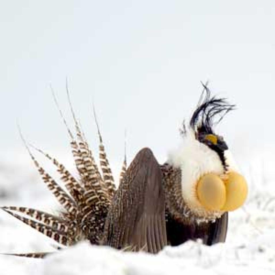
The Gunnison sage-grouse lives in isolated portions of Colorado and Utah. Its former range, extending into Arizona and New Mexico, was whittled down by energy development, cattle grazing, and invasive weeds that disturbed the sagebrush habitat on which the grouse survives. This male grouse is in full strut, fanning his tail feathers and inflating the air sacs on his chest. (Courtesy G. Vyn)
Greenness can also signal whether vegetation is flourishing, and reveal when plants start blooming in spring or start losing their leaves in fall. Cook said, “Kelling is interested in using these data to look at the relationship between the timing of bird distribution and potential climate effects and impacts, such as changes in food availability and habitat.” By comparing bird observations with greenness, scientists would be able to learn more about why some areas are crucial for a specific bird species’ survival. To round out the view, Kelling, Cook, and their colleagues combined the vegetation and eBird data along with other information like land use, land cover types, climate, and human populations to model patterns of where birds live.
The model results helped scientists identify how a bird’s environmental preferences might vary by season. For instance, birds might prefer one habitat during migration periods, and another during breeding seasons. In addition, the model showed researchers where certain species live, and how that might change over time. “The entire Mississippi River basin used to be hardwood trees, but is now predominantly agriculture,” Kelling said. The wood thrush, a small, brown-speckled songbird, breeds in hardwood forests, and like many birds, is sensitive to the loss of trees that it relies on for nesting sites and food. Historically, they occurred throughout the hardwoods along the Mississippi, but now they are gone. “If you go farther east, away from the river basin, the maps show the subtle distinctions in the breeding pattern of wood thrush. For example, you begin to see distinctions between the ridges and valleys of the Appalachian Mountains,” Kelling said. “The ridges are where all the hardwoods are, and that’s where wood thrushes breed.”
State of the birds
Kelling and his colleagues produced the models to help land managers and policy makers understand why a given environment is crucial for the birds that live there. “The fine detail in these maps can provide a land manager or conservation biologist with very specific information about where exactly these birds are,” Kelling said. Some birds, like the barn swallow, thrive in open spaces all over the world. But other species have far more specific needs, and can only survive within a limited range. For instance, the Gunnison sage-grouse depends heavily on sagebrush, and now lives only in portions of Colorado and Utah, although its range historically extended into Arizona and New Mexico.
One of Kelling’s colleagues, research scientist Michael Scott, used eBird data to help compile The State of the Birds 2011 report. The report examined how public lands provide bird habitat in the United States, and is furnished to the U.S. Interior Secretary, who leads the agencies managing public land. The data revealed that many bird species, including the Gunnison sage- grouse, live primarily on public land. While they are protected from residential sprawl, activities like natural gas drilling, mining, and cattle grazing can still threaten a bird’s already-limited habitat. “The eBird information really allowed us to get a handle on which parks or which public lands all these species live on,” Scott said. “We had to rely on eBird data because we do not have any other way to get that information.”

Wood thrushes breed throughout eastern forests, occurring east of the Great Plains from central Florida and east Texas north to southern Canada. The map lights up with their spring arrival in April and May. (Courtesy eBird/Cornell Lab of Ornithology)
While binoculars and logbooks will continue to be standard equipment for bird watching, Kelling and his team at the Cornell Lab of Ornithology are trying to make eBird even more accessible to bird watchers in the field. Kelling said, “We plan to release an iPhone application where you’ll be able to submit observations directly to eBird from your phone.” Through the dedication of thousands of citizen bird watchers like Liddell, eBird has become a powerful tool for tracking the world’s birds, and boosting what we know about birds and their environment.
References
Sullivan, B. L., C. L. Wood, M. J. Iliff, R. E. Bonney, D. Fink, and S. Kelling. 2009. eBird: A citizen-based bird observation network in the biological sciences. Biological Conservation 142: 2282-2292, doi:10.1016/j.biocon.2009.05.006.
Morello, L. 2010. Will satellites and supercomputers improve bird watching? Scientific American.
North American Bird Conservation Initiative, U. S. Committee, 2011. The State of the Birds 2011 Report on Public Lands and Waters. U.S. Department of Interior: Washington, DC. 48 pages.
Related Links
NASA Oak Ridge National Laboratory Distributed Active Archive Center (ORNL DAAC)
Moderate Resolution Imaging Spectroradiometer (MODIS)
The Cornell Lab of Ornithology
| About the remote sensing data used | |
| Satellite | Terra |
| Sensor | Moderate Resolution Imaging Spectroradiometer (MODIS) |
| Data set | MODIS Vegetation Indices 16-Day L3 (MOD13Q1) data subsets |
| Resolution | 250 meter |
| Parameter | Normalized difference vegetation index and vegetation index quality |
| DAAC | NASA Oak Ridge National Laboratory Distributed Active Archive Center (ORNL DAAC) |
Photograph in title graphic shows the tiny rufous hummingbird, which migrates more than 7,000 miles annually. Thousands of citizen bird watchers help scientists track its journey south from Alaska as it stops along the Pacific coast states, and then follow its fall return flying back north through the Rocky Mountain states. (Courtesy R. Bushby)


