Exposed Orchards

A valley grows unsettled about the lack of fog.

Thick and sluggish, fog just about covers everything in California’s Central Valley during the winter months. “As a kid, I thought the whole world was foggy in the winter,” said biometeorologist Dennis Baldocchi. “Then in high school, my friends took me hiking along Mt. Diablo Range and, oh my God it was sunny! I got above the fog and it was a different world.”

Now living in somewhat sunnier Berkeley, Baldocchi studies the connections between agriculture and climate. Several years ago he noticed that more farmers were asking him what was up with the fog. That included his father, who had been growing almonds and walnuts in the Central Valley for decades. “My dad was noticing a lot less fog than usual,” Baldocchi said.

If fog is indeed dwindling, that is a huge concern to hundreds of farmers in one of the richest agricultural lands in the world. For decades, fog has protected certain crops from frying in the hot California sun. Less fog in the Central Valley would have implications for the entire country since California produces 95 percent of U.S. fruit and nut crops. Billions of dollars are also at stake, as the United States is the world’s largest exporter of nuts.
image
Image Caption

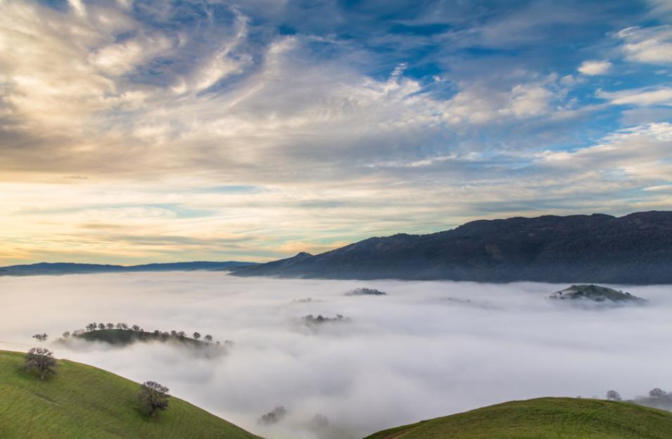
Tule fog engulfs hills near Contra Costa, California. (Courtesy M. Crumpler)

Oatmeal-thick

California’s Central Valley stretches out in a patchwork quilt of orchards, farms, and ranches. Only tractors and hulking sprinklers seem to move in the sun. This is the land that sends apricots, peaches, kiwis, almonds, walnuts, cherries, and pistachios to pantries in the United States and worldwide. The valley is bounded on the west by the Pacific Coast ranges and on the east by the Sierra Nevada Mountains, forming a slug-shaped trough 460 miles long and 60 miles wide.

image
Image Caption

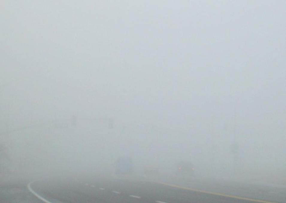
Dense tule fog often shrouds the highways in Bakersfield, California. Visibility in this photograph is less than 500 feet. (Courtesy Wikipedia)

It is in this trough that fog likes to settle for the winter. Fog is essentially a cloud sitting on the ground. It forms when water vapor close to the Earth’s surface cools and condenses to form tiny water droplets. Fog tends to form in the early morning after a rainy day, then evaporates in the hot afternoon sun.

But the valley’s oatmeal-thick and immovable tule fog, named after a freshwater marsh grass found all over the valley, has its own special recipe. In winter, cold and dense air sinks down the mountain ranges and into the valley, filling it to the brim. When this air is moist, such as after a storm, fog forms. Higher air pressure that lingers after a storm sits on the fog, keeping it from drifting away. And because the valley is an air basin, any pollution or fog that slips in is stuck there unless a strong storm lifts and pushes it out. So tule fog does not evaporate easily. It sticks around for days or weeks, a thick, white veil over the valley.

A shade for buds

Motorists hate it. Tule fog has caused many deadly pileups on Highway 99, which threads up through the center of the valley. Farmers, however, love it. Crops such as almonds, pistachios, cherries, apricots and peaches go through a necessary winter dormancy period when trees essentially go to sleep. They drop their leaves and slow their metabolism to shield themselves from the cold. Different trees need different amounts of chill hours, measured as air temperature below 7 degrees Celsius (45 degrees Fahrenheit). Pistachios, for example, need a minimum of 800 hours, while some grapes only need a few hundred.

image
Image Caption

Locally grown fruits are sold at the San Francisco farmers market. (Courtesy B. Doran)

Tule fog contributes to this chill. “It essentially provides shade for tree buds,” said Katherine Pope, orchard systems advisor at the University of California Cooperative Extension. “A bud that’s sitting out in the sun is going to be warmer than one that is shrouded in fog even if the air temperature is the same,” Pope said. Without the fog, tree buds would be four or five degrees warmer than the air and may not achieve the chill they need. Trees that get enough chill break their dormancy and regain their ability to blossom when spring arrives. A tree that does not get enough chill might bloom erratically, miss out on pollination, and fail to produce quality nuts or fruits.

Like Baldocchi, Pope had noticed a growing unease among valley farmers. “Everyone in the valley who has been paying attention has noticed a decrease in fog,” she said. In Berkeley, Baldocchi verified his father’s observation and checked fog records from airports. But these did not yield anything useful. “The records were extensive in time—which is great—but not representative of the whole region,” he said. Next, he dug into satellite data, looking through images from the Moderate Resolution Imaging Spectroradiometer (MODIS) flying on the NASA Terra and Aqua satellites. But the MODIS data were not extensive enough. “With climate you really want to have as long a record as possible,” Baldocchi said. “MODIS only goes back to the year 2000.”

Finding fog days

So Baldocchi worked with his student, Eric Waller, to stitch together surface reflectance data from MODIS and from the Advanced Very High Resolution Radiometer (AVHRR), a sensor on a fleet of satellites operated by the National Oceanic and Atmospheric Administration. The result was thirty-three years of data, long enough to see climate trends.

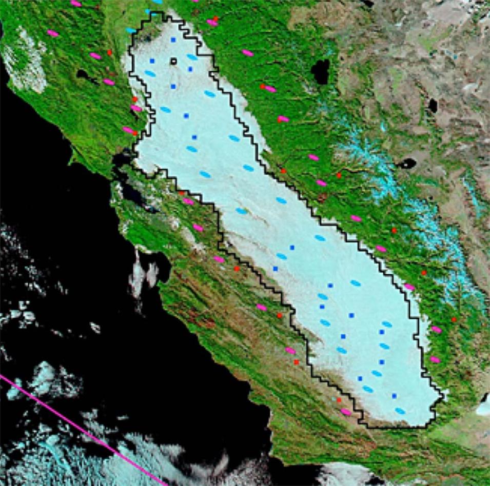
Piecing together a climate trend was not the only challenge. The researchers needed to separate cloud images from fog images. Baldocchi and Waller realized that because of the air basin effect, a satellite image of the valley on a tule fog day would show the slug-shaped trough of the valley itself. Clouds, on the other hand, would not be confined by the valley’s shape and would hover over the Sierra Nevadas or the Pacific Coast ranges.

Waller worked on an algorithm to extract individual fog days from the thirty-three-year data set. The researchers also validated the satellite images with data from University of California weather stations. Fog varied from year to year, but on average, Baldocchi and Waller found a 46 percent drop in the number of winter fog days over the past thirty-two winters.

image
Image Caption

Tule fog fills the Central Valley of California on December 2, 2008. Blue squares and ellipses represent the pixels in the Central Valley that were evaluated in the Advanced Very High Resolution Radiometer (AVHRR) and Moderate Resolution Imaging Spectroradiometer (MODIS) products, respectively. Red squares and pink ellipses represent pixels outside the valley that serve as reference points to the AVHRR and MODIS products. Together, the squares and ellipses are used to determine if the scene is representative of a tule fog day for AVHRR and MODIS. The black polygon outlines the average extent of typical fog episodes in the Central Valley, as detected by AVHRR. (Courtesy D. Baldocchi and E. Waller, 2014, Geophysical Research Letters)

Follow the fog

The findings are bad news to valley farmers already reeling from a four-year drought. “During this drought, we had no fog at all,” Baldocchi said. In a previous study, Baldocchi and his colleagues found that the annual winter chill hours are diminishing in the valley and have dropped by several hundred since the 1950s. The researchers predicted that by the end of the 21st century, orchards in California are expected to receive less than 500 chill hours per winter. Other studies predict the climate in California to warm over the next 50 to 100 years.

image
Image Caption

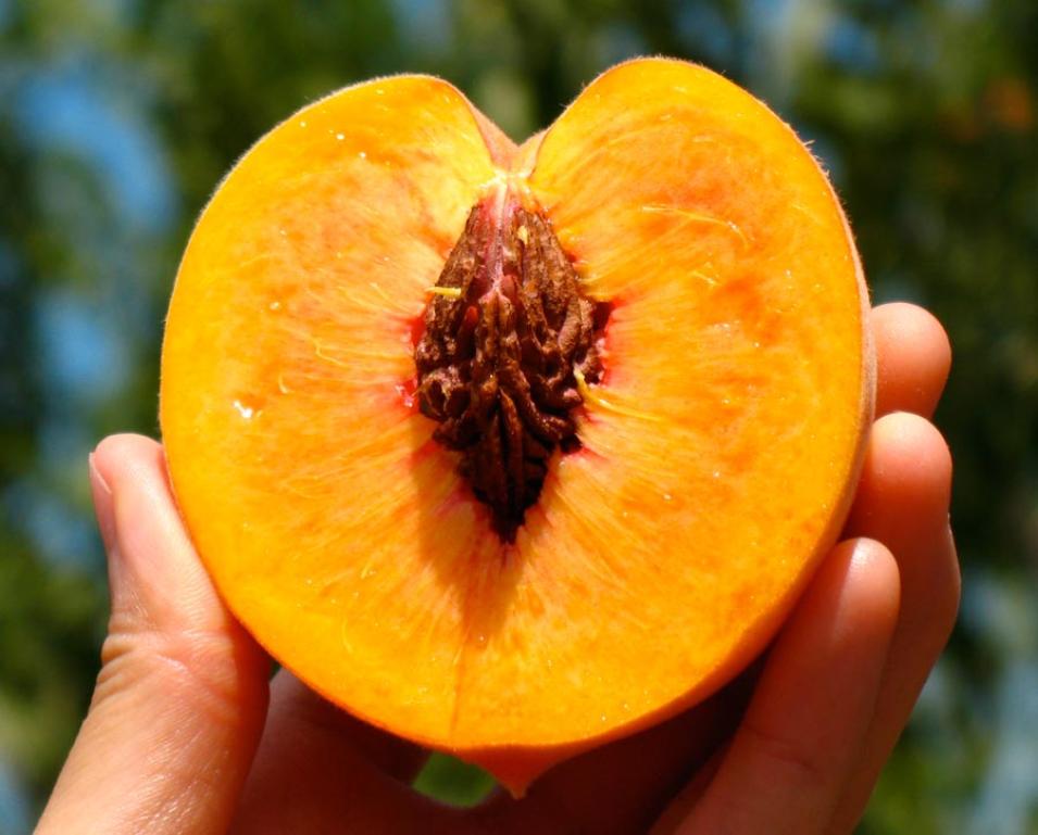
A peach picked in an orchard in Contra Costa, California glistens in the sun. (Courtesy P. King)

While Baldocchi’s findings may mean safer roads for the valley’s commuters and more solar power for renewable energy enthusiasts, they could signal another huge transition in California’s agricultural landscape. The last one came in the 1940s when rising water prices and shifting global markets forced California farmers to abandon cotton and wheat in favor of fruit and nuts. The decline in fog days and winter chill has yet to affect crop production and Pope says no study has tied these to decreases in yield. “But certainly, if this trend continues and we have increasing temperatures over winter, the two will exacerbate each other and will have yield consequences for California in the future,” Pope said. And that ultimately means smaller harvests. “It’s just going to be a matter of whether it will be in twenty years, or fifty years,” Pope added.

Meanwhile in the valley, fruit breeders are already developing crop varieties that tolerate less winter chill. Proving new drought and heat tolerant strains, or moving orchards and bringing newly planted trees to production, can take years. “Farmers may also need to consider adjusting the location of orchards to follow the fog, so to speak,” Baldocchi said. “Some regions along the foothills of the Sierra are candidates, for instance. That type of change is a slow and difficult process, so we need to start thinking about this now.”

References

Baldocchi, D., and E. Waller. 2014. Winter fog is decreasing in the fruit growing region of the Central Valley of California. Geophysical Research Letters 41. doi:10.1002/2014GL060018

Baldocchi, D. D., and S. Wong. 2008. Accumulated winter chill is decreasing in the fruit growing regions of California. Climatic Change 87(S1): 153–166.

NASA Land Processes Distributed Active Archive Center (LP DAAC). MOD09GA and MYD09GA. USGS/Earth Resources Observation and Science (EROS) Center, Sioux Falls, SD, 2015. doi:10.5067/MODIS/MOD09GA.006

Pope, K. S., V. Dose, D. Da Silva, P. Brown, and T. M. DeJong. 2015. Nut crop yield records show bud-break based chilling requirements may not reflect yield decline chill thresholds. International Journal of Biometeorology. doi:10.1007/s00484-014-0881-x

For more information

NASA Land Processes Distributed Active Archive Center (LP DAAC)

NASA Moderate Resolution Imaging Spectroradiometer (MODIS)

About the remote sensing data
Satellites Terra and Aqua
Sensor Moderate Resolution Imaging Spectroradiometer (MODIS)
Data set MODIS Surface Reflectance Daily L2G Global (MOD09GA, MYD09GA)
Resolution 1 kilometer and 500 meters
Parameter Surface reflectance
DAAC NASA Land Processes Distributed Active Archive Center (LP DAAC)

Details

Last Updated

Published

Data Center/Project

Land Processes DAAC (LP DAAC)