Upriver solutions
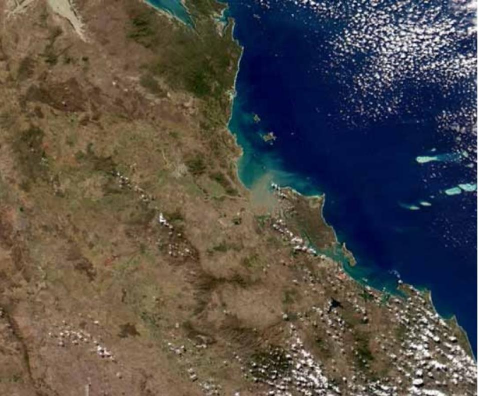
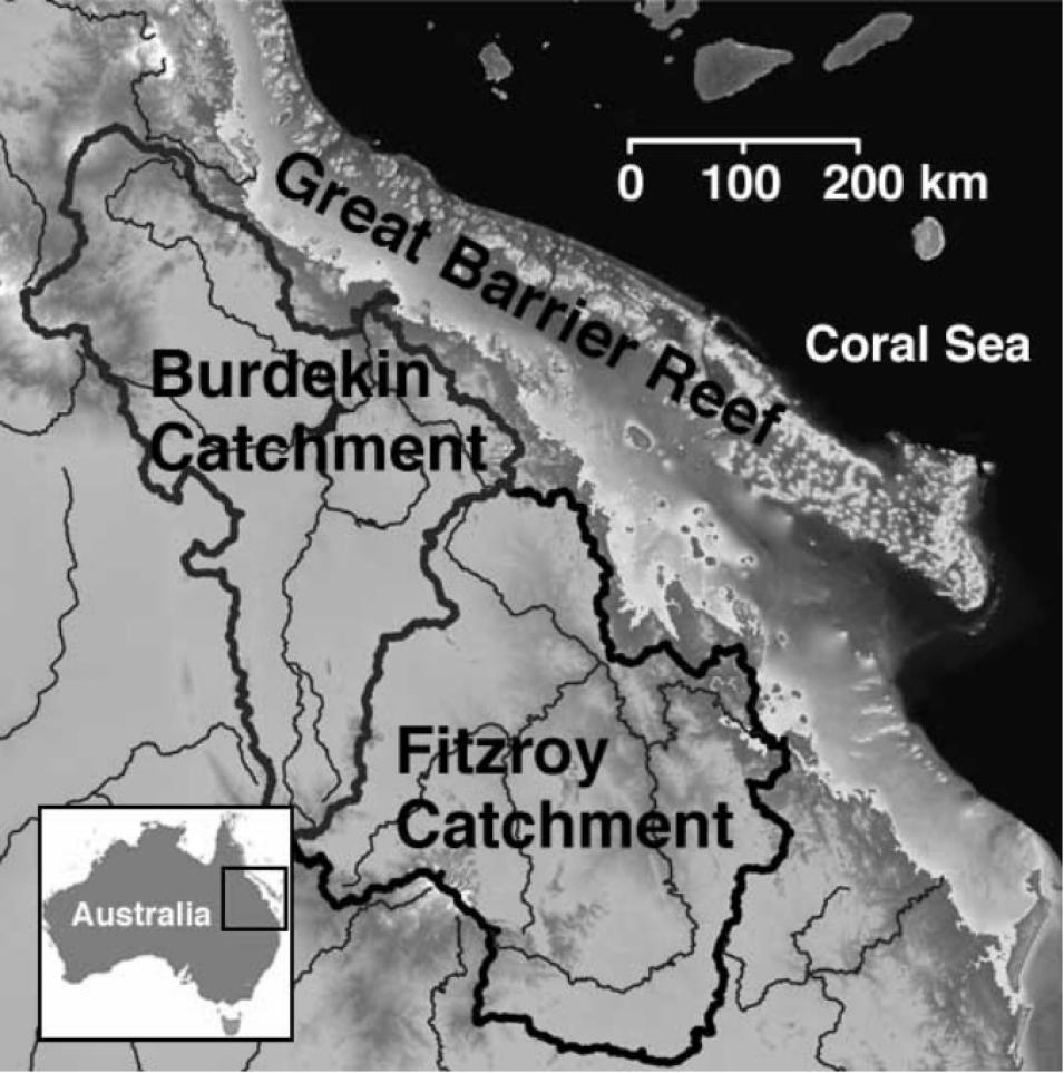
The plumes of runoff that Dekker helps track using MODIS are a good way to assess water quality on the Great Barrier Reef. However, water quality on the reef depends on conditions far inland, where the water begins flowing towards the coast. Brodie said, "If you want to do something about conditions at the mouth of the river, then there's no point doing anything on the Great Barrier Reef. You have to do it hundreds of kilometers upriver." The two greatest inputs of sediment and nutrients into the Fitzroy River are cattle ranches and farms. "We have a whole raft of pollutants coming out of the catchment, including sediment and dissolved nutrients and herbicides," Brodie said. "Much of our work is aimed at disentangling those pollutants, identifying which industries are producing which ones and in what quantities. So we do a lot of monitoring to determine source areas."
Cattle grazing is a large source of sediment into the Fitzroy. Dekker said, "There's increasing evidence that in the past 200 years, since European settlement and changes in land use, there has been a significant increase in suspended sediment and nutrient input." As the cattle graze, they break down the riparian areas along the riverbanks, sending soil into the streambed to be carried away during the next flood. Unmanaged cattle will also spread out over the land, increasing erosion by stirring up the soil and grazing on the groundcover. Brodie said, "We believe sedimentary export has increased five or six times over natural erosion because of cattle grazing."
Several government programs, under the Department of Primary Industries and Fisheries, seek to help land managers and cattle ranchers connect. "We're using the Southern Oscillation Index, a measure of air pressure, to predict what the weather is going to be like next wet season. The idea is for ranchers to manage the cattle in advance. If it's going to be a bad drought year, you could sell off your cattle now," Brodie explained. "But if it's going to be a good year with lots of grass, then you might build your cattle numbers up a bit. That allows us to retain better pasture cover."
Another program subsidizes fencing so that farmers can confine cattle to specific areas of rangeland and move the animals from paddock to paddock. Controlling the cattle allows the vegetation to recover, protects riparian areas, and holds down erosion.
Nutrient input from farming also concerns scientists. Fertilizers contain large amounts of nitrate, which can leach into groundwater and river systems. Brodie indicated that nitrate discharge from rivers has increased ten to twenty times over natural amounts.
However, controlling nutrient input from farming is a bit more challenging than preventing overgrazing, Brodie said. "We have 7,000 individual sugar cane farmers and we can't monitor everywhere," he said. "We do have some simple monitoring that they can do themselves—thirty-cent test strips that measure nitrate flowing out of the fields." However, the most important aspect of farm runoff management is to influence the way farmers use fertilizer, before it gets into the water. "We can replant vegetation and artificial wetlands," he said, "but the best solution to fertilization loss is on the farm itself, rather than trying to trap it once it gets off. That, and choosing the right amount of fertilizer for the crop."
The challenge of improving water quality coming out of ranches and cropland goes beyond monitoring and subsidizing improvements. "Another problem is political expectations," Brodie said. "Government officials are spending millions on these water quality issues, and they want to see results immediately. But you can't plant seedlings along the river one year and expect them to be doing anything the next year. It takes ten years for them to grow big enough to trap sediment and nutrients."
Plus, the river's natural variability, flooding one year and then not flowing again for several years, makes getting statistically valid data a long-term project. "Picking a human signal out of that huge natural variability is very difficult," Brodie said.
Convincing government officials that land management efforts are making progress, even though the numbers are not final, is also an ongoing challenge. "What they have to take as evidence is on the ground: that we have an extra ten farms using the grazing land management package or that we've built all this fencing to manage the cattle," Brodie said. "And those improvements will produce—believe us, trust us—a change in the river."
And the scientists believe and trust that a change in the upper reaches of the Fitzroy River will trickle down to the Great Barrier Reef Lagoon, helping keep the water clear and clean for the health and survival of the corals of the Great Barrier Reef. With a healthy reef come billions of dollars of economic benefit for Australia, potential new medicines from coral substances, and the immeasurable beauty of a complex ecosystem thriving in the waters that have been its home for eighteen million years.
References
Devlin, M.J, and J. Brodie. 2005. Terrestrial discharge into the Great Barrier Reef Lagoon: Nutrient behavior in coastal waters. Marine Pollution Bulletin 51: 9-22.
Oubelkheir, K., L. Clementson, I. Webster, P. Ford, A.G. Dekker, L. Radke, and P. Daniel. 2006. Using inherent optical properties to investigate biogeochemical dynamics in a tropical macrotidal coastal system. Journal of Geophysical Research 111(C7), C07021.
Petkovic, P. and C. Buchanan. 2002. Australian bathymetry and topography grid. Digital Dataset [3]. Canberra: Geoscience Australia. Accessed February 22, 2005.
Smith, J.E., M. Shaw, R. Edwards, D. Obura, O. Pantos, E. Sala, S. Sandin, S. Smriga, M. Hatay, and F.L. Rohwe. 2006. Indirect effects of algae on coral: Algae-mediated, microbe-induced coral mortality [4]. Ecology Letters 9: 835. Accessed June 20, 2006.
For more information
NASA Goddard Earth Sciences Data and Information Services Center (GES DISC)
Commonwealth Scientific and Industrial Research Organisation
Australian Centre for Tropical Freshwater Research at James Cook University
NASA Aqua satellite
Great Barrier Reef Marine Park Authority
| About the remote sensing data used |
| Satellites |
Aqua and Terra |
| Sensor |
Moderate Resolution Imaging Spectroradiometer (MODIS) |
| Data sets |
Ocean Color |
| Resolution |
1 kilometer |
| Tile size |
Regional extract from granules |
| Parameter |
Total suspended matter concentration in ocean
Chlorophyll-a concentration, semi-analytic ("chlor a 3")
Gelbstoff absorption coefficient at 400 nanometers |
| DAAC |
NASA Goddard Earth Sciences Data and Information Services Center (GES DISC) |


