How well can a computer algorithm estimate the intensity of a major hurricane? The IMPACT machine learning team tested this out in real time when Hurricane Ida made landfall in Port Fourchon, Louisiana as a Category 4 hurricane on August 29, 2021.
Using Machine Learning to Estimate the Intensity of Hurricane Ida
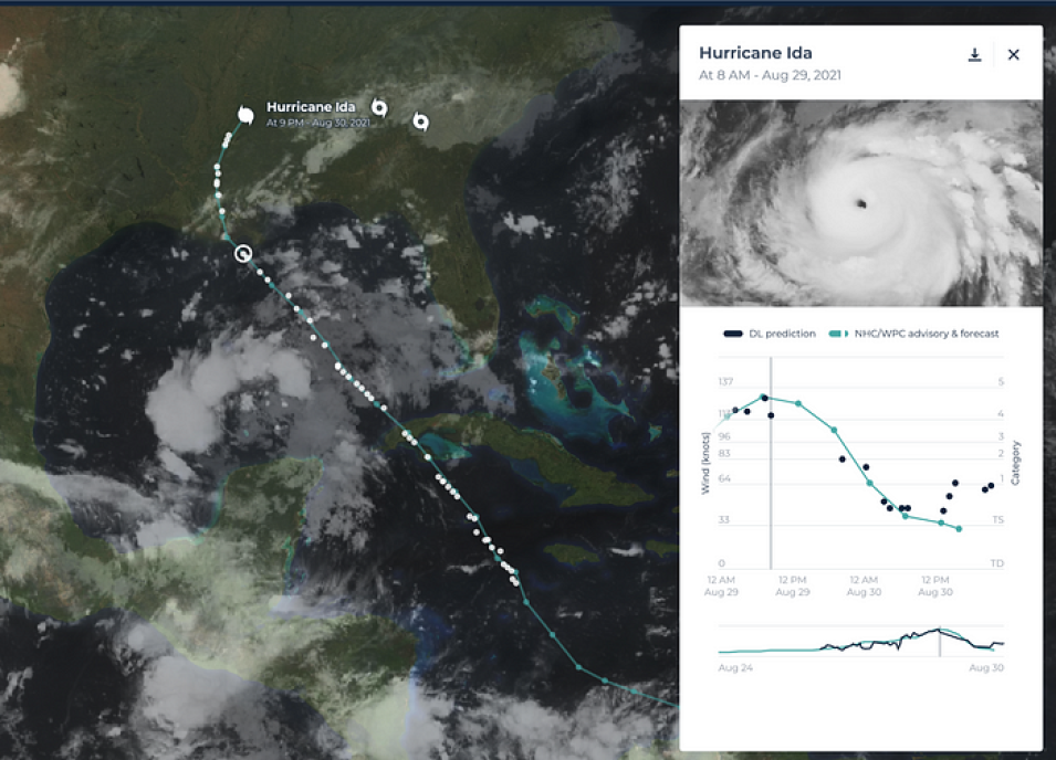
Screenshot of the user portal for IMPACT’s Deep Learning-based Hurricane Intensity Estimator showing Hurricane Ida. The portal shows a plot of machine learning wind speed estimations for Ida compared to the National Hurricane Center’s (NHC) estimated wind speeds. The portal includes current satellite imagery, track (location) and intensity (wind speeds) data from the deep-learning based algorithm.
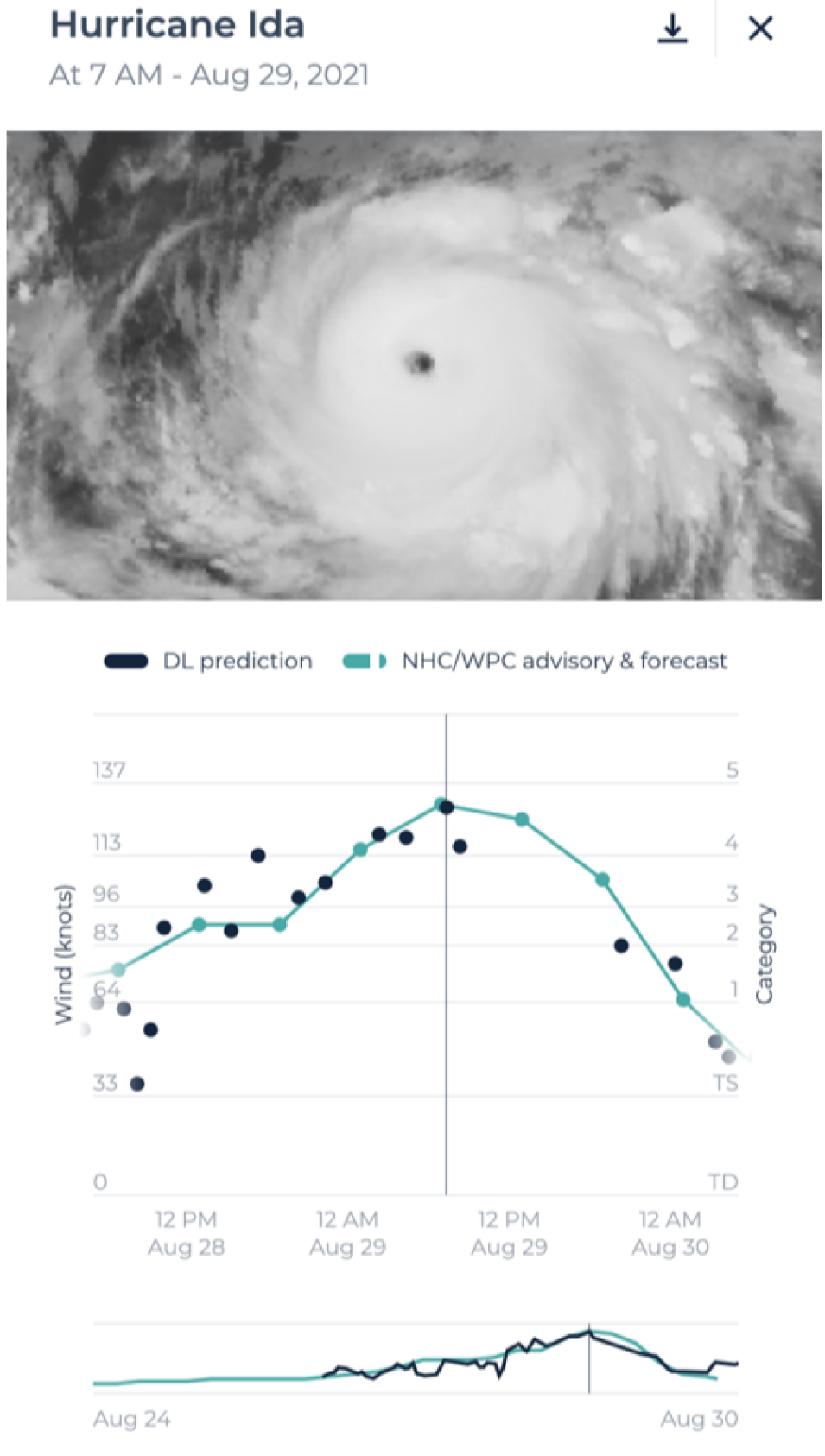
The IMPACT team tracked how well their Deep Learning-based Hurricane Intensity Estimator algorithm estimated the wind speeds and therefore, the intensity of Hurricane Ida. The results show that the machine learning technique estimated the overall pattern of increasing wind speeds prior to landfall quite well. This is demonstrated by the agreement of the estimated wind speeds (black dots) to the National Hurricane Center’s (NHC) estimated maximum wind speeds (green line).
The computer model estimated a peak wind speed of 129 knots, whereas the NHC estimated peak wind speed was 130 knots. This is a strikingly close estimation for peak wind speeds from a machine learning technique, and it bodes well for the future of automated hurricane intensity estimation. In reality, these ML method estimations do not always agree so well with NHC estimated wind speeds, but Ida is one of the great examples.
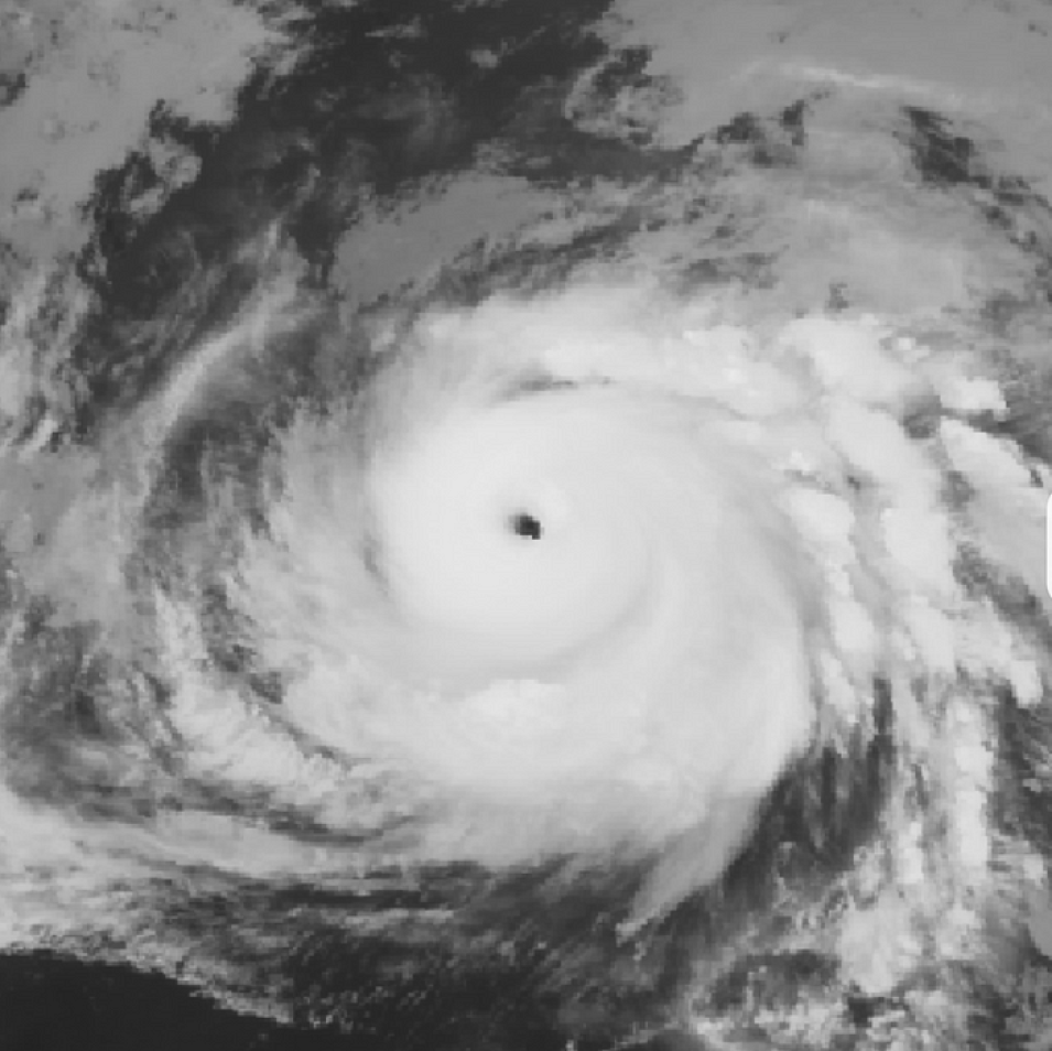
A snapshot of Hurricane Ida at 7am local time on August 29, 2021. The plot below shows the estimation of the model (black dots) versus the National Hurricane Center (NHC)/Weather Prediction Center (WPC) observed wind speeds (green dots and green solid line). The middle graph is wind speed (in knots) and hurricane category versus time. As seen on the portal for the Deep Learning-based Hurricane Intensity Estimator.
The model used by Deep Learning-based Hurricane Intensity Estimator is based on a convolutional neural network trained with large historical data of satellite imagery and corresponding wind speed information. The model is deployed in a cloud computing environment, which is triggered when an outlook of a new tropical storm is posted by the National Hurricane Center (NHC).
The advantages of this system are: (i) objective estimation of wind speed using just satellite images and (ii) the increased frequency of wind speed estimation since the automated workflow is triggered as soon as the satellite imagery becomes available (every 5–15 minutes). The resulting estimations are on display in a portal environment which also allows exploration of past hurricanes since 2018.
Users can toggle layers of NASA’s Global Precipitation Measurement (GPM) lightning data, GOES satellite longwave and shortwave infrared images, as well as sea surface temperatures on a map, allowing users to see how these change as the hurricane intensifies and weakens during its life cycle.
Improving how a machine can estimate a hurricane’s wind speeds can potentially boost disaster preparedness and response for landfalling tropical cyclones across the globe. The Hurricane Intensity Estimator is an example of how IMPACT is using NASA resources to foster innovation and enable early technology adoption.
Explore IMPACT’s Hurricane Estimator portal. The portal is currently in the alpha stage of its release, and welcomes feedback from users. Please fill out the feedback form on the bottom of the ‘About’ page.
More information about IMPACT can be found at NASA Earthdata and the IMPACT project website.
References:
M. Maskey et al., “Deepti: Deep-Learning-Based Tropical Cyclone Intensity Estimation System,” in IEEE Journal of Selected Topics in Applied Earth Observations and Remote Sensing, vol. 13, pp. 4271–4281, 2020. doi: 10.1109/JSTARS.2020.3011907
R. Pradhan, R. S. Aygun, M. Maskey, R. Ramachandran and D. J. Cecil, “Tropical Cyclone Intensity Estimation Using a Deep Convolutional Neural Network,” in IEEE Transactions on Image Processing, vol. 27, no. 2, pp. 692–702, Feb. 2018. doi: 10.1109/TIP.2017.2766358


