Open Science and Open Data at AGU

The American Geophysical Union’s Fall Meeting 2021 is fast approaching, and the IMPACT team is polishing several presentations on informatics and Earth science data management and use.

The American Geophysical Union’s Fall Meeting 2021 is fast approaching, and the IMPACT team is polishing several presentations on informatics and Earth science data management and use. Below are previews of three of these presentations.

Aimee Barciauskas is bringing “Supporting Open Science through Cloud-Based and Interoperable APIs for Data Access and Visualization: The Multi-Mission Algorithm and Analysis Platform (MAAP) Data System” to the conference. MAAP demonstrates an innovative solution that lowers the barrier to accessing and utilizing data for refining biomass models and that addresses the scientific need for rapid processing.

The Joint ESA-NASA Multi-Mission Algorithm and Analysis Platform’s (MAAP) is a cloud-based solution that offers solutions to efficiently discover, access, and process at scale disparate data. This presentation will demonstrate the key components of the MAAP data system including the accessibility of data through interoperable APIs as well as subsetting and visualizing cloud-optimized data including lidar point clouds and raster datasets.

Venn diagram showing the link between MAAP, NASA, and the ESA.
Image Caption

MAAP is an open, collaborative environment that facilitates open data use across aggregated NASA and ESA terrestrial biomass data sets and metadata. NASA MAAP image.

Datasets must be processed and curated into these additional layers of service for subset data access and scalable visualization. The data team prioritizes this curation for datasets which have been identified by the MAAP user working group as the highest value (such as the ICESat-2 ATL08 point cloud dataset and the Shuttle Radar Topography Mission Digital Elevation Model) or identified as the most challenging to use. This presentation will discuss the curation and management efforts required to support these services that lower the barrier to analysis and the user engagement efforts promoting open science.

“Stakeholder Engagement Program Activities Supporting the Satellite Needs Working Group” will be presented by Andrew Molthan and describes the Satellite Needs Working Group (SNWG) Management Office that has been established within IMPACT. SNWG is an initiative of the U.S. Group on Earth Observations (USGEO) that provides a cross-agency approach to address civil Earth observation satellite needs.

IMPACT’s SNWG Management Office shepherds products proposed and developed as a result of SNWG surveys through their implementation to operational deployment. As part of the SNWG Management Office, the Stakeholder Engagement Program (SEP) leads training and outreach in collaboration with SNWG product teams. In collaboration with solution development teams, the SEP focuses on addressing the needs of SNWG participants expressed during the assessment phase that follows each survey. This presentation will highlight preliminary activities of the SEP in supporting SNWG Cycle 1 and 2 outcomes, planned linkages to other NASA and federal partner activities, and planned engagements supporting Cycle 3 in alignment with NASA Earth Science Data System’s (ESDS) open science initiative.

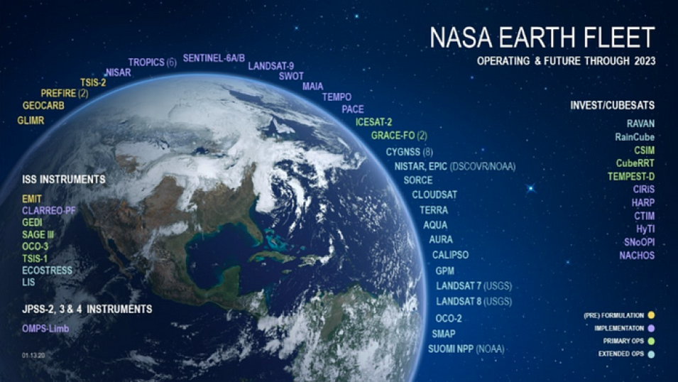
Image of the Earth surrounded by the names of all of the current and upcoming Earth observing fleet.
Image Caption

NASA’s Earth observation fleet of satellites

Another view of IMPACT’s SNWG Management Office’s efforts will be provided by Katrina Virts in the presentation “A Survey of Earth Observation Data Needed by U.S. Federal Agencies”. The SNWG surveys U.S. federal civil agencies every two years regarding the Earth observation data they need in order to accomplish their high-priority agency objectives. The 2020 SNWG survey marked the third biannual assessment cycle. Information solicited by the survey includes: the nature of the need, features, and phenomena being observed; data measurement characteristics; satellites and data products the agency uses or plans to use; agency satisfaction with currently available data; and limitations to agency use of satellite data.

For analysis purposes, agency needs are assigned to science focus areas such as atmospheric composition, carbon/ecosystems, solid Earth, water, etc. Analysis of the survey responses yields insights into the current landscape of Earth observation needs across U.S. government agencies. The evolution over multiple survey cycles has been analyzed by IMPACT’s SNWG assessment team. The presentation covers key trends that emerged in the agency-agnostic analysis that can be helpful to NASA decision-makers evaluating the ongoing, evolving, and emerging needs for NASA missions and instrument datasets expressed by participating agencies in the SNWG.

Details

Last Updated

Published