The Catalog of Archived Suborbital Earth Science Investigations (CASEI) Transitions From Beta to Full Release

CASEI is a centralized web interface for users to rapidly access information and data products acquired by NASA’s airborne or field investigations.

It’s time for high fives and fist bumps at IMPACT. After four years of planning, building, and refining, the Airborne Data Management Group (ADMG) within IMPACT reached a major milestone in their efforts to develop a centralized web interface for users to rapidly access information and data products acquired by NASA’s airborne or field investigations. The Catalog of Archived Suborbital Earth Science Investigations (CASEI), originally launched in beta version in the summer of 2021, now contains extensive, searchable metadata for 107 campaigns (65% of all currently known airborne and field campaigns), more than 500 instruments, and over 120 platforms. Achieving this level of content curation means that CASEI can graduate from beta status to a fully released user resource. As a web-based, openly accessible user resource, CASEI is the most extensive search and discovery platform available to Earth science researchers and anyone interested in learning more about suborbital research endeavors.

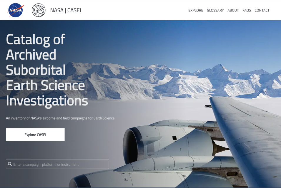
Screenshot of the Catalog of Archived Suborbital Earth Science Investigations (CASEI) website
Image Caption

The Catalog of Archived Suborbital Earth Science Investigations (CASEI) homepage

A previous IMPACT blog post explained the factors that originally motivated CASEI’s construction. Responses to the inaugural Satellite Needs Working Group (SNWG) assessment survey in 2016 revealed that researchers needed an easier method of discovering and accessing airborne and field data. From its inception, CASEI was designed to address this challenge. The overarching project goal was to reduce the time required to locate data, thus accelerating the time to actionable science.

CASEI accomplishes this feat by providing consolidated access to information and data products that are spread among NASA’s Distributed Active Archive Centers (DAACs). Each discipline-specific DAAC organizes documents and datasets according to their own procedures, requirements, and data access pathways. With CASEI, instead of searching through multiple DAAC data catalogs with varying interfaces and search parameters, users can submit a single query to locate specific information — from the types of instruments flown on a particular aircraft to the variety of measurements collected during a campaign. Search results include direct links to data product landing pages managed by the DAACs.

CASEI also has an array of filtering options packed with metadata to provide context for users. As one example, science researchers might be seeking historical observation data that could support a new research question. With previously developed search tools, airborne and field data are typically buried within vast amounts of other data (usually from satellites). However, CASEI allows users to quickly search and filter NASA’s airborne and field data products exclusively. Users can browse data from a particular vertical measurement region, data collected via a particular platform, or data gathered through remote or in situ measurement methods. They can also apply multiple combinations of filters to generate highly customized results.

Screenshot of CASEI data filtered by measurement
Image Caption

CASEI users can search for airborne and field data using a variety of filtering methods, including sorting data products by measurement styles and date ranges.

Curating Metadata

Meticulously curated metadata forms the backbone of the CASEI inventory. The trove of information compiled in CASEI concerning campaign events, observations, and characteristics provides necessary context for accurately interpreting and using data products. A dedicated curation team has spent thousands of hours compiling details about the science objectives, temporal and spatial measurement characteristics, sensor configurations and platform placement, funding mechanisms, personnel, and many other aspects of non-satellite investigation details. Their work ensures that users can trust that the information they find in CASEI is thorough and reliable.

Dr. Stephanie Wingo, a research scientist at The University of Alabama in Huntsville, serves as ADMG team lead. When asked about how her team manages such comprehensive curation efforts, she pointed to how team diversity and the use of information management tools support their work.

"We have a great team of curators — folks from a variety of backgrounds that, upon joining the team, undergo an extensive, actively-involved training. The team makes use of a variety of tools to ensure consistent determinations throughout the curation process — these include objective decision trees, an subject matter expert-reviewed set of terminology definitions, and a fully mapped data model."

While training and tools go a long way in helping curators, combing through documents and repositories simply takes a lot of time. Ashlyn Shirey is an ADMG curator who has been working with the team for three years. She described what the metadata curation process entails to add a single new airborne campaign to the CASEI interface.

"On average, it takes about 2–3 days for a curator to collect metadata for a new campaign, then the campaign must be reviewed by two additional curators. Campaigns that have multiple deployments over several years can take up to a week or more to complete the first round of curation. Also, campaigns that happened decades ago can take additional time due to information being limited for those campaigns."

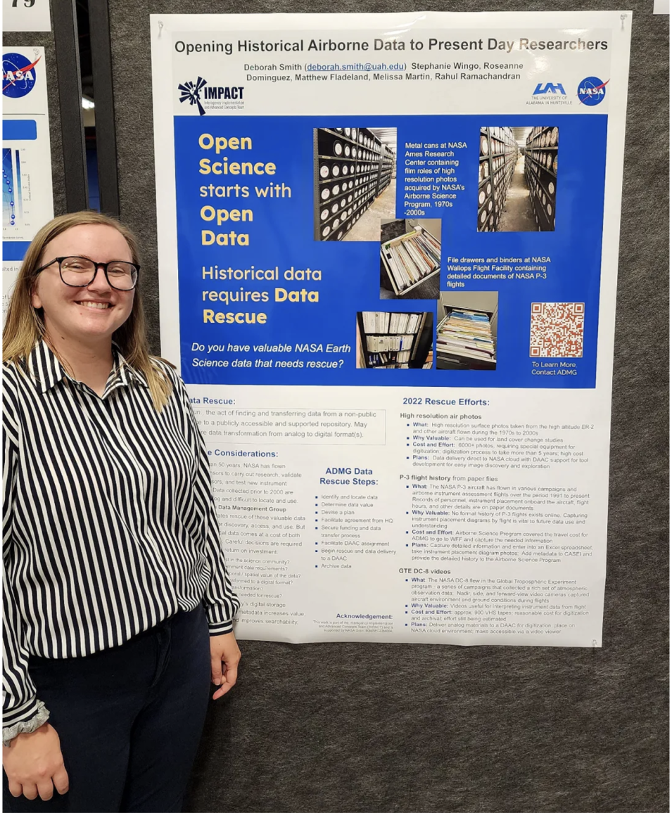
CASEI curator Ashlyn Shirey stands in front of a poster showing airborne data at NASA’s MSFC Science and Technology Poster Jamboree
Image Caption

Ashlyn Shirey, a CASEI curator, attended NASA’s MSFC Science and Technology Poster Jamboree in June 2023 and shared information about CASEI as well as ADMG’s recent airborne data rescue efforts.

Ashlyn also shared how curators ensure that they are providing accurate information to airborne and field investigation data users.

"We make sure only to use authoritative sources for collecting our metadata such as journal papers, field catalogs, and flight reports. Also, the curation process for every campaign requires the guidance and approval of three team members — the primary curator plus two reviewers — before being made publicly available through CASEI."

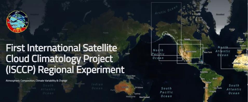
The ADMG team has taken care to not only focus on recent campaigns but also to curate information about historical campaigns from up to 50 years ago. For example, the NASA-led First International Satellite Cloud Climatology Project (ISCCP) Regional Experiment (FIRE) conducted five deployments with over 240 flights from 1986 to 1998. The FIRE campaign focused primarily on gathering measurements of marine stratocumulus and cirrus cloud systems to help determine their role in global climate events. Airborne remote and in situ sensor data combined with ground-based, balloon, shipborne, and satellite cloud observations produced a robust collection of over 120 data products. By entering search parameters in CASEI, researchers today can quickly gain access to historical data and information from campaigns such as FIRE to explore long-term variability in atmospheric phenomena. The data products from FIRE are archived at the Atmospheric Science Data Center (ASDC), a NASA DAAC focused on atmospheric science data products and services.

Poster for the NASA-led First International Satellite Cloud Climatology Project (ISCCP) Regional Experiment (FIRE)
Image Caption

The First International Satellite Cloud Climatology Project (ISCCP) Regional Experiment (FIRE) is one of the oldest campaigns incorporated into CASEI.

Opening Science Access

It’s fitting that the full release of CASEI is occurring this year, as it highlights one of NASA’s current top priorities. NASA declared 2023 the “Year of Open Science” as part of a broad effort to shift the paradigm for science data access and use. The ADMG team’s dedicated efforts directly support NASA’s goal to foster more “inclusive, transparent, and collaborative scientific processes.” Team lead Stephanie Wingo shared how she perceives that CASEI plays a major role in NASA’s Open Source Science Initiative (OSSI).

"Open science is more than simply open data (which, open data itself carries a host of weighty implications). While ADMG and other groups are working to improve data openness, open science requires steps even further beyond. ADMG and CASEI are supporting open science by providing an efficient, intuitive means for the discovery of, contextualization for, and access to suborbital Earth science data — which further supports the appropriate reuse of data, increasing the return on investments made for data collection and stewardship."

Deborah Smith, a principal research scientist at The University of Alabama in Huntsville and the original project leader of ADMG, agrees that CASEI is adding considerable value to airborne data management and research practices.

"CASEI helps to open the history of airborne and field activities and details of each activity to all users. Paired with the data rescue efforts of ADMG, the data are slowly becoming open to all. I am always happy when I hear a scientist say that what we are doing is highly valuable and much appreciated. Many folks knew airborne data needed better organization and access, and we are making that happen."

Even in its beta version, CASEI already caught the attention of the airborne science community. Eli Walker, an ADMG team member who specializes in gathering statistics and information about CASEI’s use, is pleased with the early adoption metrics.

"Google Analytics data have revealed that there is a global interest in CASEI with initial data showing users from nearly every continent. This is very impressive because, before now, CASEI was not even fully released and broadly announced yet. We can conclude that people are exploring the website, learning about what CASEI is, and actually viewing the contextual metadata that we produce."

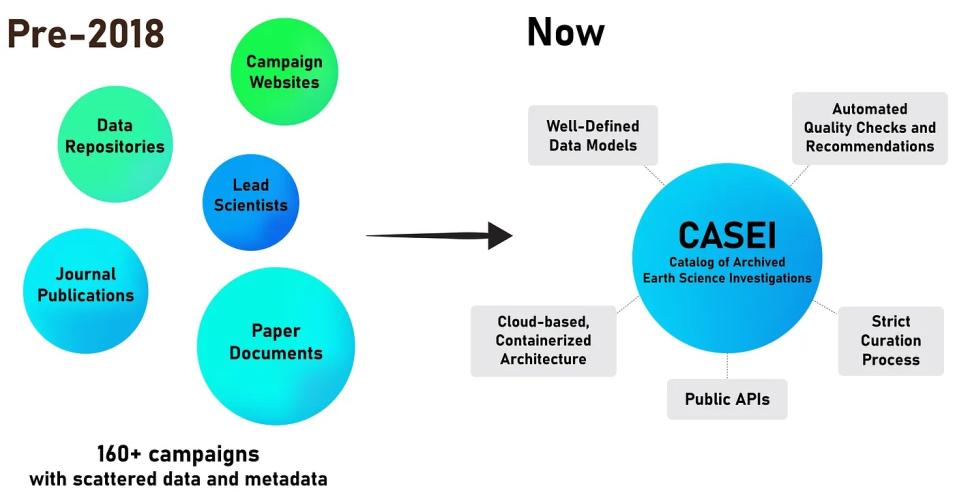
Since 2018, CASEI has centralized campaign information and data product links for NASA’s airborne and field investigations
Image Caption

CASEI successfully corrals campaign information and data product links for NASA’s airborne and field investigations by applying rigorous metadata standards.

Enhancing CASEI

While the ADMG team is celebrating the “full release” milestone, they won’t be stepping away from their keyboards any time soon. They still have dozens of campaigns to curate and add to the CASEI interface as well as a long wish list of user interface enhancements to implement. Late last year, the team convened a “CASEI Future State Workshop” to review their progress and determine the next steps for CASEI evolution and maintenance. They established that their top priorities are to continue campaign curation and to implement iterative improvements to the CASEI user interface to better support an efficient, intuitive user experience. With 107 of 164 known campaigns added to CASEI, they are well on their way to accomplishing their curation goal. However, the goalpost keeps moving as more historical campaigns are discovered that need to be added to CASEI.

Several updates are in development that will be added to CASEI later this year and beyond:

  • Maps of platform tracks and locations (flight paths, ship voyages, field sites) for all campaigns in the CASEI inventory
  • Increased transparency in curation status: posts on what campaigns, instruments, and platforms are currently being curated and coming soon to the CASEI database
  • Support for determining coincident satellite overpasses
  • Additional links to resources on campaign- or data-specific tools and software as well as historical perspectives on the origin of individual platforms and their use in NASA Earth science.

Looking to the Future

As CASEI progresses into and beyond full release, ADMG and the NASA Earth Science Data Systems (ESDS) program are exploring long-term solutions to support these unique metadata and discovery capabilities. Currently, a collaborative team consisting of ADMG, DAAC, and NASA Earth Science Data and Information System (ESDIS) personnel are planning what will become the Airborne and Field Data Resource Center — a virtually operating center to oversee the stewardship of airborne and field data products. Once the center is operational, CASEI will be a cornerstone of its offerings. For now, CASEI will continue to be administered by the ADMG.

Now is the time to celebrate the years of focused effort it took to build CASEI. Dozens of students, scientists, and developers have worked together successfully to create a nimble, valuable tool that directly supports scientific progress. However, the team is already eager for tomorrow and the opportunity it brings to make their great product even greater.

You can explore CASEI and learn more about ADMG via their web pages.

More information about IMPACT can be found on the NASA Earthdata and IMPACT project websites.

LinkedIn Profiles: Stephanie Wingo, Deborah Smith, Ashlyn Shirey, and Eli Walker.
Details

Last Updated

Published