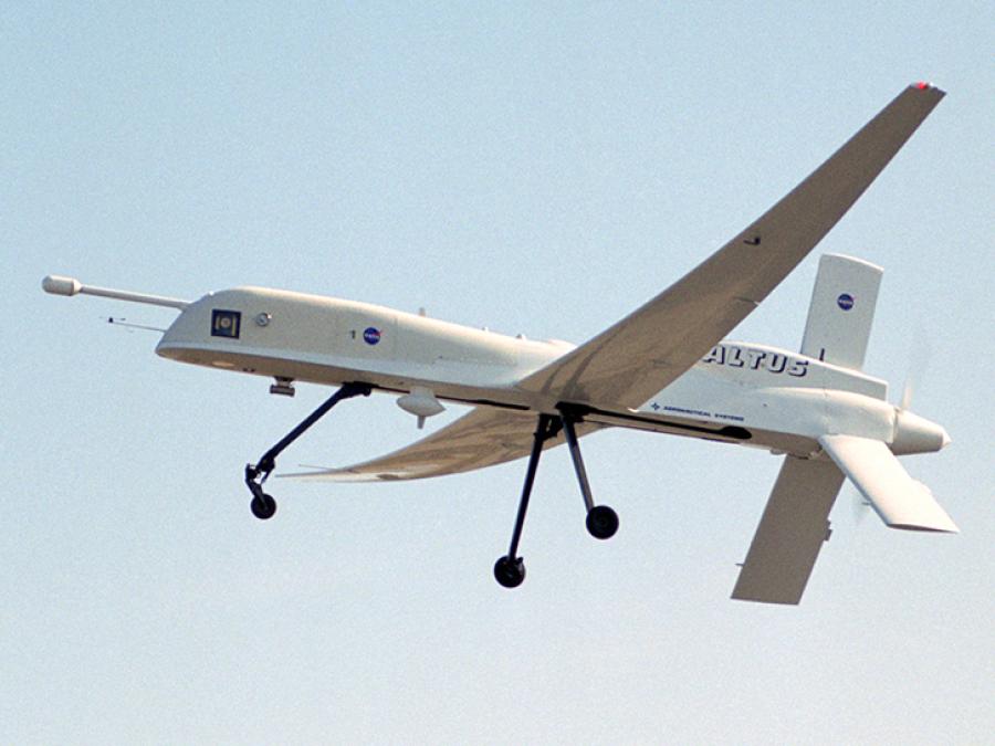
image of Altus aircraft in flight
image of lightning
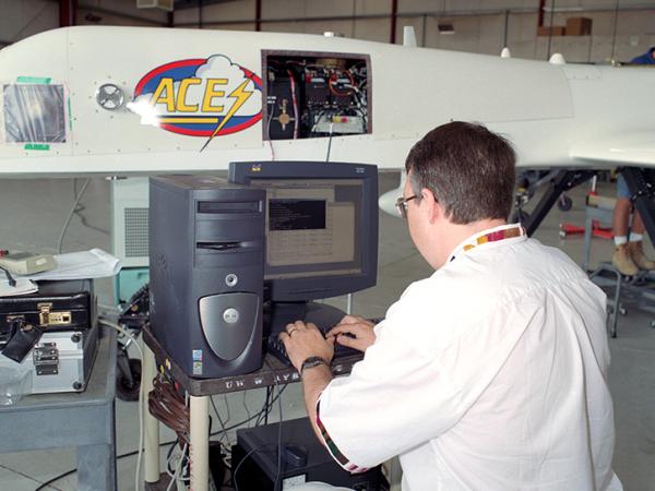
image of person working on ACES project

ACES

ALTUS Cumulus Electrification Study

The ALTUS Cumulus Electrification Study (ACES) was a field investigation that focused on studying electrical activity within storms and validating satellite observations from the Lightning Imaging Sensor (LIS). ACES consisted of one deployment in August 2002 over the Florida Everglades. Researchers chased down thunderstorms using an uninhabited aerial vehicle (UAV), allowing them to achieve dual goals of gathering weather data safely and testing new aircraft technology. This marked the first time a UAV was used to conduct lightning research.

Aimed at better understanding the causes of an electrical storm's fury and its effects on our home planet, this study was a collaboration among the Marshall Space Flight Center (MSFC); The University of Alabama at Huntsville; NASA's Goddard Space Flight Center, Greenbelt, Md.; Pennsylvania State University, University Park; and General Atomics Aeronautical Systems Inc., San Diego.

Objectives

ACES addresses three primary science objectives:

  • Lightning Imaging Sensor (LIS) Validation
  • Lightning-Storm Relationships
  • Storm Electrical Budget

Overview

The validation effort will provide detailed characterization of lightning type, cloud-top optical energy, and power statistics that is needed to better interpret the global lightning database collected by LIS.

The ALTUS electrical measurements and ancillary ground-based measurements, from the extensive electrical and meteorological observing systems already in place at KSC, will provide detailed information on cloud properties throughout the thunderstorm life cycle. The relationships between storm electrical and kinematic properties is of particular interest as they might be used to discriminate severe from non-severe storms. How mesoscale boundaries (e.g., land/ocean) affect the development and evolution of these properties will also be explored.

Finally, ACES electrical measurements will enable us to uniquely address important questions about the electrical budget of thunderstorms, the global electric circuit, and the electrodynamic interaction with the upper atmosphere.

Lightning Imaging Sensor (LIS) Validation

The UAV measurements provide an uninterrupted depiction of the storm growth and decay life cycle-from the very first indication of electrification to the first lightning through thunderstorm dissipation. The timing of the initial electrification and the complete documentation of total lightning activity provide important validation data for newly developed three-dimensional storm electrification models with explicit (and detailed) microphysics (Mansell, 2000). Such models make explicit forward predictions of the co-evolving microphysics, kinematics, and the total flash rate partitioned into in-cloud and Cloud to-Ground (CG) lightning components, including flash polarity. The ability of the UAV to stay aloft for an extended period also offers an opportunity to observe convective storms as they transition from multi-cellular storms into organized mesoscale convective weather systems having well defined convective and stratiform precipitation regions and electrical coupling to the upper atmosphere.

The combined UAV and ground-based observations will provide a necessary measurement set that yields more physically realistic cloud models, which in turn can be expected to benefit the forthcoming higher-resolution research and operational mesoscale forecast models.

Flow chart showing the connection of UAV measurements to the enabled science and to NASA's science themes.
Image Caption

The connection of the measurements to the enabled science and thus to NASA's science themes, depicted in the figure above, is clear.

Storms are the fundamental elements of the global water and energy cycle and the agents of severe weather, flash floods, and wild fire initiation. The unique set of observations afforded by the ability of the UAV to continuously observe storms for extended periods of time will improve our understanding of the process physics and lead to improved models of individual thunderstorms and convective weather systems.

Lightning-Storm Relationships

Both theory and observations show that the processes that lead to the production of lightning are tightly controlled by the cloud updraft and the formation of ice (Baker, 1995; Dye, 1986). Lightning initiates soon after the onset of strong convection, after significant cloud mass and ice have formed in the upper regions of the thunderstorm. It is this physical coupling that enables us to use lightning to study strong convection and ice development. Developing these lightning relationships is important because lightning is often easier to measure than most convective parameters and lightning measurements can be easily made from space.

Storm Electrical Budget

An opportunity to obtain the current budget in a thunderstorm will present itself if we conduct a field campaign at Patrick Air Force Base (PAFB), Florida. The complete current budget consists in determining the vertically directed currents flowing above, within, and beneath a thundercloud. By determining the current budget, it will be possible to test support for the convective theory (Vonnegut, 1963) of thunderstorm charging since this theory places specific constraints on the expected storm currents.

Mission

The Uninhabited Aerial Vehicle (UAV) represents an exciting new technology that can contribute in significant and unique ways to lightning and storm observations. In turn, these measurements can be linked to global scale processes (e.g., global water and energy cycle, climate variability and prediction, atmospheric chemistry) to provide an improved understanding of the total Earth system.

We have chosen the ALTUS II aircraft produced by General Atomic-Aeronautical Systems, Inc. (GA-ASI) for the ACES investigation. The decision to select GA-ASI as the partner was based on a number of factors including the maturity level of the ALTUS aircraft, its performance capabilities and proven flight record, and the successful integration and flight of the ACES payload on ALTUS in September 2000 under a Small Business Innovation Research (SBIR) activity with IDEA managed by one of the Co-Investigators (Co-Is), Dr. R. Goldberg.

We propose to fly ALTUS as a component of a currently funded field experiment. That field experiment, in the vicinity of NASA Kennedy Space Center (KSC), is being conducted to both validate the Tropical Rainfall Measuring Mission (TRMM) satellite measurements, and investigate lightning activity and its relationship to storm morphology. The ACES payload, already developed and flown on ALTUS, includes several electrical, magnetic, and optical sensors to remotely characterize the lightning activity and the electrical environment within and around thunderstorms.

ACES will contribute important electrical and optical measurements not available from other sources. Also, the high-altitude vantage point of the UAV observing platform offers a "cloud top" perspective especially useful for the validation study. In turn, the ground-based experiment will enable the UAV measurements to be more completely interpreted and evaluated in the context of the thunderstorm structure, evolution, and environment. Together, the UAV and ground-based observations will advance the application of global space-based lightning measurements (which are relatively easy to make) toward a better understanding of the Earth system.

Three important science objectives will be simultaneously addressed by this UAV investigation: (1) Lightning Imaging Sensor (LIS) validation, (2) lightning-storm relationships, and (3) storm electric budget. The validation effort will provide detailed characterization of lightning type, cloud-top optical energy, and power statistics that is needed to better interpret the global lightning database collected by LIS.

The ALTUS electrical measurements and ancillary ground-based measurements, from the extensive electrical and meteorological observing systems already in place at KSC, will provide detailed information on cloud properties throughout the thunderstorm life cycle. The relationships between storm electrical and kinematic properties is of particular interest as they might be used to discriminate severe from non-severe storms. How mesoscale boundaries (e.g., land/ocean) affect the development and evolution of these properties will also be explored.

Goals

There are two primary demonstration goals in the ACES project.

First, by exploiting the unique capabilities of ALTUS, we will demonstrate the utility and promise of UAV platforms for investigating thunderstorm and other weather phenomena. Slow flight speed, coupled with long endurance and high-altitude flight give the ALTUS aircraft the ability to be maintained continuously near thunderstorms for long periods of time and enable investigations to be conducted over entire storm life cycles. This overcomes the limitations of conventional aircraft that, as a result of much faster flight speeds, provide only a few brief "snapshots" of storm activity sandwiched between long intervening periods with no observations. The ALTUS, with its lower flight speed, can remain within measurement range (i.e., ~5 km) even while making turns. Presently, only the ALTUS has this combination of capabilities, essential for conducting complete storm life cycle investigations (i.e., no gaps). This demonstration goal supports a principal objective of the NRA.

A second goal, supportive of the NRA objectives, is to provide a demonstration of real-time monitoring and control of the UAV science payload and data. During flights, selected instrument output (e.g., electric field) will be sent to the ground via the ALTUS telemetry link enabling us to monitor target storms in real time. In fact, we have proposed to monitor the ambient electric field environment in real time to avoid high electric field (>25 kV/m) regions, and thus reduce to a low probability the threat of incurring a lightning strike to the aircraft. Output from the ALTUS video camera will also help monitor storm conditions in real time.

Experiment Design

In order to achieve our objectives, we expect to use the ALTUS to observe thunderstorms during two field campaigns in the summer months of 2002 and 2003. It is anticipated that each campaign will last approximately 4 weeks with a goal of performing 8 to 10 UAV flights during each campaign. Each mission will require about 4 to 5 hours on station at altitudes from 40,000 feet to 55,000 feet. For the missions, we will need ALTUS to fly close to, and when possible, above (but never into) thunderstorms using safe operational procedures.

We propose to base the flight operations from Patrick Air Force Base (PAFB), just south of KSC, Florida. At this location, we can take advantage of, and provide close coordination with, the measurements being acquired in central Florida in conjunction with the NASA funded Lightning Imaging Sensor Data Applications Demonstration (LISDAD) experiment. In addition, real-time access and support from ground-based systems already in place, along with standard meteorological data products, will be available to the ACES project. This KSC instrumentation, represents one of the most densely packed and unique suites of operational weather sensors available anywhere in the world. The data provided to ACES will be employed in real time to aid mission planning and execution. During post deployment, this data will aid in the science analyses and in the education and public outreach lesson plan development.
Study DatesAugust 2002
Region
Florida Everglades
Focus AreaLightning

The ALTUS UAV system consists of one ALTUS aircraft, one Ground Control Station (GCS), one Ground Data Terminal (GDT), and Ground Support Equipment (GSE). A typical setup is illustrated in the figure below. Presently ALTUS can operate at a maximum range of approximately 125 n mi.

This poses no limitation for the proposed Florida (or an Alabama) deployment since we would like to remain within 200 km of the center of the ground-based network. A C-band Line-of-Sight (LOS) data link provides two uplink and two downlink data streams to establish full duplex communication between the ALTUS aircraft and the GCS. Normally, one uplink and two downlinks are utilized.

Advantages of the ALTUS Over Alternate Platforms for Storm Investigations

The performance characteristics of the ALTUS, including some very unique capabilities, make this UAV ideally suited for pursuing the proposed thunderstorm studies. The performance characteristics include high-altitude flight, long-duration missions with long "on station" time, slow flight speed, and quick response time. No other aircraft platform has this combination of capabilities, essential for acquiring complete storm life cycle observations.

The basic goal of the flight patterns is to stay as close to the thunderstorm of interest for as long as possible. In most cases, it will be desirable to overfly the storm as it initiates, grows, matures, and decays. Occasionally the storm becomes too intense or vertically developed to directly overfly. In that case the ALTUS may be flown around the storm while staying as close to the storm as possible. Turns will be made as quickly and smoothly as possible to maximize the data collection quality. The primary flight pattern will be the petal as shown in the figure to the right.

This pattern will be best for isolated storms that can be overflown. The approach to the storm will be on a vector directly over the center of the storm. The initial flight path will continue until the aircraft has passed over the storm. As soon as possible after the aircraft clears the storm top, the aircraft executes a sharp (but smooth) turn until it is again on a vector over the storm center. Note that as the storm moves, the pattern will stay constant in the storm frame-of-reference, that is, we want to stay with the storm, not with some set location fixed in relation to the ground. This pattern will continue until the storm has decayed or the aircraft is vectored to another target.

If the petal flight pattern is not appropriate for the storm situation, the next desirable flight pattern is called the racetrack. This pattern will be most appropriate for lines of thunderstorms or storms with significant anvils. The approach to the storm is along a vector in line with the storm center or storms centerline. Once the aircraft has cleared the storm (or reached the end of the storm line or anvil), the aircraft executes a 90/270-degree turn set to return it to the same storm relative heading as on the previous vector, only in the opposite direction. This pattern continues until the storm has decayed or the aircraft is vectored to another target. If the storm is too tall or severe for direct overflights, the polygon pattern, will be the next best choice. The approach pattern will be to make the closest approach to the storm as conditions allow. Once this closest approach is made, the aircraft is to make a series of glancing approaches to the storm. The occasional, small turns are to be made as quickly and as smoothly as possible so that the maximum time is spent on straight and level flight. This pattern continues until the storm has decayed or the aircraft is vectored to another target.

The final flight track is called the line. It is for cases where there is a line of storms that are too severe or tall to overfly. The aircraft is to approach the storm as if it were going to overfly or penetrate the first storm in the line. At the distance of closest approach, the aircraft is to turn and fly straight and level, parallel with the front face of the storm system. After the UAV passes the storm system, it will execute a 90/270-degree turn set away from the storm to bring the aircraft back along the initial storm relative flight line only now in the opposite direction. The actual distance to the storm edge will be determined by the storm type and severity. This pattern will continue until the storm system decays, moves out of range, or the aircraft is vectored to another target.

View a playlist of ACES videos, including interviews with the investigators and footage of the ALTUS in flight.