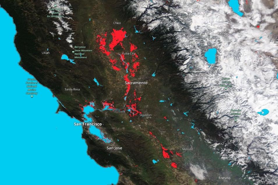
Mapping floodwater extent for active floods is critical for local and regional officials and for disaster relief organizations that need to ascertain where to focus their efforts. NASA's Land, Atmosphere Near real-time Capability for Earth observation (LANCE) provides data to the Dartmouth Flood Observatory. Learn more about LANCE's MODIS NRT Global Flood Product.
Users can visualize imagery related to floods in Worldview, or download data using the links below.
