HLS Team Completes Historical Processing

Users can now access the full Harmonized Landsat and Sentinel-2 (HLS) data archive back to April 2013.
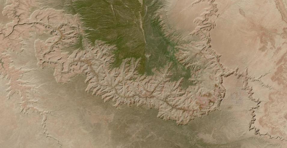
Clear sky image of the Grand Canyon at 30-meter resolution; canyon winds through center of image with greenish area at top of image
Image Caption

The Colorado River winds through the Grand Canyon in northern Arizona, USA, in this cloud-free HLS S30 image acquired on August 5, 2023. Interactively explore this image of the Colorado River in NASA Worldview. Credit: NASA Worldview.

The completion of historical processing of the Harmonized Landsat and Sentinel-2 (HLS) S30 data product provides a continuous archive of Sentinel-acquired HLS data and imagery dating back to 2015. Combining the S30 data with previously back-processed HLS Landsat-acquired (L30) data (which was accomplished in May 2022) creates a continuous HLS data and imagery archive from 2013 to present.

The S30 back processing was carried out between March and June 2023. The effort was managed by the HLS team within NASA's Interagency Implementation and Advanced Concepts Team (IMPACT) with support from staff at NASA's Land Processes Distributed Active Archive Center (LP DAAC) and NASA's Global Imagery Browse Services (GIBS). This back-processing effort added about 1.5 petabytes (PB) of data to the HLS archive.

“The completion of historical processing increases the density of time-series analyses using HLS products,” says John Mandel, a NASA IMPACT HLS applications data manager. “This enables users to better understand the land surface and monitor change at a higher frequency.”
Body of water in the desert in center of image; green salt pans to south
Image Caption

HLS Sentinel/MSI image of the Dead Sea with salt evaporation ponds showing as green areas south of the main body of water. Image acquired on December 21, 2022. Interactively explore this image of the Dead Sea in NASA Worldview. Credit: NASA Worldview.

HLS data provide near-global terrestrial observations at 30-meter resolution with a latency of two to three days. HLS products are created from imagery acquired by four sensors aboard four different satellites that are harmonized to work as a single data collection: the Operational Land Imager (OLI) and OLI-2 sensors aboard the joint NASA/USGS Landsat 8 and 9 satellites, and the MultiSpectral Instrument (MSI) aboard the ESA (European Space Agency) Sentinel-2A and -2B spacecraft. Back-processing to the beginning of the Landsat 8 and Sentinel-2 data records (2013 and 2015, respectively) began after the full release of HLS data in 2021.

“Despite Landsat and Sentinel-2 having similar purposes and characteristics, users generally have to pick one constellation or the other,” Mandel says. “By normalizing the differences [between Landsat and Sentinel-2 instrument data], we have a dataset that lets users work with all four satellites currently operating and any new systems we incorporate, such as Sentinel-2C that is scheduled for launch [in 2024].”

Two primary HLS data products are available: S30 and L30. S30 comprises MSI harmonized surface reflectance resampled to 30-meters into the Sentinel-2 tiling system and adjusted to the Landsat 8/9 spectral response bandwidths. L30 comprises OLI harmonized surface reflectance and Top-of-Atmosphere (TOA) thermal infrared data resampled to 30-meters into the Sentinel-2 tiling system.

HLS data contribute significantly to explorations into terrestrial processes. A principal application area is agriculture, including studies into vegetation health, drought impacts, and crop development, management, and identification.

Explore HLS Data

Details

Last Updated

Published

Data Center/Project

Land Processes DAAC (LP DAAC)