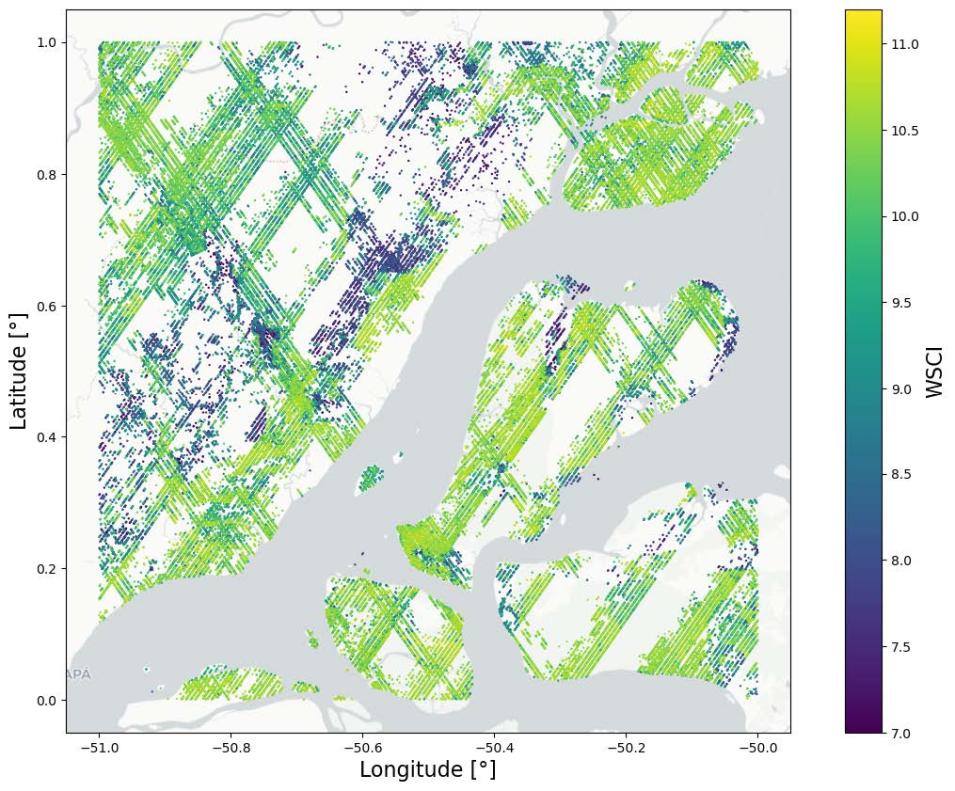
“Structural complexity of the forest canopy is a good indicator of a forest’s habitat quality, species diversity, and ecosystem function,” said Dr. Rupesh Shrestha, a research staff member at NASA's ORNL DAAC. “This Level 4C product provides the first near-global estimate of forest canopy structural complexity and its uncertainties, which can lead to a fine-scale understanding of how the structural complexity varies across different ecological regimes.”
In general, canopy structural complexity (CSC) is a measure of how leaves, branches, and stems are distributed across both horizontal and vertical spaces in a forest canopy. It also is an ecosystem attribute that can be accurately estimated from airborne- or terrestrial-lidar measurements, according to Shrestha.
These measurements are an integral part of the new GEDI dataset.
“Empirical relationship models developed from more than 800,000 Airborne Laser Scanning (ALS) CSC estimates and co-located GEDI Level 2A waveform relative height metrics for different plant functional types around the globe were used to generate the global footprint-level WSCI product,” Shrestha said. “Uncertainty estimates are provided as prediction intervals at 95% confidence for every footprint.”
Those plant functional types included deciduous broadleaf trees, evergreen broadleaf trees, evergreen needleleaf trees, and a combination of grasslands, shrubs, and woodlands. Along with the WSCI estimate data, which are provided in 74,860 data files in HDF5 format (.h5) and cover the period from April 17, 2019, to March 16, 2023, the Level 4C product includes associated uncertainty metrics, quality flags, and other information about the GEDI Level 2A waveform for the product’s selected algorithm setting group. (Note: The algorithm setting group selection used for the Level 4C product is the same as the GEDI Level 2A product.)
Shrestha noted there will be a gridded 1-kilometer version of the WSCI product published in the near future, as well as updates to previously released products once the more recent GEDI instrument data become operational following the mission’s year-long pause from March 2023 to April 2024. Lower-level datasets (i.e., Level 1 and Level 2 products) will be generated first, with Level 3 and Level 4 products coming later. “GEDI Version 3 products are also in development and will include improved geolocation and other algorithmic improvements,” he said.
Providing a More Complete Picture of Forest Change
Scientists around the globe have been using GEDI data to get a better picture of how Earth’s forests are changing and measure how much aboveground carbon the world’s forests store, both of which are central to gauging how changes in forest structure are impacting Earth’s climate, particularly in regard to atmospheric concentrations of carbon dioxide. Undoubtedly, the new Level 4C WSCI product will aid such investigations.
“Data on structural complexity gives ecologists a better understanding of forest species diversity and ecosystem processes, and can offer insights into forest health and functioning,” Shrestha said. “This is critical information land managers can use to formulate their strategies and plans. These data are also beneficial for scientists using structural complexity as an indicator for restoration of degraded lands.”
However, Shrestha added that, like other footprint-level GEDI datasets, the new WSCI data product may contain spatial gaps in its coverage. Such gaps are due to the nature of GEDI's installation on the International Space Station and the space station's orbit, which restricts the location of the footprints to geographic areas residing within 51.6 degrees north and south latitude. Further, it’s important to note that instrument observations are only available along the orbital tracks, which form a crosshatch pattern on Earth's surface. Therefore, coverage gaps are present between the tracks as well.
The GEDI Mission
The GEDI instrument was installed on the International Space Station’s Japanese Experiment Module-Exposed Facility in December 2018. GEDI is a full waveform lidar instrument offering the highest resolution and densest sampling of any lidar ever put in orbit.
The sole GEDI observable is the lidar waveform and all GEDI data products are derived from it. Lidar waveforms quantify the vertical distribution of vegetation by recording the amount of laser energy reflected by plant material (stems, branches, and leaves) at different heights above the ground. From these waveforms, different structure information can be extracted, such as surface topography, canopy height metrics, canopy cover metrics, and vertical structure metrics.

