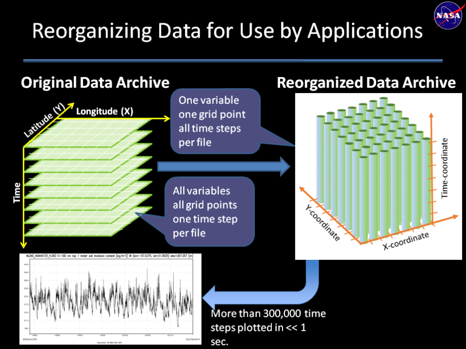
To assist members of the hydrological community in developing their own time-series datasets for specific locations, the Goddard Earth Sciences Data and Information Services Center (GES DISC) launched and operationalized a data rods project with the support of the Advancing Collaborative Connections for Earth System Science (ACCESS) program. ACCESS is a competitive awards program managed by NASA's Earth Science Data Systems (ESDS) Program that develops and implements technologies to effectively manage, discover, and use NASA's archive of Earth observations for scientific research and applications.
The GES DISC data rods ACCESS project had two primary goals:
- Reorganize two large hydrological datasets as time series for more efficient access by the Consortium of Universities for the Advancement of Hydrologic Science, Inc. (CUAHSI) and the larger hydrology community
- Integrate these time-series data (as data rods) into established hydrology community tools, such as the CUAHSI Hydrologic Information System (CUAHSI-HIS), the U.S. Environmental Protection Agency's (EPA) Better Assessment Science Integrating Point and Non-point Sources (BASINS) environmental analysis system, and the Data Rods Explorer on HydroShare's Tethys Platform
GES DISC's data rods contain data for various water cycle variables obtained from the North American Land Data Assimilation System (NLDAS) and the Global Land Data Assimilation System (GLDAS), and cover the time periods of 1979-present and 2000-present, respectively. Users can extract a time series for a specific period simply by specifying the start date, the end date, and a location. In addition, users also can access high-resolution time-series data from the Integrated Multi-satellitE Retrievals for GPM (IMERG) Final Precipitation Level 3 half hourly product featuring more than 100,000 time stamps.
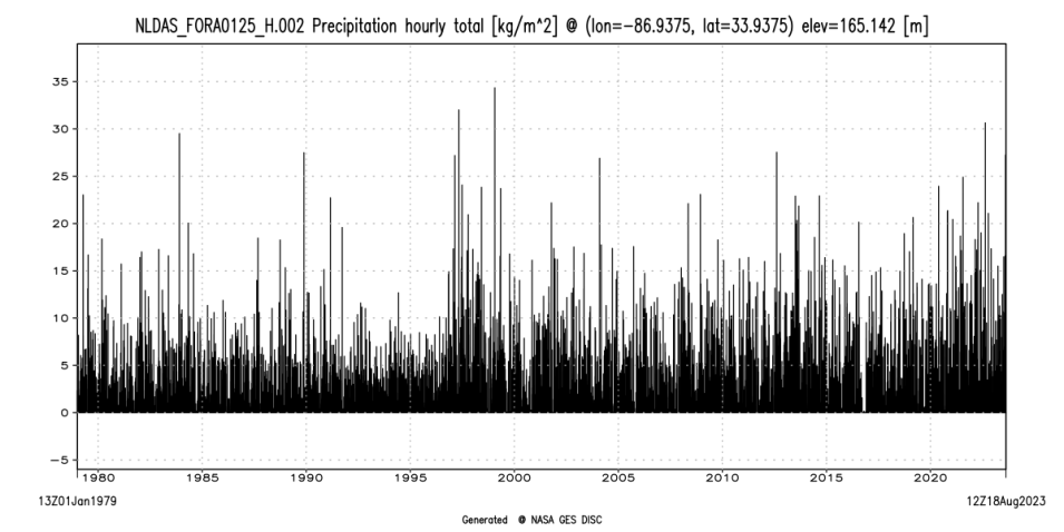
“The [Data Rods for Hydrology] tool provides fast access to time-series data along with a time-series graph, and avoids the need to download the data, as it provides data in ASCII format,” said Dr. Binita KC, user needs lead at GES DISC. “[Data rods] solve the problem users face when trying to create time series of the NLDAS hourly forcing precipitation data for single grid cells for the entire period of coverage.”
Prior to the creation of data rods, users would have to subset data for the parameters they were interested in at the appropriate latitude and longitude, and then download those files at one time-step per file. With a dataset that has a three-hourly temporal resolution, the number of files adds up quickly. Now, as long as users know the parameter they want to examine, the latitude and longitude of the point, and the length of time they want to study, they can query one of these data rods and retrieve all the data they need—remarkably fast.
Users can find a link to the Data Rods for Hydrology tool at the bottom of the GES DISC website home page (under the Tools heading). The Hydrology Data Rods page describes the data rods time series service and features three tables:
- Table 1 lists variables reorganized as a time series (data rods) along with sample URLs of the web service for each variable; the web service currently accepts five keywords: variable, location, startDate, endDate, and type
- Table 2 describes the Key-Value-Pair (KVP) syntax of the web service. The startDate and endDate are optional; the date/time of the first and last time steps, respectively, are the default values. All sample URLs for "plot" that do not specify startDate ;and endDate return a time series of the entire date range
- Table 3 describes the basic characteristics of NLDAS and GLDAS data
Users can also access GES DISC's Hydrology Data Rods via an Application Programming Interface (API), such as the one provided in the tutorial How to Access the Hydrology Data Rods Time Series API Using Python.

