Event

On August 28, 2013, a tropical wave formed off of the west coast of Africa and moved westward. The tropical wave eventually developed into a large low-level cyclonic flow that extended from the western Caribbean Sea to the eastern north Pacific Ocean. From this tropical wave, two hurricanes developed, Ingrid in the western Gulf of Mexico and Manuel in the Eastern Pacific. Intense tropical rainfall inundated Mexico’s Pacific and Gulf coasts when both storms made landfall during September 15-16, 2013. Storm-induced floods and mudslides resulted in over 130 casualties and more than 500 million dollars in damage. 
 
Late on September 14th, Ingrid strengthened into a hurricane and was headed for the coast of Mexico near Tampico with peak sustained winds of 75 mph. As a part of the Hurricane and Severe Storm Sentinel (HS3) Field Campaign, NASA's Global Hawk 871, an unmanned aerial aircraft, flew over Ingrid on September 15th carrying instruments that measure radar reflectivity which can be used to derive wind speed and rain rates.

Science Question

Can areas of heavy rain and wind be identified within Ingrid ahead of landfall?
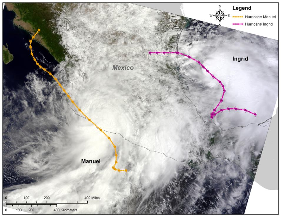
Global Hawk flight paths are superimposed above a satellite image of Hurricanes Ingrid (pink) and Manuel (yellow).
Image Caption

During the HS3 airborne field campaign, the Global Hawk 871 aircraft flew over Hurricanes Ingrid and Manuel to measure radar reflectivity.

About the Data

The HS3 airborne field campaign studied processes that influence hurricane formation and intensity change in the Atlantic Ocean basin. HS3 leveraged two NASA Global Hawk unmanned aerial systems which can fly for up to 24 hours, have an 8,500 nautical mile range and are capable of carrying large payloads of scientific instruments. During the September 15, 2013 flight, Global Hawk 871 flew over Hurricane Ingrid carrying three instruments: the High Altitude Imaging Wind and Rain Airborne Profiler (HIWRAP), the Hurricane Imaging Radiometer (HIRAD), and the High Altitude Monolithic Microwave Integrated Circuit (MMIC) Sounding Radiometer (HAMSR). A few passes were made through Ingrid before extreme cold temperatures forced the Global Hawk to return to base.
 
Data collected during the HS3 field campaign, including the September 15th Ingrid flight, are distributed by the Global Hydrometeorology Resource Center Distributed Active Archive Center (GHRC DAAC).
 

Relevant Publications

  • Braun, S.A., P.A. Newman, and G.M. Heymsfield,  (2016): NASA’s Hurricane and Severe Storm Sentinel (HS3) Investigation, Bulletin of the American Meteorological Society 97, 2085-102, http://dx.doi.org/10.1175/BAMS-D-15-00186.1
  • Brown, S.T., B. Lambrigtsen, et al., (2011): The High-Altitude MMIC Sounding Radiometer for the Global Hawk Unmanned Aerial Vehicle: Instrument Description and Performance, IEEE Transactions of Geoscience and Remote Sensing, 49, 3291-3301, http://dx.doi.org/10.1109/TGRS.2011.2125973.
  • Didlake, A.C., G.M. Heymsfield, et al., (2015): The Coplane Analysis Technique for Three-Dimensional Wind Retrieval Using the HIWRAP Airborne Doppler Radar, Journal of Applied Meteorology and Climatology 54, 605-23, http://dx.doi.org/10.1175/JAMC-D-14-0203.1
  • Rodger, C.J., J.B. Brundell, and R.L. Dowden, (2005): Location accuracy of VLF World Wide Lightning Location (WWLL) network: Post-algorithm upgrade. Annales Geophysicae, 23, 277–290.
  • Ruf, C.; J.B. Roberts, et al., (2012): Calibration and image reconstruction for The Hurricane Imaging Radiometer (HIRAD), Geoscience and Remote Sensing Symposium (IGARSS), International Geoscience and Remote Sensing Symposium , Munich, 2012 22-27 July 2012, pp.4641,4643, http://dx.doi.org/10.1109/IGARSS.2012.6350431

References

Details

Last Updated

Published

Data Center/Project

Global Hydrometeorology Resource Center DAAC (GHRC DAAC)