Origins
Although the first MODIS instrument didn’t go into space until 1999, the MODIS story begins at least a decade earlier with several heritage sensors, including NOAA's Advanced Very High Resolution Radiometer (AVHRR), which was used for meteorology and monitoring sea surface temperature, sea ice, and vegetation; NASA’s Coastal Zone Color Scanner (CZCS) and the Sea-viewing Wide Field of View Sensor (SeaWiFS), which were used to monitor biological activity in the ocean; and the Enhanced Thematic Mapper (ETM+) and Multispectral Scanner System (MSS) instruments aboard the USGS Landsat series of satellites, which were used to monitor terrestrial conditions. MODIS was designed to take measurements in the same spectral wavelengths viewed by these legacy instruments and extend their datasets, thereby promoting the necessary continuity of the essential climate variables required to advance the understanding of both long- and short-term environmental change.
MODIS possesses a unique set of attributes and capabilities for observing Earth’s atmosphere, land, and ocean. It acquires data in 36 spectral bands ranging from 0.4 to 14.4 microns, which makes it a useful tool for detecting land, cloud, snow, ice, and aerosol properties, surface and atmospheric temperatures, ocean color, ozone, water vapor, and much more. It provides imagery in 250-, 500-, and 1,000-meter resolutions, and it has a wide (2,330-kilometer) field of view that provides global coverage every one to two days.
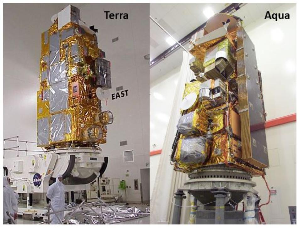
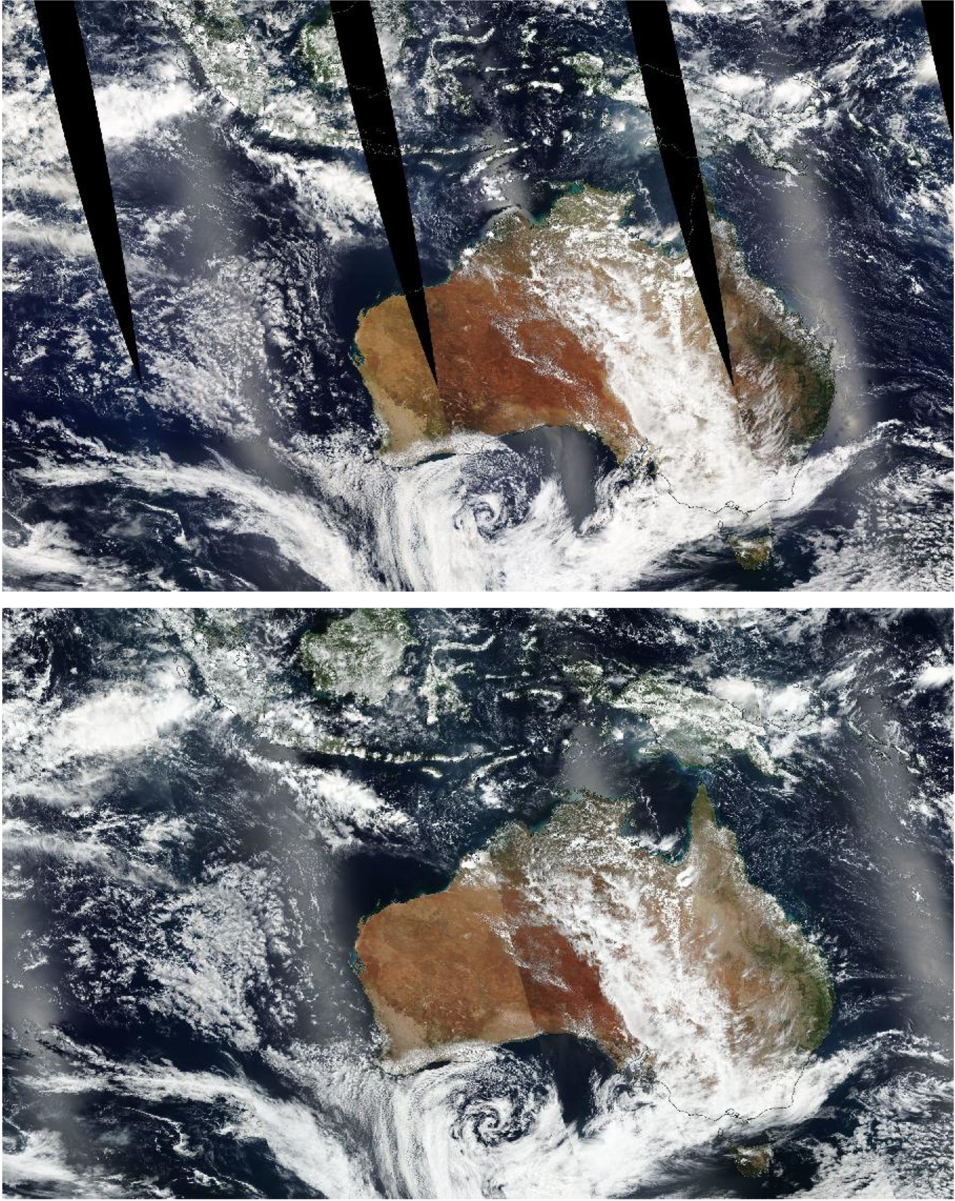
Terra’s orbit is timed so that its instruments pass from north to south across the equator in the morning, at 10:30 a.m. local time. Conversely, Aqua passes south to north over the equator in the afternoon, at 1:30 p.m. local time. By working in tandem to observe the same areas of Earth in the morning and the afternoon, these platforms provide scientists with a record of the changes in the atmospheric, oceanic, and terrestrial components of the Earth system and maximize opportunities for imagery that is free from clouds or optical phenomena (e.g., glare or sunglint) that can degrade image quality.
These attributes and capabilities made the MODIS instruments an “order of magnitude better” than its radiometric predecessor, the AVHRR, said Robert Wolfe, chief of the Terrestrial Information Systems Laboratory and manager of NASA’s Level 1 and Atmosphere Archive and Distribution System Distributed Active Archive Center (LAADS DAAC).
“If you look at the spectral range and the number of bands, the number of applications that we’ve focused on for MODIS, or research areas we’ve focused on for MODIS, it’s clear the people who designed MODIS really did a great job of bringing the science community together to identify the spectral bands that are needed to do the science and then building an instrument with those capabilities in mind,” he said. “I would say MODIS is a large leap ahead in terms of technology and capability.”
The significance of that leap is evident in the previously unseen phenomena scientists have been able to observe using MODIS.
“MODIS has made the first observations for determining cloud optical properties from space—how large or small cloud drops, or ice crystals are and whether clouds contain liquid water or ice—those had never been done,” said Dr. Michael King, MODIS scienct team lead. “It also allowed the first quantitative global aerosol observations or measurements over both land and ocean. Previous missions had done the ocean, but the expanded wavelengths offered by MODIS [provided] the ability to do aerosols over the land as well.”
It is also evident in the exponential increase in science quality data products spanning a wide range of Earth science disciplines.
According to figures from NASA's Earth Science Data and Information System (ESDIS) Metrics System (EMS), approximately 15 petabytes (PB) of MODIS data from both Terra and Aqua were in the EOSDIS collection at the end of 2021, making up roughly 25% of the collection's approximately 59 PB of data volume. Since 2000, the year the first MODIS data were publicly available, approximately 66 PB of data have been distributed to global data users. The distribution of data from MODIS remains the highest of any instrument in the EOSDIS collection, with 14 PB distributed during the 2021 fiscal year. MODIS data are available through several NASA's discipline-specific Distributed Active Archive Centers (DAACs).
“When we began to see it grow from only climate modelers using the data to everyone using the data, the products and services began to explode,” said Dr. Miguel Román, chief climate scientist with Leidos and land discipline lead for the MODIS and Suomi NPP VIIRS science teams. “We ended up splitting MODIS data across multiple DAACs and enhancing the data feeds to provide near real-time products through NASA’s Land, Atmosphere Near real-time Capability for [Earth observation] (LANCE). Eventually, we had a diverse international community of scientists and applied practitioners built on this one instrument.”
