Whether caused by heavy rains, storm surge, high tide, or a failing dam or levee, floods occur throughout the world and can have devastating consequences for people, ecosystems, and economies. Floods can happen in minutes or span several hours and last days, weeks, or longer. Further, flooded areas can be difficult to access and dangerous to work in, which makes it difficult to acquire information about a flood’s extent and impact. Therefore, the ability to accurately detect and assess the extent of floods via remote sensing is critical to mitigating, monitoring, and responding to these destructive events.
NASA's Goddard Space Flight Center in Greenbelt, Maryland, has worked to meet this need with the Near Real-Time (NRT) Global Flood Mapping product, which it created in 2011. This product was developed through a partnership between the Dartmouth Flood Observatory (which has since relocated to the University of Colorado, Boulder), and a team at Goddard. In 2017, NASA's Applied Sciences began transitioning the NRT global flood product to NASA’s Land, Atmosphere Near real-time Capability for Earth observation (LANCE), with additional support from NASA’s Earth Science and Data Information System Project (ESDIS) and LANCE MODIS, a division within LANCE that processes and distributes NRT data from the Moderate Resolution Imaging Spectroradiometer (MODIS) instruments aboard NASA’s Aqua and Terra satellites.
In March, the new and improved flood mapping product, the MODIS NRT Global Flood Product (also known as the MODIS Aqua+Terra Global Flood Product L3 NRT 250m, or MCDWD_L3_NRT), was released in LANCE. The legacy flood mapping product will be discontinued at some point in 2022.
Like its predecessor, the new product provides daily global flood maps based on imagery from the MODIS instruments aboard NASA’s Aqua and Terra satellites. Two benefits of the new LANCE product include more robust production and lower latency (by a few hours) meaning it is available to users in a more-timely manner. The product is also being made available in NASA’s Global Imagery Browse Services (GIBS) and NASA Worldview, which allows users to browse imagery and data more easily than possible with the legacy product.
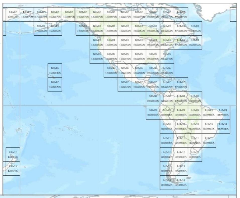
“Having the product in GIBS and Worldview will allow users to more easily browse the products than they could in our legacy system, where there would be a snapshot of the tile, but they’d have to look tile-by-tile and download it to a computer and then into a GIS application, so I think for the end user that’s a huge advantage,” said Dan Slayback, a research scientist in Goddard’s Biospheric Sciences Laboratory.
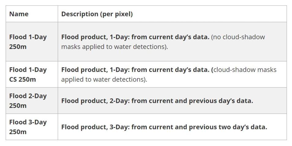
Like the legacy product, the LANCE product is derived from the NRT MODIS Surface Reflectance datasets and the process of generating it involves three key steps: applying the water detection algorithm to each MODIS observation (from both the Aqua and Terra satellites); compositing water detections over time, to reduce errors (principally from cloud shadow false positives) and more rigorously identify water; and differentiating flooding from locations of expected surface water. Given that the best product for a given flood event depends on four unpredictable factors — the specific location or area of interest, cloud cover, spatial extent of likely flood water, and the likely duration of flooding — the best product for a user depends on the particular event characteristics and the user’s specific needs. For casual browsing, the 3-day composite product is often the most useful.


