NASA's Citizen Science for Earth Systems Program (CSESP) is focused on developing and implementing projects that harness contributions from members of the general public to advance our understanding of Earth as a system. Including the public in participatory science enables CSESP to leverage the enormous potential of many more observers to expand and enhance NASA science. Citizen participation also promotes visceral public understanding and advocacy for Earth science.
CSESP advances the use of citizen contributions to Earth science research by directly supporting citizen science activities and by deploying technology to further citizen involvement in research.
Citizen Science in Action
By having thousands of participants taking data all over the world, CSESP projects have been able to significantly increase the scope and scale of several Earth observing systems. We accomplish this by increasing the statistical precision of satellite observations through many more—and more geographically comprehensive—validation measurements, and by rigorously combining field data with satellite observations to generate new and useful products. Through CSESP projects, citizen scientists actually do the science and see their own data used in analyses that culminate in new scientific insights or essential products for decision-making.
Citizen science includes, but is not limited to:
- formulating research questions
- conducting experiments
- collecting and analyzing data collected by citizen and/or professional scientists
- interpreting results
- making new discoveries
- developing technologies and applications
Our projects use innovative new technologies to make taking meaningful scientific data easier and more efficient, and to make those data more accurate, consistent, and scientifically powerful.
We rigorously follow the best practices of citizen science such as full openness of data, recruiting for diversity, and ethical treatment of all participants.
For information about CSESP NASA funding opportunities, please monitor the NASA Research Opportunities in Space and Earth Sciences (ROSES) website, the ROSES BLOG, or subscribe to the email lists through the NASA Solicitation and Proposal Integrated Review and Evaluation System (NSPIRES). Our solicitation is currently in ROSES 24 as A.50.
CSESP Solicitations

2022 Down-selection
A scheduled down-selection was done in 2022. Of the seven 18-month prototype projects funded in 2020, five were selected to continue to full implementation with an additional three years of funding.
2022 Full Implementation Projects:
- Community Eyes on River Ice: Broadening participation in freshwater ice observation to support hydrologic research, river forecasting, and winter travel safety; Katie Spellman/University of Alaska, Fairbanks
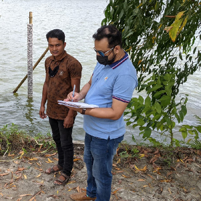
- Engaging Citizen Scientists to Monitor Water Quality in Chesapeake Bay; Patrick Neale, Smithsonian Institution
- FjordPhyto: Engaging Tourists in Field and Satellite Observations to Understand Polar Phytoplankton Dynamics—Implementation Phase; Maria Vernet/University of California, San Diego
- Lake Observations from Citizen Scientists and Satellites: Validation of Satellite Altimetry to Support Hydrologic Science—Continuation Phase; Tamlin Pavelsky/University of North Carolina, Chapel Hill
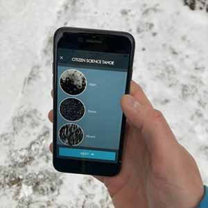
- Mountain Rain or Snow—A Citizen Science Project; Keith Jennings/Lynker Technologies LLC
2020
Two types of proposals were requested in the 2020 CSESP ROSES solicitation (PDF). The first type was for research initiatives gathering new data; the second type was for reusing, enhancing, or characterizing existing NASA citizen science data. Proposals were required to demonstrate clear linkages between citizen science and NASA observation systems to advance NASA’s Earth science mission. Eight projects received funding — seven for gathering new data and one for using and enhancing existing citizen science data.
2020 Prototype Projects Collecting New Data
- Collaboration with Citizen Scientists to Enhance Open Ocean and Coastal Observations and Sampling and to Augment Impacts and Utility of Remote Sensing for Physical, Biological, Ecological, and Environmental Studies and Applications; Nikolai Maximenko/University of Hawaii, Honolulu
- Community Eyes on River Ice - Broadening Participation in Freshwater Ice Observation to Support Hydrologic Research, River Forecasting, and Winter Travel Safety; Katie Spellman/University of Alaska, Fairbanks
- Community Science Project Leveraging Online and User Data through GLOBE And Zooniverse Engagement (CLOUD GAZE); Marile Colon Robles/Science Systems And Applications, Inc.
- Engaging Citizen Scientists to Monitor Water Quality in Chesapeake Bay; Patrick Neale, Smithsonian Institution
- FjordPhyto: Engaging Tourists to Understand Polar Phytoplankton Dynamics Using Field and Satellite Observations; Maria Vernet/University of California, San Diego
- Lake Observations from Citizen Scientists and Satellites: Validation of Satellite Altimetry to Support Hydrologic Science; Tamlin Pavelsky/University of North Carolina, Chapel Hill
- Using Citizen Science Observations to Monitor the Rain-Snow Transition of the Western U.S. and Improve Satellite Estimates of Precipitation Phase; Keith Jennings/Lynker Technologies LLC
2020 Funded Project Using Existing Data
- Can Citizen Science and Low-Cost Sensors Help Improve Earth System Data? Assessing High Frequency Geostationary Air Quality Observations; Prakash Doraiswamy/Research Triangle Institute
2016
The 2016 CSESP solicitation sought proposals to address the above-stated goals through one or both of the following:
- Projects using citizen science for research on biodiversity and conservation biology, atmospheric composition, water, energy cycle and surface water topography, and physical oceanography.
- Citizen science data collection using calibrated low-cost off-the-shelf components that can be widely deployed.

CSESP 2016 awards were made in the form of cooperative agreements via two phases: Prototype Phase and Implementation Phase. In 2016, 16 proposals were selected via an independent review panel for a 13-month Prototype Phase period. These projects addressed real-world problems at local, regional, continental, or global scales. They complemented NASA satellite observations with increased temporal or spatial sampling, contributed to the validation of NASA data products derived from satellite observations, deployed innovative sensors to measure our environment, or used other innovations to enhance the utility of NASA's observation systems in space, air, land, and water.
All projects demonstrated linkages between citizen science and NASA satellite observations. After the Prototype Phase, all CSESP-funded projects underwent an independent review. Six of the 16 projects were selected for continued funding during the three-year Implementation Phase.
The 16 prototype projects submitted final reports in January 2018. The reports described progress made and milestones achieved during the Prototype Phase and also proposed a work plan for the three-year Implementation Phase. Based on these reports, an independent panel of experts selected six projects for continued funding during the three-year Implementation Phase. These projects were chosen based on success (both scientific and citizen engagement) during the Prototype Phase, relevance to NASA's mission and objectives, and intrinsic scientific merit.
2016 Implementation Projects

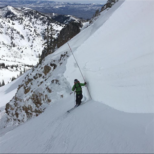
- A Citizen Science Campaign to Validate Snow Remote Sensing Products (Updated October 2019), Anthony Arendt, University of Washington, Seattle
- Can Citizen Science and Low-Cost Sensors Help Improve Earth System Data? (Updated October 2019), Implications to Current and Next Generation of Space-Based Air Quality Measurements, Prakash Doraiswamy, Research Triangle Institute
- CEAMS: Citizen-Enabled Aerosol Measurements for Satellites (Updated October 2019): A Network for High-Resolution Measurements of PM2.5 and Aerosol Optical Depth, John Volckens, Colorado State University
- From Soundscapes to Landscapes: Monitoring Animal Biodiversity from Space Using Citizen Scientists (Updated October 2019), Matthew Clark, Sonoma State University
- Lake Observations from Citizen Scientists and Satellites (previously Tracking Water Storage in Lakes) (Updated October 2019), Tamlin Pavelsky, University of North Carolina, Chapel Hill
- Using Citizen Science to Understand Thirty Years of Change in Global Kelp Cover by Expanding the Zooniverse to NASA Satellite Imagery (Updated October 2019), Jarrett Byrnes, University of Massachusetts, Boston
2016 Prototype Projects
- A Citizen Science Campaign to Validate Snow Remote Sensing Products, Anthony Arendt, University of Washington, Seattle
- Alaska Testbed for the Fusion of Citizen Science and Remote Sensing, John Walsh, University of Alaska, Fairbanks
- Can Citizen Science and Low-Cost Sensors Help Improve Earth System Data? Implications to Current and Next Generation of Space-Based Air Quality Measurements, Prakash Doraiswamy, Research Triangle Institute
- Citizen Science in Urban Regions to Address Satellite Subpixel Uncertainties in the Vegetation, Climate, and Air Quality Nexus, George Jenerette, University of California, Riverside
- Citizen-Enabled Aerosol Measurements for Satellites, CEAMS: A Network for High-Resolution Measurements of PM2.5 and Aerosol Optical Depth, John Volckens, Colorado State University
- Cloud Forecasting and 3-D Radiative Transfer Model Validation using Citizen-Sourced Imagery, Albin Gasiewski, University of Colorado, Boulder
- Coral Bleaching Assessment through Remote Sensing and Integrated Citizen Science, CoralBASICS, Juan Torres-Perez, Bay Area Environmental Research Institute, Inc.
- Crowdsourced Imagery and Ancillary Observations for Drought Monitoring and Agricultural Applications, Andrew Molthan, Marshall Space Flight Center
- Data Mining Twitter for Augmenting NASA Precipitation Research and Applications, William Teng, ADNET Systems, Inc.
- Development, Testing and Implementation of Low Cost and Effective In Situ Soil Moisture Sensor for Citizen Science, Narendra Das, Jet Propulsion Laboratory
- From Soundscapes to Landscapes: Monitoring Animal Biodiversity from Space Using Citizen Scientists, Matthew Clark, Sonoma State University
- Mosquito Mappers, Russanne Low, Institute for Global Environmental Strategies
- Re-wilding Urban Environments: Integrating Remote Sensing and Citizen Science to Study the Environmental Context and Ecological Consequences of Returning Avian Predators, Benjamin Zuckerberg, University of Wisconsin, Madison
- Stream Tracker: Crowd Sourcing and Remote Sensing to Monitor Stream Flow Intermittence, Stephanie Kampf, Colorado State University
- Tracking Water Storage in Lakes: Citizens and Satellites, Tamlin Pavelsky, University of North Carolina, Chapel Hill
- Using Citizen Science to Understand Thirty Years of Change in Global Kelp Cover by Expanding the Zooniverse to NASA Satellite Imagery, Jarrett Byrnes, University of Massachusetts, Boston
The Citizen Science for Earth Science Data Working Group
The Citizen Science for Earth Science Data Working Group (WG) is composed of scientists and data users affiliated with the NASA Earth Science efforts related to citizen science. It primarily comprises representatives from funded CSESP projects, although additional participants from Earth science and citizen science communities may be selected.
The group is responsible for providing guidance on topics related to standards for Earth science citizen science project data, software, tools, and citizen engagement. The WG represents the broad needs of the Earth science and citizen science user communities. Any recommendation by the WG shall not constitute an implementation instruction but incorporates a broad community knowledge and should be consulted as a resource for information.
The NASA ESDS Citizen Science Data Working Group White Paper, released in 2020, provides suggestions for addressing legal, policy, and ethical issues; standards for citizen science data collection and management; information on ensuring usability of citizen science data and communication regarding its use; and best practices for long-term archival of citizen science data.