An Earthdata Login is required before users can download data or use selected tools from the Distributed Active Archive Centers (DAACs) that comprise NASA's Earth Observing System Data and Information System (EOSDIS).
Discover New Ways to Use Data
There are many ways to process Earth science data for scientific research. Stop by the Data User Profiles to see some examples. If you already have data and need a specific processing method, check out our data recipes and see if there is one that fits your needs.

Data Recipes
Data recipes are tutorials or step-by-step instructions that help users learn how to discover, access, subset, visualize, and use Earth science data, information, tools, and services.
Data Tools
Find tools for searching and ordering data; data handling; subsetting and filtering; geolocation, reprojection and mapping; and data visualization and analysis.
GIS Tools
Find tools from which data can be visualized, subsetted, and downloaded in different file formats that are GIS analysis-ready.

Data User Profiles
Read stories of how and where Earth science data are being used for research and applications.

Earthdata Code Collaborative
The Earthdata Code Collaborative (ECC) is a platform for developing, testing, and discovering Earthdata-related applications and services.
Earthdata APIs
NASA's Earthdata Developer Portal is for application developers who wish to build applications that search, access, and browse EOSDIS Earth science data.
Webinars and Tutorials
NASA tutorials and webinars span the Earth science disciplines and include detailed guidance and instructions for using NASA Earth science data and other resources.
Visualization Tools
Use these interactive tools to explore, visualize, and download NASA Earth science data.
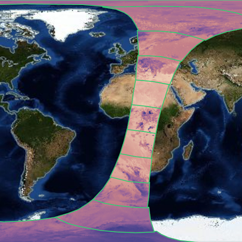
Worldview
The Worldview tool allows you to interactively browse over 1000 global, full-resolution satellite imagery layers and download the underlying data.
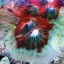
Worldview Snapshots
Worldview Snapshots is a lightweight tool for creating image snapshots from a selection of popular NASA satellite imagery layers.
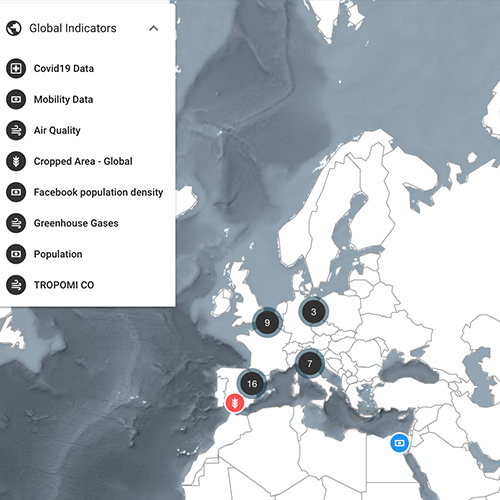
Earth Observing Dashboard
The interactive Earth Observing Dashboard, a joint project between NASA, the Japan Aerospace Exploration Agency (JAXA), and ESA (European Space Agency), has been used to track changes in food production, air pollution, ship traffic, water quality, and more.
Earthdata Search
Search through petabytes of NASA Earth science data to download the data you need.
Still cannot find what you need? Check out the Earthdata Forum. Here, data users can ask questions and interact with peers. Whether you are a novice or expert data user, have a question about processing, validation, or analysis of the data, these forums allow you to interact with other members of the community interested in these topics. The forums are also a place where you can share stories of data use and application with the larger Earth science data community.
OUR OPEN DATA, SERVICES, AND SOFTWARE POLICIES
NASA promotes the full and open sharing of all data with research and applications communities, private industry, academia, and the general public. Learn about data standards and how to cite NASA Earth science data.
More Resources
Backgrounders are informational articles providing a deeper explanation of key topics in Earth science to aid in understanding data and data use.