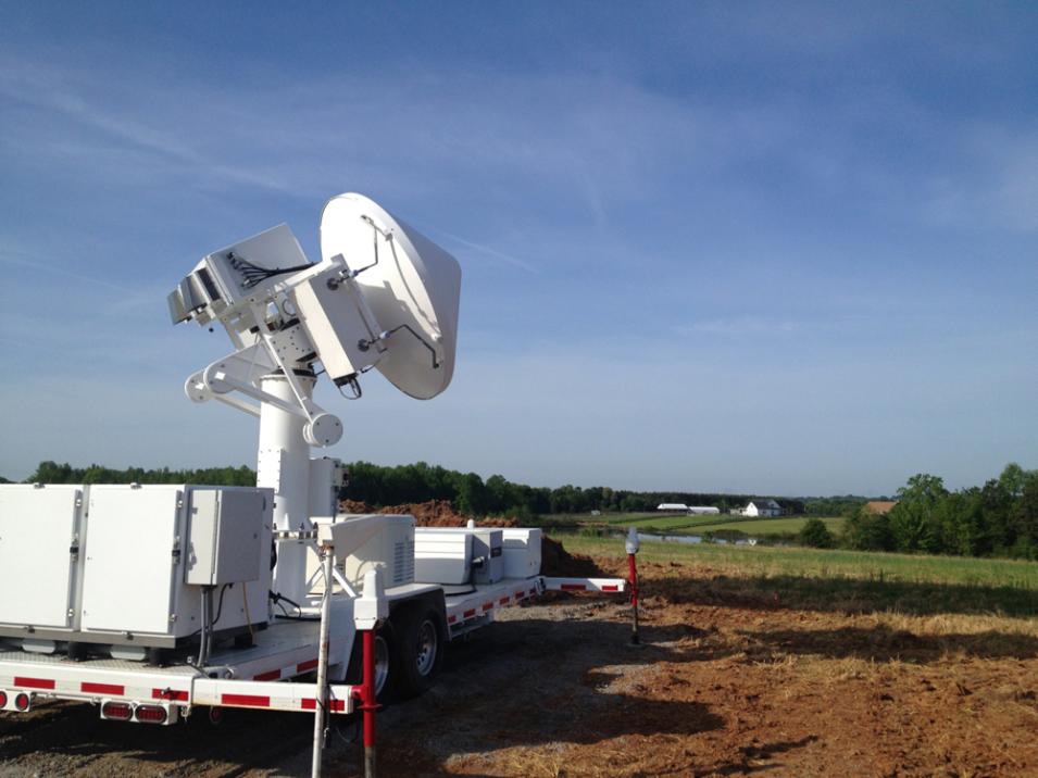
The Dual-frequency Dual-polarized Doppler Radar (D3R) is a mobile Ku-/Ka-band fully polarimetric Doppler radar, specifically developed for the Global Precipitation Measurement (GPM) mission Ground Validation (GV) program. D3R was designed to provide pre- and post-launch precipitation observations using frequencies similar to those of the Ku-/Ka-band Dual-frequency Precipitation Radar (DPR) aboard the GPM Core satellite. These measurements enabled the development of algorithms and retrieval methods prior to the launch of the GPM Core satellite and provide validation data for post-launch GPM DPR observations.
A weather radar is an active remote sensing instrument that transmits electromagnetic (EM) radiation toward a volume of atmospheric targets to gather information such as their amount, size, and type. When the radiation encounters the targets, some of the energy is absorbed and scattered while some is reflected back, or backscattered, toward the radar’s receiver where it is measured. D3R is a dual-frequency radar that transmits radiation at 13.91 GHz (Ku-band) and 35.56 GHz (Ka-band).
Ku-band: Generally detects moderate to heavy rainfall
Ka-band: Primarily used to detect light rain and snow, also more easily attenuated
D3R uses a solid state transmitter along with two parabolic antennas for signal transmission. The larger antenna (72 in. diameter) transmits the Ku-band radiation while the smaller antenna (28 in. diameter) transmits the Ka-band radiation. Each antenna is covered by a radome to protect it from the surrounding weather conditions. The Ku-/Ka-band measurement combination gives D3R a higher sensitivity to small raindrops, drizzle, and snow particles; aiding in drop size distribution (DSD) calculations. D3R is fully polarimetric, meaning it can transmit and receive EM-radiation with a horizontal or vertical polarization. Dual-polarized measurements give insight into the microphysical characteristics of precipitation, allowing for identification of the precipitation type and improved precipitation estimates.
D3R is also a Doppler radar and therefore can resolve wind velocities within precipitation. The speed and direction of movement by precipitation particles will affect the backscattered signal, revealing information about the air motions relative to the radar. These Doppler measurements provide insight into the dynamics within precipitation systems. D3R was designed to broaden short-frequency precipitation observations, provide further microphysical precipitation measurements, and give insight into satellite retrieval processes and measurement errors. D3R has served in various GPM GV field campaigns (Figure 1), providing high-resolution ground based precipitation measurements.
GPM DPR data are available at the NASA Goddard Earth Sciences Data and Information Services Center (GES DISC).
