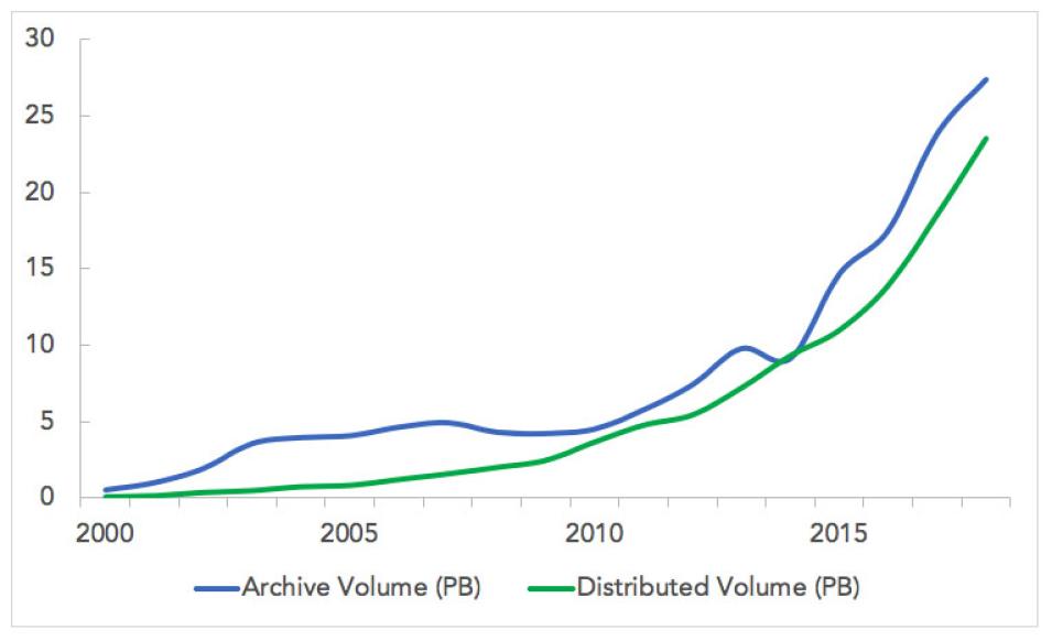
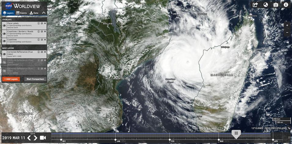
A legacy of open data and investment in innovative technology manifested across several ESDS projects and initiatives in 2018. Strategic investments focusing on cloud innovation led to the charter of the Interagency Implementation and Advanced Concepts Team (IMPACT) which will partner with other Federal agencies, the applications community, decision makers, non-governmental organizations, and other organizations to demonstrate the potential of cloud computing. In response to the projected rapid growth of data volumes in the EOSDIS archive, ESDS has begun development and testing of "Cumulus," an open source, cloud-based framework for data ingest, archive, management, and distribution. The Cumulus infrastructure was also used by IMPACT machine learning experts to develop a deep learning-based hurricane intensity estimation portal.
Earth Observations from Private Sector Small-Satellite Constellations
NASA is obtaining access to commercial satellite data to assess the utility of this information in achieving goals and objectives related to NASA's Earth Science Division Research and Analysis (R&A) and Applied Sciences (AS) Programs and any associated decision-support applications. The overall objective of the pilot is to determine the viability of purchasing science data products that are directly related or lead to Essential Climate Variables (ECV) from American commercial market vendors.
On September 28, 2018 NASA awarded three vendors for the Small Constellations Satellite Data Buy Pilot: Spire Global, Inc., Planet Labs, Inc., and DigitalGlobe, Inc. There is a robust plan in place to evaluate the utility of the data with results expected in early 2020.
New Missions
EOSDIS partners with data creators and providers to archive and distribute Earth science data to a global community of millions of users. EOSDIS offers this service through discipline-specific and common tools, at no cost to the data provider, with the added benefit of protecting data from disaster and technology obsolescence. In 2018, EOSDIS updated all of the relevant processes, policies, standards, and documents that proposing data producers must complete as part of the data submission process.
Support for Orbital and Airborne Missions 2018 saw continued focus on airborne missions. The Airborne Data Management Group (ADMG), along with the Earth System Science Pathfinder (ESSP) program office began providing support for Earth Venture Suborbital-3 (EVS-3) missions.
Competitive Programs
ESDS drives innovation through competitive programs such as Advancing Collaborative Connections for Earth System Science (ACCESS), Citizen Science for Earth Systems Program (CSESP), and Making Earth System Data Records for Use in Research Environments (MEaSUREs). In 2018, the ten ACCESS 2015 projects presented their final work, resulting in more than 30 peer-reviewed publications. Five ACCESS 2017 projects began their work, while six CSESP projects were selected for implementation and several MEaSUREs projects entered their final year.
Science Tools and Portals
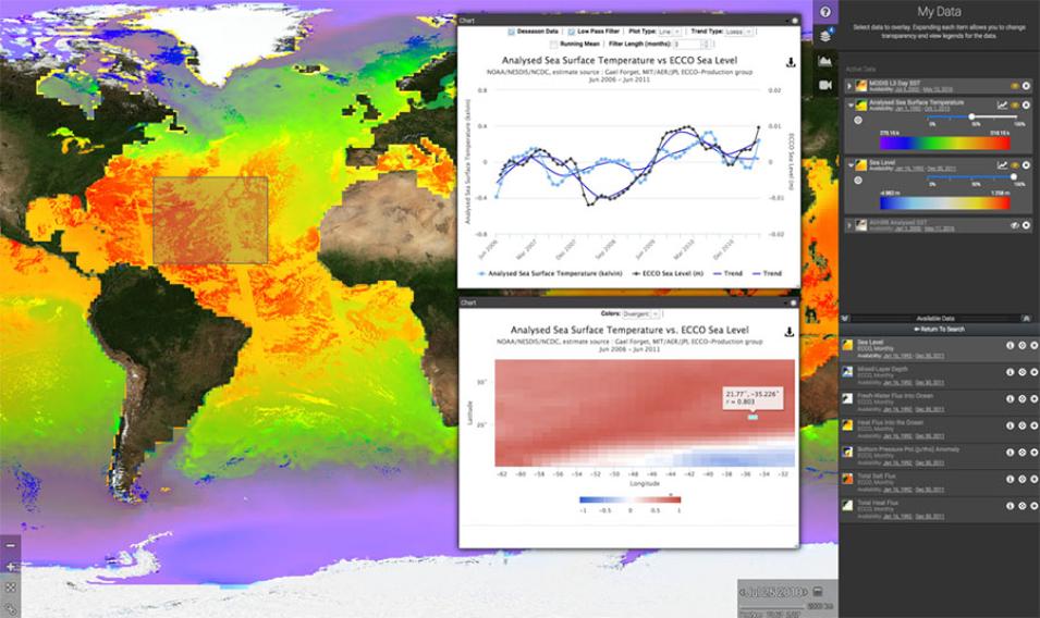
Science portals comprehensively address and communicate information about a specific science issue in collaboration with research and analysis programs. The first of these portals, the Sea Level Change Portal (SLCP) provides a one-stop source for data, analysis tools, and simulations relevant to sea level rise. Several new datasets were added to the portal in 2018. In 2019, new tools will be added, including a projection tool, a coastal sea level budget tool, and an update of the Data Analysis Tool.


