We are in the process of migrating all NASA Earth science data sites into Earthdata from now until end of 2026. Not all NASA Earth science data and resources will appear here until then. Thank you for your patience as we make this transition.
Read about the Web Unification Project
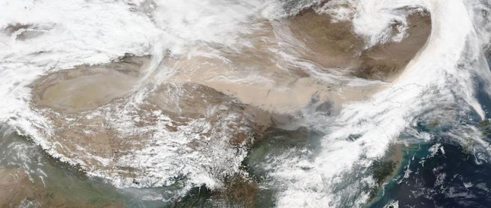
Dust Storm Blowing Across China
Image captured on 15 March 2021, by the VIIRS instrument, aboard the joint NASA/NOAA Suomi NPP satellite.
True color image of a dust storm from the Gobi Desert blowing across China. This image was acquired on 15 March 2021 by the Visible Infrared Imaging Radiometer Suite (VIIRS), aboard the joint NASA/NOAA Suomi National Polar orbiting Partnership (Suomi NPP) satellite.
Note the light brown dust/sand in the center of the image and dust visible in the swirling clouds. Also view the high aerosol index associated with the dust. The weather bureau has called it the biggest sandstorm in a decade (Reuters).
Visit Worldview to visualize near real-time imagery from NASA's EOSDIS, and check out more Worldview weekly images in our archive.
Details
Last Updated
Published on
April 12, 2021
