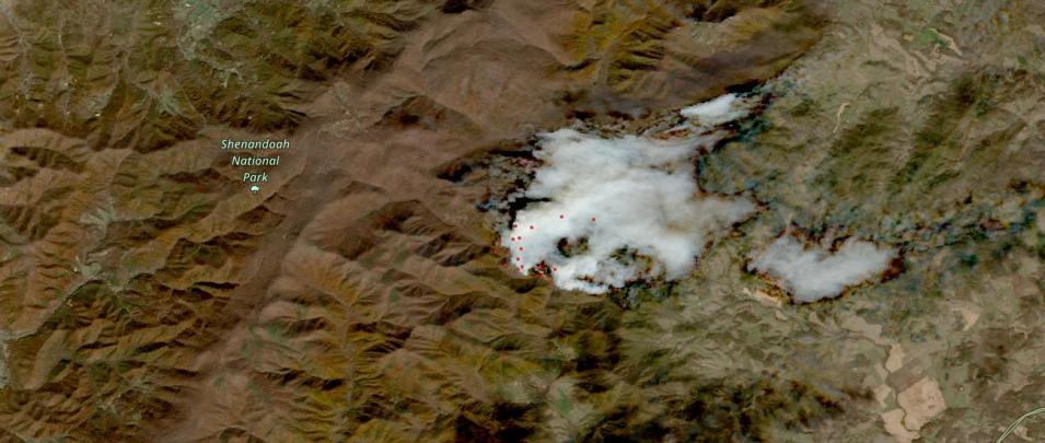
This true-color Harmonized Landsat and Sentinel-2 (HLS) image shows wildfires in and around Shenandoah National Park about 75 miles southwest of Washington, D.C. The image was acquired on November 4, 2023, by the Multi-Spectral Instrument (MSI) aboard the ESA (European Space Agency) Sentinel-2A and -2B satellites. The fire started October 24 and has burned approximately 1,012 hectares (approximately 2,500 acres). Interactively explore this image in NASA Worldview.
The HLS dataset provides 30-meter resolution, true-color surface reflectance imagery from the Operational Land Imager (OLI) and OLI-2 instruments aboard the joint NASA/USGS Landsat 8 and Landsat 9 satellites and MSI aboard ESA’s Sentinel-2A and -2B satellites. The data from the two instruments aboard the four satellites are processed through a set of algorithms to make the imagery consistent and comparable across the instruments.
Red dots on the image are active fires detected by the Visible Infrared Imaging Radiometer Suite (VIIRS) instrument aboard the joint NASA/NOAA NOAA-20 satellite. The sensor resolution is 375 m, imagery resolution is 250 m, and the temporal resolution is twice daily.
Visit Worldview to visualize near real-time imagery from NASA's EOSDIS; find more in our Worldview weekly image archive.
