We are in the process of migrating all NASA Earth science data sites into Earthdata from now until end of 2026. Not all NASA Earth science data and resources will appear here until then. Thank you for your patience as we make this transition.
Read about the Web Unification Project
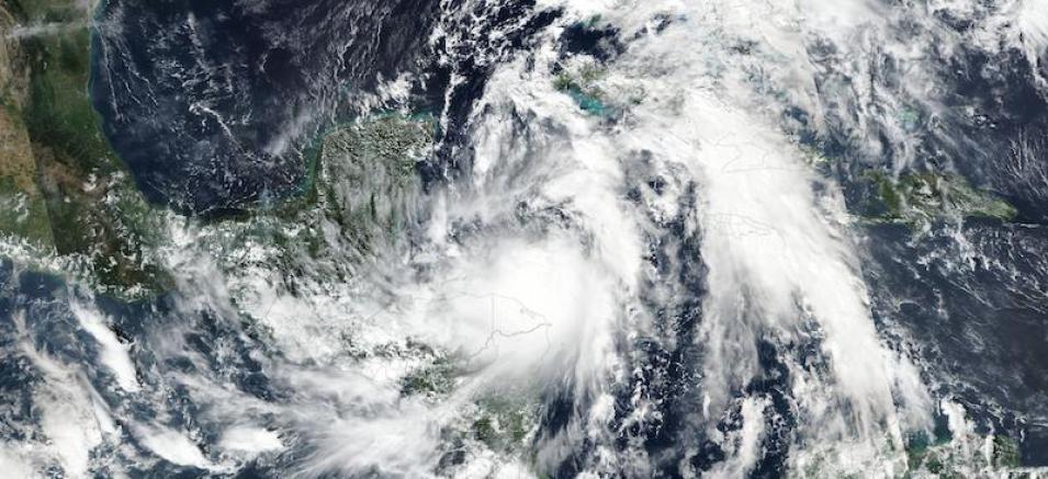
Tropical Storm Zeta Near Honduras
Image captured on 25 October 2020, by the VIIRS instrument, aboard the joint NASA/NOAA Suomi NPP satellite.
Image of Tropical Storm Zeta near Honduras, acquired on 25 October 2020. Weather forecasters expect the storm to strengthen into a hurricane and will affect the Yucatan Peninsula, Mexico by Monday afternoon or evening and make landfall on southeastern Louisiana, USA by Wednesday afternoon or evening. The photo-like, true color corrected reflectance image was captured by the Visible Infrared Imaging Radiometer Suite (VIIRS), aboard the joint NASA/NOAA Suomi NPP satellite.
Visit Worldview to visualize near real-time imagery from NASA's EOSDIS, and check out more Worldview weekly images in our archive.
References: Gulf Coast Braces As Tropical Storm Zeta Poised To Become A Hurricane
Details
Last Updated
Published on
Nov. 2, 2020
