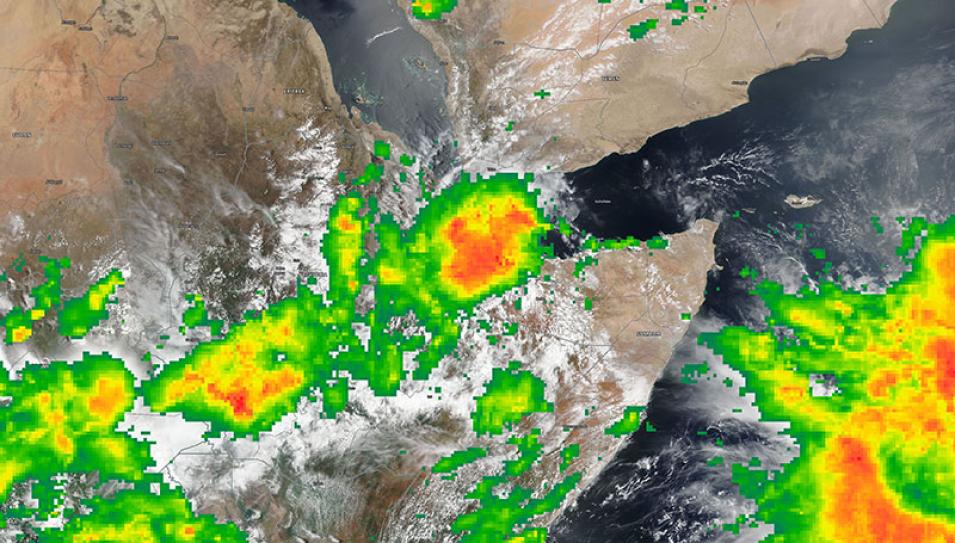
Image of Tropical Storm Sagar over Djibouti and Somalia, acquired on 19 May 2018. This true color corrected reflectance image was captured by the Visible Infrared Imaging Radiometer Suite (VIIRS) aboard the joint NASA/NOAA Suomi National Polar-orbiting Partnership (Suomi NPP) satellite. Rain Rate from the Integrated Multi-satellite Retrieval for Global Precipitation Measurement (IMERG) is overlain showing high rainfall rates in red.
Visit Worldview to visualize near real-time (NRT) data from NASA's Earth Observing System Data and Information System (EOSDIS).
