Due to the lapse in federal government funding, NASA is not updating this website. We sincerely regret this inconvenience.
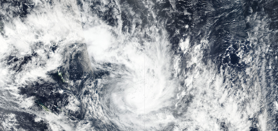
Tropical Cyclone Ana over Fiji
Image captured on 31 January 2021, by the VIIRS instrument, aboard the joint NASA/NOAA Suomi NPP satellite.
True color image of Tropical Cyclone Ana over Fiji. This image was acquired on 31 January 2021 by the Visible Infrared Imaging Radiometer Suite (VIIRS), aboard the joint NASA/NOAA Suomi National Polar orbiting Partnership (Suomi NPP) satellite.
Tropical Cyclone Ana was a Category 2 system that made landfall near Rakiraki. Destructive storm force wind speeds averaged 100 km/hour with occasional guts of up to 140 km/hour.
Visit Worldview to visualize near real-time imagery from NASA's EOSDIS, and check out more Worldview weekly images in our archive.
References: Media Release Number 8 Jan 2021, Fiji Meteorological Service.
Details
Last Updated
Published on
Feb. 8, 2021
