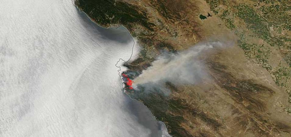
Image of the Soberanes Fire, Monterey County, California acquired on 24 July 2016 by the Moderate Resolution Imaging Spectroradiometer (MODIS) aboard the Aqua satellite. As of 24 July 2016, 9:30pm PT, the fire is 5% contained with 11,000 acres burned.
Visit Worldview to visualize near real-time data from NASA's Earth Observing System Data and Information System (EOSDIS).
Sources: Soberanes Fire. CALFIRE.
