We are in the process of migrating all NASA Earth science data sites into Earthdata from now until end of 2026. Not all NASA Earth science data and resources will appear here until then. Thank you for your patience as we make this transition.
Read about the Web Unification Project
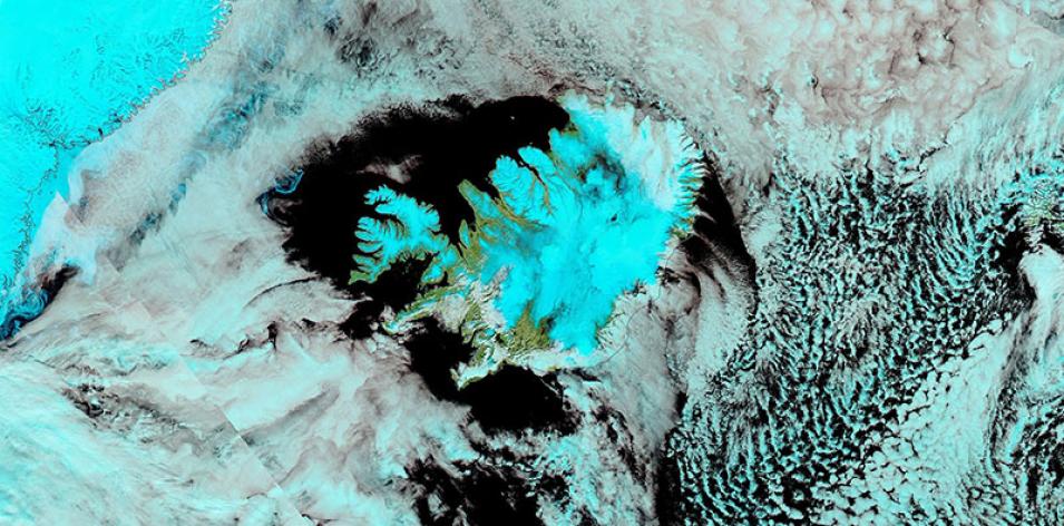
Snow Covering Iceland
Image captured on 26 April 2020, by the MODIS instrument, aboard the Aqua satellite.
False-color (Bands 7-2-1) corrected reflectance image of snow covering Iceland. The image was acquired on 26 April 2020 by the Moderate Resolution Imaging Spectroradiometer (MODIS) instrument, aboard the Aqua satellite.
In this false-color image, the 7-2-1 band combination can be used to distinguish snow and ice from clouds. Snow appears in cyan and clouds are white/white-light cyan. You can also turn on the Snow Cover (Normalized Difference Snow Index) layer to evaluate how much snow is on the ground.
Visit Worldview to visualize near real-time imagery from NASA's EOSDIS, and check out more Worldview weekly images in our archive.
Details
Last Updated
Published on
Nov. 3, 2020
