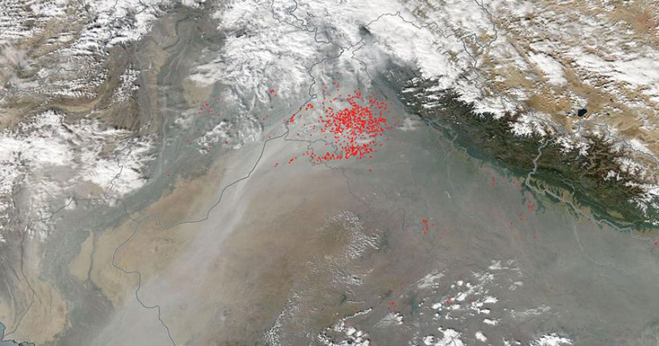
Image of smoke and fires in northwest India acquired on 9 November 2015 by the Moderate Resolution Imaging Spectroradiometer (MODIS) sensor aboard the Aqua satellite. Fires in this area at this time of year are often attributed to agricultural burning, where residue from previous crops are burned and fields are readied for the new growing season that lasts from November to April.
Visit Worldview to visualize near real-time data from NASA's Earth Observing System Data and Information System (EOSDIS).
Sources: Fires and smoke in northwestern India. NASA Earth Observatory.
