Due to the lapse in federal government funding, NASA is not updating this website. We sincerely regret this inconvenience.
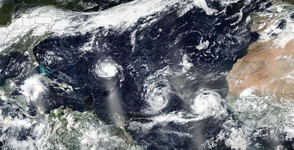
Hurricane Florence, Tropical Storm Isaac and Hurricane Helene in the Atlantic Ocean
Image captured on 9 September 2018, by the VIIRS instrument, aboard the joint NASA/NOAA Suomi-NPP satellite.
Image of Hurricane Florence, Tropical Storm Isaac and Hurricane Helene in the Atlantic Ocean (from left to right). This image was acquired on 9 September 2018 by the Visible Infrared Imaging Radiometer Suite (VIIRS) instrument, aboard the joint NASA/NOAA Suomi National Polar-orbiting Partnership (Suomi-NPP) satellite.
Visit Worldview to visualize near real-time (NRT) data from NASA's Earth Observing System Data and Information System (EOSDIS).
Details
Last Updated
Published on
Sept. 11, 2020
