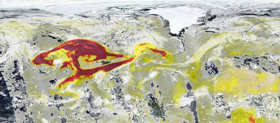
High Aerosol Index over USA
Image of high aerosol index over USA, as a result of fires in the western US, acquired on 13 September 2020. The Aerosol Index layer from the Ozone Mapping Profiler Suite (OMPS) aboard the joint NASA/NOAA Suomi National Polar orbiting Partnership (Suomi NPP) satellite, is overlaid on top of the true-color image. The Aerosol Index is a unitless range from < 0.00 to >=5.00, shown as yellows to reds, where 5.0 (reds) indicates heavy concentrations of aerosols that could reduce visibility or impact human health.
The photo-like, true-color corrected reflectance image was captured by the Visible Infrared Imaging Radiometer Suite (VIIRS), also aboard Suomi NPP satellite.
Visit Worldview to visualize near real-time imagery from NASA's EOSDIS, and check out more Worldview weekly images in our archive.
