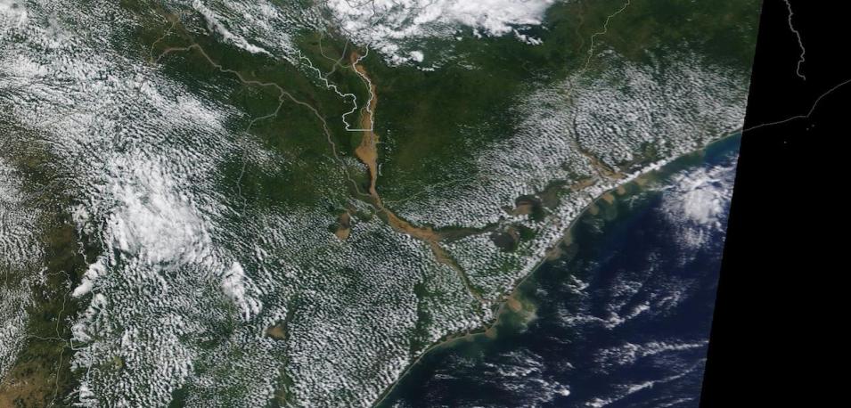
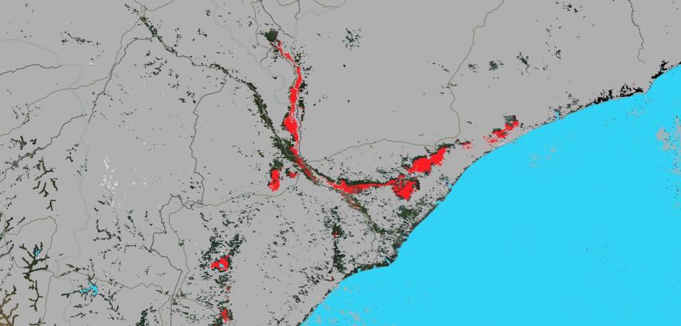
Top image is a true-color corrected reflectance image of flooding in Mozambique and Malawi, neighboring nations in southeastern Africa, on March 22, 2023. Note the brown, sediment laden rivers in the center of the image as well as the sediment plumes exiting into the Mozambique Channel. The lower image shows the Flood 3-Day Window composite ending on March 22, 2023. Red indicates flooded areas, blue indicates existing surface water, and grey indicates areas of insufficient data (which is usually due to cloud cover). Note how the red flooded areas correspond with the sediment laden rivers.
The flooding was caused by Tropical Cyclone Freddy that repeatedly brought torrential rain to the region. See previous Worldview Images of the Week: Tropical Cyclone Freddy over Madagascar, Tropical Cyclone Freddy over Madagascar (Again), and Cyclone Freddy Continues over Mozambique and Malawi. The cyclone is likely to be named the longest-lived tropical cyclone at 34 days as a named storm, according to the World Meteorological Organization.
These images are from the Moderate Resolution Imaging Spectroradiometer (MODIS) instruments aboard NASA's Terra and Aqua satellites. Visit Worldview to interactively compare these images.
View the Worldview Tour story Assessing Floodwaters to learn more about the MODIS Near Real-Time (NRT) Global Flood Product.
Visit Worldview to visualize near real-time imagery from NASA's EOSDIS; check out more Worldview weekly images in our archive.
Dataset: MCDWD_L3_NRT doi:10.5067/MODIS/MCDWD_L3_NRT.061

