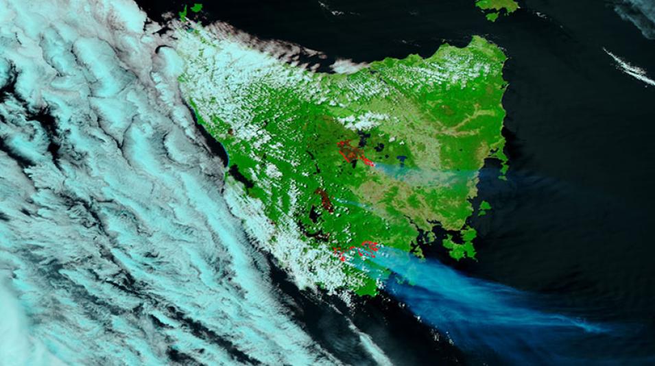
False-color image of fires in Tasmania, Australia, acquired on 28 January 2019 by the Visible Infrared Imaging Suite (VIIRS) instrument, aboard the joint NASA/NOAA Suomi National Polar-orbiting Partnership (Suomi NPP) satellite.
This false-color image using VIIRS bands M11-I2-I1 is useful for distinguishing burn scars. The red dots indicate active fires at the time of the satellite observation, and the previously burned areas are in a reddish-brown. Use the comparison tool to view the difference between the landscapes on 15 January and 28 January.
Visit Worldview to visualize near real-time imagery from NASA's Earth Observing System Data and Information System (EOSDIS).
