We are in the process of migrating all NASA Earth science data sites into Earthdata from now until end of 2026. Not all NASA Earth science data and resources will appear here until then. Thank you for your patience as we make this transition.
Read about the Web Unification Project
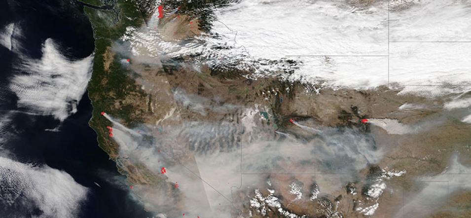
Fires Across the Western USA
Image captured on 7 September 2020, by the VIIRS instrument, aboard the joint NASA/NOAA NOAA-20 satellite.
Image of fires and smoke across the western USA, acquired on 7 September 2020. The image shows fires burning in the states of Washington, Oregon, California, Idaho, Utah, and Colorado. The photo-like, true color corrected reflectance image was captured by the Visible Infrared Imaging Radiometer Suite (VIIRS) aboard the joint NASA/NOAA NOAA-20 satellite.
Red dots overlaid on the image are thermal anomalies/hotspots detected by the VIIRS thermal anomalies algorithm. They represent the center of a 375m pixel flagged as containing one or more thermal anomalies.
Visit Worldview to visualize near real-time imagery from NASA's EOSDIS, and check out more Worldview weekly images in our archive.
Details
Last Updated
Published on
Sept. 16, 2020
