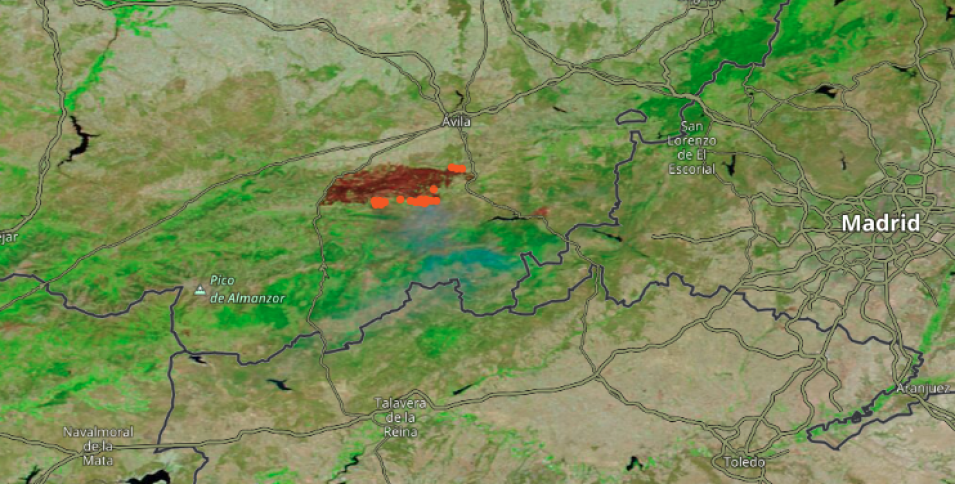
False-color corrected reflectance image (Bands 7-2-1) of fires in Avila Province, Spain, on 16 August 2021. The area is suffering from high temperatures and low humidity leading to very dry conditions. This image was acquired by Moderate Resolution Imaging Spectroradometer (MODIS) aboard NASA's Terra satellite. This image is a false-color Red-Green-Blue (RGB) composite where Red is Band 7, Green is Band 2, and Blue is Band 1.
This combination is most useful for distinguishing burn scars from naturally low vegetation or bare soil and enhancing floods. Vegetation appears green, water is black, and burn scars are red. Overlaid on the image is the Terra/MODIS Fires and Thermal Anomalies layer, which is shown as orange dots that represent the center of a 1km pixel containing one or more fires or other thermal anomalies. Learn more - What does a MODIS active fire detection mean on the ground?
Click on the image to visit Worldview and view the map with interactive features in a new browser tab. Use the back and forward arrows in the lower left corner of the map to see when the fires began to be visible in the satellite imagery.
Visit Worldview to visualize near real-time imagery from NASA's EOSDIS, and check out more Worldview weekly images in our archive.
