Due to the lapse in federal government funding, NASA is not updating this website. We sincerely regret this inconvenience.
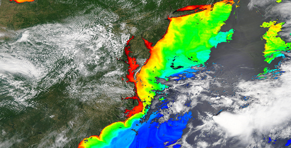
Chlorophyll a along the Mid-Atlantic coast, USA
Image captured on 27 May 2019, by the MODIS instrument, aboard the Terra satellite.
True color base image overlaid with Chlorophyll a from the Moderate Resolution Imaging Spectroradiometer (MODIS) instrument, aboard the Terra satellite. The information was acquired on 27 May 2019. This rainbow color palette applied to the Chlorophyll a layer shows a gradient from reds to blues/violets where reds indicate high Chlorophyll a concentrations, and blues/violets indicate lower Chlorophyll a concentrations.
Visit Worldview to visualize near real-time imagery from NASA's Earth Observing System Data and Information System (EOSDIS).
Details
Last Updated
Published on
Sept. 11, 2020
