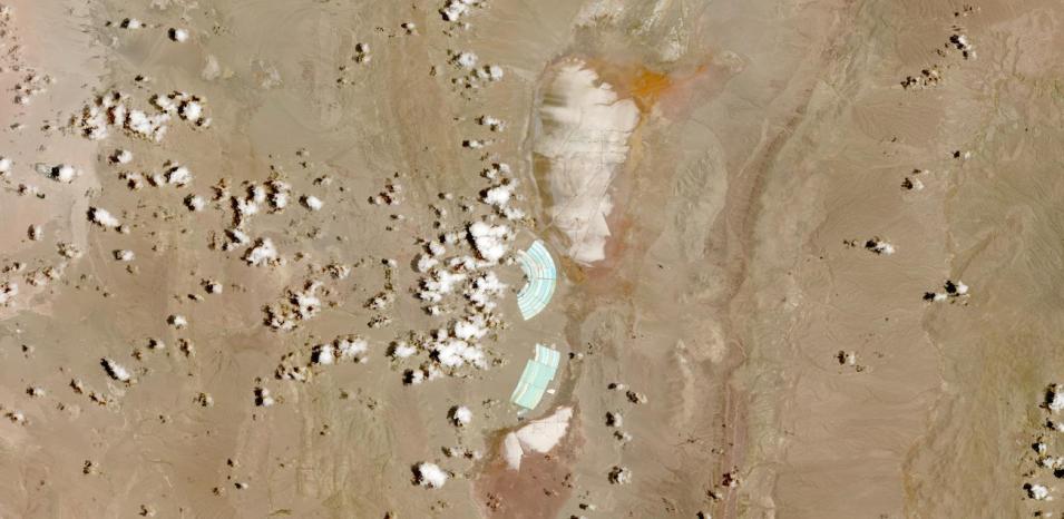
True-color image of the Cauchari-Olaroz Lithium Mine in Jujuy Province, Argentina. In the center of the image are bright green/cyan evaporation ponds with salars, or salt flats, to the north and south of the ponds. Lithium brine is pumped from the salars into the evaporation ponds. Solar evaporation concentrates the lithium brine in the ponds, then the concentrated lithium brine is processed into battery-grade lithium carbonate for use in electric vehicles and other battery-powered devices. This image was acquired on December 31, 2023, by the MultiSpectral Instrument (MSI) aboard the ESA (European Space Agency) Sentinel-2A satellite. Explore the Cauchari-Olaroz Lithium Mine in Worldview. This area is part of the "Lithium Triangle", where the Salar de Atacama, Chile is also located.
The imagery available in NASA's Worldview are part of the Harmonized Landsat Sentinel-2 (HLS) project, which provides 30-meter resolution, true-color surface reflectance imagery from the Operational Land Imager (OLI) and OLI-2 instruments aboard the joint NASA/USGS Landsat 8 and Landsat 9 satellites and the Sentinel MSI instruments aboard the ESA Sentinel-2A and -2B satellites. The data from the two instruments aboard the four satellites are processed through a set of algorithms to make the imagery consistent and comparable across the instruments. This includes atmospheric correction, cloud and cloud-shadow masking, spatial co-registration and common gridding, illumination and view angle normalization, and spectral bandpass adjustment.
Visit Worldview to visualize near real-time imagery from NASA's EOSDIS, and check out more Worldview weekly images in our archive.
Dataset: doi:10.5067/HLS/HLSL30.002
Reference: Gray, Richard (2024). How humans have changed the Earth’s surface in 2023. BBC News. Accessed January 4, 2024.
