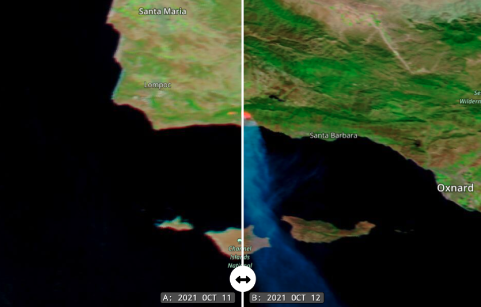
False-color corrected reflectance images (Bands 7-2-1) of the Alisal Fire, west of Santa Barbara in California on 11 and 12 October 2021. These images were acquired by the Moderate Resolution Imaging Spectroradiometer (MODIS), aboard the Terra satellite and the Aqua satellite. These images are a false color Red-Green-Blue (RGB) composite where Red is Band 7, Green is Band 2, and Blue is Band 1. This combination is most useful for distinguishing burn scars from naturally low vegetation or bare soil and enhancing floods. Vegetation appears green, water is black and burn scars are red. The bright red areas represent the actively burning fire front.
Click on the image to visit Worldview to swipe the bar back and forth in the comparison image to see how much the fire grew from 11 October to 12 October. The fire started around 2:30 PM PDT/21:30 UTC on 11 October and is barely visible on the left image acquired by MODIS/Aqua at 2:55 PM PDT/21:55 UTC. The image on the right, acquired by MODIS/Terra, shows the fire on 12 October at 12:20 PM PDT/19:20 UTC and has grown considerably.
Visit Worldview to visualize near real-time imagery from NASA's EOSDIS, and check out more Worldview weekly images in our archive.
